 |
|
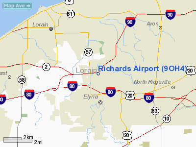
Location & QuickFacts
| FAA Information Effective: | 2008-09-25 |
| Airport Identifier: | 9OH4 |
| Airport Status: | Operational |
| Longitude/Latitude: | 082-06-23.5340W/41-24-14.1600N
-82.106537/41.403933 (Estimated) |
| Elevation: | 690 ft / 210.31 m (Estimated) |
| Land: | 0 acres |
| From nearest city: | 3 nautical miles N of Elyria, OH |
| Location: | Lorain County, OH |
| Magnetic Variation: | 06W (1985) |
Owner & Manager
| Ownership: | Privately owned |
| Owner: | Ralph Richards |
| Address: | 2301 W.river Road
Elyria, OH 44035 |
| Phone number: | 216-324-3109
OR CALL 324-6092 |
| Manager: | Ralph Richards |
| Address: | 2301 W. River Road
Elyria, OH 44035 |
| Phone number: | 216-324-3109 |
Airport Operations and Facilities
| Airport Use: | Private |
| Wind indicator: | Yes |
| Segmented Circle: | No |
| Control Tower: | No |
| Landing fee charge: | No |
| Sectional chart: | Detroit |
| Region: | AGL - Great Lakes |
| Boundary ARTCC: | ZOB - Cleveland |
| Tie-in FSS: | CLE - Cleveland |
| FSS on Airport: | No |
| FSS Toll Free: | 1-800-WX-BRIEF
OR LOCAL CALL 323-5212. |
Airport Services
| Airframe Repair: | NONE |
| Power Plant Repair: | NONE |
Runway Information
Runway E/W
| Dimension: | 1700 x 60 ft / 518.2 x 18.3 m |
| Surface: | TURF, |
| |
Runway E |
Runway W |
| Traffic Pattern: | Left | Left |
| Obstruction: | 30 ft pline | 25 ft pline, 60.0 ft from runway |
|
Runway N/S
| Dimension: | 970 x 50 ft / 295.7 x 15.2 m |
| Surface: | TURF, |
| |
Runway N |
Runway S |
| Traffic Pattern: | Left | Left |
|
Radio Navigation Aids
| ID |
Type |
Name |
Ch |
Freq |
Var |
Dist |
| CL | NDB | Harri | | 344.00 | 07W | 7.5 nm |
| EZE | NDB | Engel | | 226.00 | 07W | 18.0 nm |
| BKL | NDB | Burke Lakefront | | 416.00 | 07W | 21.3 nm |
| AAU | NDB | Ashland | | 329.00 | 07W | 27.3 nm |
| PT | NDB | Pelee Island | | 283.00 | 05W | 33.9 nm |
| PCW | NDB | Port Clinton | | 423.00 | 06W | 35.0 nm |
| LQL | NDB | Lakeland | | 263.00 | 08W | 36.8 nm |
| AK | NDB | Akron | | 362.00 | 07W | 38.2 nm |
| MF | NDB | Manns | | 372.00 | 06W | 41.3 nm |
| DJB | VOR/DME | Dryer | 083X | 113.60 | 05W | 3.7 nm |
| SKY | VOR/DME | Sandusky | 029X | 109.20 | 04W | 24.8 nm |
| LNN | VOR/DME | Lost Nation | 039X | 110.20 | 08W | 36.4 nm |
| CXR | VOR/DME | Chardon | 074X | 112.70 | 05W | 43.0 nm |
| ACO | VOR/DME | Akron | 091X | 114.40 | 04W | 44.6 nm |
| MFD | VORTAC | Mansfield | 025X | 108.80 | 03W | 38.9 nm |
| CLE | VOT | Cleveland | | 110.40 | | 11.6 nm |
| CAK | VOT | Akron/canton Regional | | 110.60 | | 42.0 nm |
Remarks
Images and information placed above are from
http://www.airport-data.com/airport/9OH4/
We thank them for the data!
| General Info
|
| Country |
United States
|
| State |
OHIO
|
| FAA ID |
9OH4
|
| Latitude |
41-24-14.160N
|
| Longitude |
082-06-23.534W
|
| Elevation |
690 feet
|
| Near City |
ELYRIA
|
We don't guarantee the information is fresh and accurate. The data may
be wrong or outdated.
For more up-to-date information please refer to other sources.
|
|


