 |
|
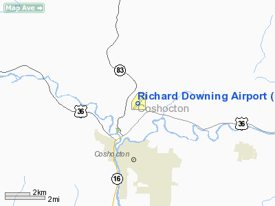
Location & QuickFacts
| FAA Information Effective: | 2008-09-25 |
| Airport Identifier: | I40 |
| Airport Status: | Operational |
| Longitude/Latitude: | 081-51-12.1750W/40-18-33.0500N
-81.853382/40.309181 (Estimated) |
| Elevation: | 979 ft / 298.40 m (Surveyed) |
| Land: | 290 acres |
| From nearest city: | 3 nautical miles N of Coshocton, OH |
| Location: | Coshocton County, OH |
| Magnetic Variation: | 07W (2000) |
Owner & Manager
| Ownership: | Publicly owned |
| Owner: | Coshocton Co Reg Arpt Auth |
| Address: | 24569 Airport Rd
Coshocton, OH 43812 |
| Phone number: | 614-824-4382 |
| Manager: | Bethel R. Toler |
| Address: | 24569 Airport Rd
Coshocton, OH 43812 |
| Phone number: | 740-622-2252 |
Airport Operations and Facilities
| Airport Use: | Open to public |
| Wind indicator: | Yes |
| Segmented Circle: | No |
| Control Tower: | No |
| Lighting Schedule: | DUSK-DAWN
ACTVT MIRL RY 04/22 - 122.9. PAPI RYS 04/22 OPER CONTINOUSLY. |
| Beacon Color: | Clear-Green (lighted land airport) |
| Landing fee charge: | No |
| Sectional chart: | Detroit |
| Region: | AGL - Great Lakes |
| Boundary ARTCC: | ZID - Indianapolis |
| Tie-in FSS: | CLE - Cleveland |
| FSS on Airport: | No |
| FSS Toll Free: | 1-800-WX-BRIEF |
| NOTAMs Facility: | CLE (NOTAM-d service avaliable) |
| Federal Agreements: | NGY |
Airport Communications
| CTAF: | 123.000 |
| Unicom: | 123.000 |
Airport Services
| Fuel available: | 100LLA |
| Bottled Oxygen: | NONE |
| Bulk Oxygen: | NONE |
Runway Information
Runway 04/22
| Dimension: | 4099 x 75 ft / 1249.4 x 22.9 m |
| Surface: | ASPH, Good Condition |
| Weight Limit: | Single wheel: 30000 lbs.
Dual wheel: 35000 lbs. |
| Edge Lights: | Medium |
| |
Runway 04 |
Runway 22 |
| Longitude: | 081-51-28.2400W | 081-50-56.1300W |
| Latitude: | 40-18-16.9430N | 40-18-49.1370N |
| Elevation: | 972.00 ft | 978.00 ft |
| Alignment: | 37 | 127 |
| Traffic Pattern: | Left | Left |
| Markings: | Non-precision instrument, Good Condition | Non-precision instrument, Good Condition |
| VASI: | 2-light PAPI on left side | 2-light PAPI on left side |
| Visual Glide Angle: | 3.50° | 0.00° |
| Runway End Identifier: | No | Yes
OTS INDEFLY. |
| Centerline Lights: | No | No |
| Touchdown Lights: | No | No |
| Obstruction: | 72 ft trees, 2350.0 ft from runway, 80 ft left of centerline, 29:1 slope to clear | , 50:1 slope to clear |
|
Radio Navigation Aids
| ID |
Type |
Name |
Ch |
Freq |
Var |
Dist |
| MLR | NDB | Millersburg/dcmsnd | | 382.00 | 06W | 14.0 nm |
| HRA | NDB | Zanesville | | 204.00 | 06W | 24.4 nm |
| HEH | NDB | Newark | | 524.00 | 06W | 32.8 nm |
| MF | NDB | Manns | | 372.00 | 06W | 38.5 nm |
| TSO | NDB | Tolson | | 395.00 | 07W | 38.6 nm |
| CFX | NDB | Cadiz | | 239.00 | 07W | 38.8 nm |
| AAU | NDB | Ashland | | 329.00 | 07W | 43.3 nm |
| CM | NDB | Sumie | | 391.00 | 05W | 45.7 nm |
| TVT | VOR/DME | Tiverton | 112X | 116.50 | 03W | 15.4 nm |
| CTW | VOR/DME | Newcomerstown | 055X | 111.80 | 07W | 17.9 nm |
| ZZV | VOR/DME | Zanesville | 051X | 111.40 | 06W | 22.2 nm |
| BSV | VOR/DME | Briggs | 071X | 112.40 | 04W | 32.3 nm |
| APE | VORTAC | Appleton | 114X | 116.70 | 06W | 35.0 nm |
| MFD | VORTAC | Mansfield | 025X | 108.80 | 03W | 47.6 nm |
| CAK | VOT | Akron/canton Regional | | 110.60 | | 41.0 nm |
Remarks
Images and information placed above are from
http://www.airport-data.com/airport/I40/
We thank them for the data!
| General Info
|
| Country |
United States
|
| State |
OHIO
|
| FAA ID |
I40
|
| Latitude |
40-18-33.050N
|
| Longitude |
081-51-12.175W
|
| Elevation |
979 feet
|
| Near City |
COSHOCTON
|
We don't guarantee the information is fresh and accurate. The data may
be wrong or outdated.
For more up-to-date information please refer to other sources.
|
|


