 |
|
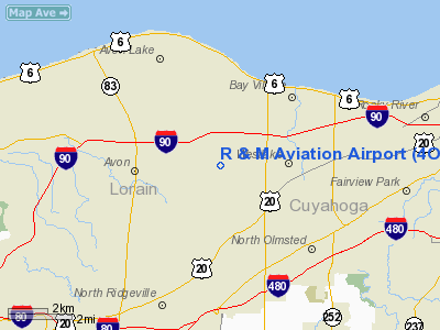
Location & QuickFacts
| FAA Information Effective: | 2008-09-25 |
| Airport Identifier: | 4OI7 |
| Airport Status: | Operational |
| Longitude/Latitude: | 081-58-12.5090W/41-27-13.1570N
-81.970141/41.453655 (Estimated) |
| Elevation: | 690 ft / 210.31 m (Estimated) |
| Land: | 40 acres |
| From nearest city: | 2 nautical miles E of Avon, OH |
| Location: | Lorain County, OH |
| Magnetic Variation: | 06W (1985) |
Owner & Manager
| Ownership: | Privately owned |
| Owner: | M. T. Keller/r. A. Keller |
| Address: | 32135 Detroit Road
Avon, OH 44011 |
| Phone number: | 216-937-5221 |
| Manager: | M. T. Keller |
| Address: | 32135 Detroit Road
Avon, OH 44011 |
| Phone number: | 216-937-5221 |
Airport Operations and Facilities
| Airport Use: | Private |
| Segmented Circle: | No |
| Control Tower: | No |
| Landing fee charge: | No |
| Sectional chart: | Detroit |
| Region: | AGL - Great Lakes |
| Boundary ARTCC: | ZOB - Cleveland |
| Tie-in FSS: | CLE - Cleveland |
| FSS on Airport: | No |
| FSS Toll Free: | 1-800-WX-BRIEF |
Runway Information
Runway 18/36
| Dimension: | 2900 x 100 ft / 883.9 x 30.5 m |
| Surface: | TURF, |
| |
Runway 18 |
Runway 36 |
| Traffic Pattern: | Right | Left |
| Obstruction: | 65 ft pline, 50.0 ft from runway | |
|
Radio Navigation Aids
| ID |
Type |
Name |
Ch |
Freq |
Var |
Dist |
| CL | NDB | Harri | | 344.00 | 07W | 6.9 nm |
| EZE | NDB | Engel | | 226.00 | 07W | 11.3 nm |
| BKL | NDB | Burke Lakefront | | 416.00 | 07W | 14.5 nm |
| LQL | NDB | Lakeland | | 263.00 | 08W | 29.9 nm |
| AAU | NDB | Ashland | | 329.00 | 07W | 32.1 nm |
| AK | NDB | Akron | | 362.00 | 07W | 35.0 nm |
| PT | NDB | Pelee Island | | 283.00 | 05W | 37.0 nm |
| PCW | NDB | Port Clinton | | 423.00 | 06W | 40.6 nm |
| MF | NDB | Manns | | 372.00 | 06W | 46.6 nm |
| DJB | VOR/DME | Dryer | 083X | 113.60 | 05W | 10.4 nm |
| LNN | VOR/DME | Lost Nation | 039X | 110.20 | 08W | 29.6 nm |
| SKY | VOR/DME | Sandusky | 029X | 109.20 | 04W | 30.9 nm |
| CXR | VOR/DME | Chardon | 074X | 112.70 | 05W | 36.5 nm |
| ACO | VOR/DME | Akron | 091X | 114.40 | 04W | 40.5 nm |
| BSV | VOR/DME | Briggs | 071X | 112.40 | 04W | 49.3 nm |
| MFD | VORTAC | Mansfield | 025X | 108.80 | 03W | 45.0 nm |
| CLE | VOT | Cleveland | | 110.40 | | 6.1 nm |
| CAK | VOT | Akron/canton Regional | | 110.60 | | 40.2 nm |
Remarks
- BASED ON LACK OF SUFFICIENT AVAILABLE AIRSPACE TO ESTABLISH AN AIRPORT TRAFFIC PATTERN FOR THIS AIRPORT AND THE EXISTING JOHNSON'S FIELD AIRPORT LOCATED SSW.
Images and information placed above are from
http://www.airport-data.com/airport/4OI7/
We thank them for the data!
| General Info
|
| Country |
United States
|
| State |
OHIO
|
| FAA ID |
4OI7
|
| Latitude |
41-27-13.157N
|
| Longitude |
081-58-12.509W
|
| Elevation |
690 feet
|
| Near City |
AVON
|
We don't guarantee the information is fresh and accurate. The data may
be wrong or outdated.
For more up-to-date information please refer to other sources.
|
|


