 |
|
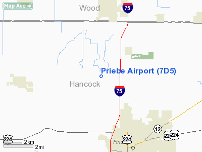
Location & QuickFacts
| FAA Information Effective: | 2008-09-25 |
| Airport Identifier: | 7D5 |
| Airport Status: | Operational |
| Longitude/Latitude: | 083-41-03.7600W/41-06-50.1900N
-83.684378/41.113942 (Estimated) |
| Elevation: | 795 ft / 242.32 m (Estimated) |
| Land: | 10 acres |
| From nearest city: | 5 nautical miles NN of Findlay, OH |
| Location: | Hancock County, OH |
| Magnetic Variation: | 05W (1985) |
Owner & Manager
| Ownership: | Privately owned |
| Owner: | Jane Priebe |
| Address: | 3861 County Road 140
Findlay, OH 45840 |
| Phone number: | 419-299-3071 |
| Manager: | Adam Flick |
| Address: | 3861 County Road 140
Findlay, OH 45840 |
| Phone number: | 419-299-3071 |
Airport Operations and Facilities
| Airport Use: | Open to public |
| Wind indicator: | Yes |
| Segmented Circle: | No |
| Control Tower: | No |
| Lighting Schedule: | RDO-CTL
ACTIVATE LIRL RWY 03/21-123.0. |
| Landing fee charge: | No |
| Sectional chart: | Detroit |
| Region: | AGL - Great Lakes |
| Boundary ARTCC: | ZOB - Cleveland |
| Tie-in FSS: | CLE - Cleveland |
| FSS on Airport: | No |
| FSS Toll Free: | 1-800-WX-BRIEF |
| NOTAMs Facility: | CLE (NOTAM-d service avaliable) |
Airport Communications
Airport Services
| Airframe Repair: | MAJOR |
| Power Plant Repair: | MINOR |
| Bottled Oxygen: | NONE |
| Bulk Oxygen: | NONE |
Runway Information
Runway 03/21
| Dimension: | 1918 x 18 ft / 584.6 x 5.5 m |
| Surface: | ASPH, Poor Condition
SFC BREAKING UP; WEED & GRASS ENCROACHMENT; 2 IN - 4 IN DEPRESSIONS. |
| Edge Lights: | Low |
| |
Runway 03 |
Runway 21 |
| Longitude: | 083-41-10.4100W | 083-40-58.4539W |
| Latitude: | 41-06-40.9100N | 41-06-57.5642N |
| Elevation: | 795.00 ft | 0.00 ft |
| Traffic Pattern: | Left | Left |
| Markings: | None, Poor Condition
03/21 UNMKD. | None, Poor Condition |
| Obstruction: | 20 ft pline, 201.0 ft from runway, 76 ft left of centerline
+15 FT PLINE 0 FT FM 120 FT R TO 156 FT FM 125 FT L; +23 FT RR 38 FT FM 125 FT R TO 183 FT FM 125 FT L; +20 FT PLINE 90 FT FM 125 FT R TO 200 FT FM 75 FT L. | 74 ft trees, 201.0 ft from runway, 100 ft right of centerline
RWY 21 +74 FT TREES 0 FT FM 71 FT R TO 108 FT FM 125 FT R. |
|
Radio Navigation Aids
| ID |
Type |
Name |
Ch |
Freq |
Var |
Dist |
| BNR | NDB | Benton Ridge | | 334.00 | 05W | 5.6 nm |
| FZI | NDB | Fostoria | | 379.00 | 05W | 13.8 nm |
| PDR | NDB | Ottawa | | 233.00 | 05W | 14.1 nm |
| TII | NDB | Tiffin | | 269.00 | 05W | 21.6 nm |
| LYL | NDB | Lima | | 362.00 | 04W | 29.0 nm |
| USE | NDB | Fulton | | 375.00 | 05W | 36.0 nm |
| DFI | NDB | Defiance | | 246.00 | 05W | 36.1 nm |
| RUV | NDB | Rushsylvania | | 326.00 | 05W | 39.4 nm |
| MNN | NDB | Marion | | 201.00 | 05W | 40.9 nm |
| BYN | NDB | Bryan | | 260.00 | 04W | 41.6 nm |
| PCW | NDB | Port Clinton | | 423.00 | 06W | 44.1 nm |
| VFU | NDB | Stanley | | 411.00 | 05W | 44.8 nm |
| EDJ | NDB | Bellefontaine | | 242.00 | 05W | 45.0 nm |
| ADG | NDB | Adrian | | 278.00 | 06W | 48.8 nm |
| TOL | TACAN | Toledo | 072X | | 05W | 29.3 nm |
| MAH | VOR | Marathon | | 114.90 | 05W | 6.0 nm |
| AOH | VOR | Allen County | | 108.40 | 04W | 27.6 nm |
| BUD | VOR | Buckeye | | 109.80 | 05W | 41.1 nm |
| VWV | VOR/DME | Waterville | 078X | 113.10 | 02W | 20.4 nm |
| FDY | VORTAC | Findlay | 019X | 108.20 | 02W | 10.1 nm |
Remarks
- BIRDS ON AND INVOF ARPT.
- VFR ONLY
Images and information placed above are from
http://www.airport-data.com/airport/7D5/
We thank them for the data!
| General Info
|
| Country |
United States
|
| State |
OHIO
|
| FAA ID |
7D5
|
| Latitude |
41-06-50.190N
|
| Longitude |
083-41-03.760W
|
| Elevation |
795 feet
|
| Near City |
FINDLAY
|
We don't guarantee the information is fresh and accurate. The data may
be wrong or outdated.
For more up-to-date information please refer to other sources.
|
|


