 |
|
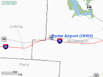
Location & QuickFacts
| FAA Information Effective: | 2008-09-25 |
| Airport Identifier: | OH92 |
| Airport Status: | Operational |
| Longitude/Latitude: | 082-10-59.5160W/39-57-15.2410N
-82.183199/39.954234 (Estimated) |
| Elevation: | 1070 ft / 326.14 m (Estimated) |
| Land: | 0 acres |
| From nearest city: | 1 nautical miles W of Hopewell, OH |
| Location: | Muskingum County, OH |
| Magnetic Variation: | 06W (1985) |
Owner & Manager
| Ownership: | Privately owned |
| Owner: | Daryl Porter |
| Address: | 10000 Westpike
Hopewell, OH 43746 |
| Phone number: | 614-787-2225 |
| Address: |
|
Airport Operations and Facilities
| Airport Use: | Private |
| Wind indicator: | Yes |
| Segmented Circle: | No |
| Control Tower: | No |
| Lighting Schedule: | PHONE REQ
|
| Landing fee charge: | No |
| Sectional chart: | Cincinnati |
| Region: | AGL - Great Lakes |
| Boundary ARTCC: | ZID - Indianapolis |
| Tie-in FSS: | CLE - Cleveland |
| FSS on Airport: | No |
| FSS Toll Free: | 1-800-WX-BRIEF |
Runway Information
Runway E/W
| Dimension: | 2000 x 75 ft / 609.6 x 22.9 m |
| Surface: | TURF, |
| Edge Lights: | Low |
| |
Runway E |
Runway W |
| Traffic Pattern: | Right | Right |
| Obstruction: | 25 ft trees, 100.0 ft from runway | 25 ft trees, 25.0 ft from runway |
|
Radio Navigation Aids
| ID |
Type |
Name |
Ch |
Freq |
Var |
Dist |
| PKB | FAN MARKER | Marietta Ohio | | | 03W | 49.4 nm |
| HRA | NDB | Zanesville | | 204.00 | 06W | 12.5 nm |
| HEH | NDB | Newark | | 524.00 | 06W | 13.6 nm |
| CM | NDB | Sumie | | 391.00 | 05W | 26.4 nm |
| MLR | NDB | Millersburg/dcmsnd | | 382.00 | 06W | 38.1 nm |
| CHC | NDB | Grens | | 272.00 | 04W | 39.1 nm |
| DKG | NDB | Don Scott | | 348.00 | 05W | 41.9 nm |
| UGS | NDB | University | | 250.00 | 06W | 42.0 nm |
| CYO | NDB | Circleville | | 366.00 | 05W | 45.0 nm |
| DLZ | NDB | Delaware | | 215.00 | 06W | 46.5 nm |
| OS | NDB | Fuler | | 515.00 | 05W | 47.3 nm |
| BU | NDB | Boutn | | 230.00 | 05W | 47.8 nm |
| RZT | NDB | Ross County | | 236.00 | 05W | 49.9 nm |
| LCK | TACAN | Rickenbacker | 069X | | 05W | 35.5 nm |
| XUB | VOR | Yellow Bud | | 112.50 | 05W | 44.8 nm |
| ZZV | VOR/DME | Zanesville | 051X | 111.40 | 06W | 13.4 nm |
| TVT | VOR/DME | Tiverton | 112X | 116.50 | 03W | 30.4 nm |
| CTW | VOR/DME | Newcomerstown | 055X | 111.80 | 07W | 36.5 nm |
| APE | VORTAC | Appleton | 114X | 116.70 | 06W | 22.1 nm |
| JPU | VORTAC | Parkersburg | 023X | 108.60 | 03W | 48.5 nm |
| CMH | VOT | Port Columbus | | 111.00 | | 32.4 nm |
Remarks
Images and information placed above are from
http://www.airport-data.com/airport/OH92/
We thank them for the data!
| General Info
|
| Country |
United States
|
| State |
OHIO
|
| FAA ID |
OH92
|
| Latitude |
39-57-15.241N
|
| Longitude |
082-10-59.516W
|
| Elevation |
1070 feet
|
| Near City |
HOPEWELL
|
We don't guarantee the information is fresh and accurate. The data may
be wrong or outdated.
For more up-to-date information please refer to other sources.
|
|


