 |
|
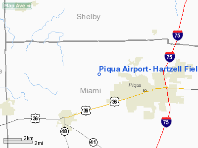
Piqua Airport- Hartzell Field Airport |
Location & QuickFacts
| FAA Information Effective: | 2008-09-25 |
| Airport Identifier: | I17 |
| Airport Status: | Operational |
| Longitude/Latitude: | 084-18-30.4000W/40-09-52.9000N
-84.308444/40.164694 (Estimated) |
| Elevation: | 994 ft / 302.97 m (Surveyed) |
| Land: | 150 acres |
| From nearest city: | 3 nautical miles NW of Piqua, OH |
| Location: | Miami County, OH |
| Magnetic Variation: | 06W (2005) |
Owner & Manager
| Ownership: | Publicly owned |
| Owner: | City Of Piqua |
| Address: | City Building
Piqua, OH 45356 |
| Phone number: | 937-778-2051 |
| Manager: | Mark Runge |
| Address: | 5465 West St, Rt 185
Piqua, OH 45356 |
| Phone number: | 937-778-4207 |
Airport Operations and Facilities
| Airport Use: | Open to public |
| Wind indicator: | Yes |
| Segmented Circle: | No |
| Control Tower: | No |
| Lighting Schedule: | DUSK-DAWN
ACTVT MIRL RY 08/26 & REIL RYS 08 & 26 - CTAF. |
| Beacon Color: | Clear-Green (lighted land airport) |
| Landing fee charge: | No |
| Sectional chart: | Detroit |
| Region: | AGL - Great Lakes |
| Boundary ARTCC: | ZID - Indianapolis |
| Tie-in FSS: | DAY - Dayton |
| FSS on Airport: | No |
| FSS Toll Free: | 1-800-WX-BRIEF |
| NOTAMs Facility: | DAY (NOTAM-d service avaliable) |
Airport Communications
| CTAF: | 123.000 |
| Unicom: | 123.000 |
Airport Services
| Fuel available: | 100LLA1+
FUEL AVAILABLE 24 HOURS CREDIT CARD. |
| Bottled Oxygen: | NONE |
| Bulk Oxygen: | NONE |
Runway Information
Runway 08/26
| Dimension: | 3997 x 75 ft / 1218.3 x 22.9 m |
| Surface: | ASPH, Good Condition |
| Weight Limit: | Single wheel: 30000 lbs.
Dual wheel: 36000 lbs. |
| Edge Lights: | Medium |
| |
Runway 08 |
Runway 26 |
| Longitude: | 084-18-55.2740W | 084-18-05.4220W |
| Latitude: | 40-09-47.9390N | 40-09-57.8140N |
| Elevation: | 994.00 ft | 985.00 ft |
| Alignment: | 76 | 127 |
| Traffic Pattern: | Left | Left |
| Markings: | Non-precision instrument, Good Condition
RWY 08/26 MARKINGS ARE FADED AND WEATHERED. | Non-precision instrument, Good Condition |
| Runway End Identifier: | Yes | Yes |
| Centerline Lights: | No | No |
| Touchdown Lights: | No | No |
| Obstruction: | 84 ft tree, 1841.0 ft from runway, 321 ft right of centerline, 19:1 slope to clear
RWY 08 CROPS 0 FT TO 200 FT FM RWY END 80 FT L 125 FT R. | 76 ft tree, 2007.0 ft from runway, 515 ft right of centerline, 23:1 slope to clear
RWY 26 CROPS 0 FT TO 200 FT FM RWY END 110 FT L 150 FT R. |
|
Radio Navigation Aids
| ID |
Type |
Name |
Ch |
Freq |
Var |
Dist |
| VES | NDB | Versailles | | 356.00 | 04W | 10.2 nm |
| CQA | NDB | Lakefield | | 205.00 | 04W | 22.4 nm |
| EDJ | NDB | Bellefontaine | | 242.00 | 05W | 25.9 nm |
| CCJ | NDB | Clark County | | 341.00 | 04W | 30.0 nm |
| XEN | NDB | Xenia | | 395.00 | 03W | 32.2 nm |
| RUV | NDB | Rushsylvania | | 326.00 | 05W | 34.3 nm |
| LYL | NDB | Lima | | 362.00 | 04W | 35.0 nm |
| PLD | NDB | Portland | | 257.00 | 03W | 35.5 nm |
| HKF | NDB | Hook Field | | 239.00 | 04W | 40.5 nm |
| UYF | NDB | London | | 263.00 | 06W | 41.2 nm |
| MRT | NDB | Marysville | | 403.00 | 05W | 44.2 nm |
| VFU | NDB | Stanley | | 411.00 | 05W | 44.2 nm |
| OXD | NDB | Oxford | | 282.00 | 04W | 45.1 nm |
| IL | NDB | Airbo | | 407.00 | 04W | 48.3 nm |
| HAO | NDB | Hamilton | | 260.00 | 04W | 49.1 nm |
| UWL | NDB | New Castle | | 385.00 | 02W | 49.6 nm |
| FFO | TACAN | Patterson | 099X | | 04W | 23.8 nm |
| XSF | TACAN | Springfield | 065X | | 04W | 29.1 nm |
| AOH | VOR | Allen County | | 108.40 | 04W | 36.1 nm |
| DQN | VOR/DME | Dayton | 092X | 114.50 | 01W | 9.8 nm |
| SGH | VOR/DME | Springfield | 079X | 113.20 | 04W | 29.1 nm |
| ROD | VORTAC | Rosewood | 122X | 117.50 | 05W | 14.2 nm |
| RID | VORTAC | Richmond | 043X | 110.60 | 03W | 34.7 nm |
| DAY | VOT | Dayton J M Cox-day | | 111.00 | | 16.3 nm |
Remarks
- AEROBATIC BOX LCTD WITHIN 1 NM RAD OF ARPT SFC TO 4500 FT MSL SR-SS.
Images and information placed above are from
http://www.airport-data.com/airport/I17/
We thank them for the data!
| General Info
|
| Country |
United States
|
| State |
OHIO
|
| FAA ID |
I17
|
| Latitude |
40-09-52.900N
|
| Longitude |
084-18-30.400W
|
| Elevation |
994 feet
|
| Near City |
PIQUA
|
We don't guarantee the information is fresh and accurate. The data may
be wrong or outdated.
For more up-to-date information please refer to other sources.
|
|


