 |
|
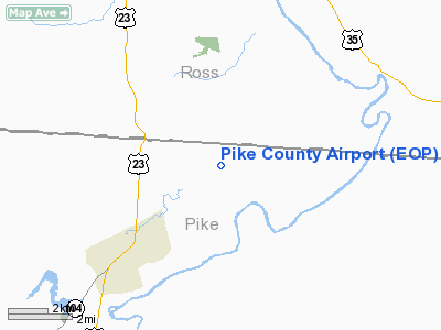
Location & QuickFacts
| FAA Information Effective: | 2008-09-25 |
| Airport Identifier: | EOP |
| Airport Status: | Operational |
| Longitude/Latitude: | 082-55-41.4300W/39-10-00.9600N
-82.928175/39.166933 (Estimated) |
| Elevation: | 660 ft / 201.17 m (Estimated) |
| Land: | 70 acres |
| From nearest city: | 3 nautical miles NE of Waverly, OH |
| Location: | Pike County, OH |
| Magnetic Variation: | 06W (2000) |
Owner & Manager
| Ownership: | Publicly owned |
| Owner: | Pike County Arpt Auth |
| Address: | 2577 Alma-omega Rd
Waverly, OH 45690 |
| Phone number: | 740-947-7346 |
| Manager: | Donald Simonton |
| Address: | 2577 Alma-omega Rd
Waverly, OH 45690 |
| Phone number: | 740-947-4952 |
Airport Operations and Facilities
| Airport Use: | Open to public |
| Wind indicator: | Yes |
| Segmented Circle: | No |
| Control Tower: | No |
| Lighting Schedule: | DUSK-DAWN
ACTVT MIRL RY 07/25 - CTAF, PAPI RYS 07 & 25 ON DUSK-DAWN |
| Beacon Color: | Clear-Green (lighted land airport) |
| Landing fee charge: | No |
| Sectional chart: | Cincinnati |
| Region: | AGL - Great Lakes |
| Boundary ARTCC: | ZID - Indianapolis |
| Tie-in FSS: | DAY - Dayton |
| FSS on Airport: | No |
| FSS Toll Free: | 1-800-WX-BRIEF |
| NOTAMs Facility: | DAY (NOTAM-d service avaliable) |
| Federal Agreements: | N |
Airport Communications
| CTAF: | 123.000 |
| Unicom: | 123.000 |
Airport Services
| Fuel available: | 100LLA |
| Airframe Repair: | NONE |
| Power Plant Repair: | NONE |
| Bottled Oxygen: | NONE |
| Bulk Oxygen: | NONE |
Runway Information
Runway 07/25
| Dimension: | 4900 x 75 ft / 1493.5 x 22.9 m |
| Surface: | ASPH, Good Condition |
| Weight Limit: | Single wheel: 58000 lbs. |
| Edge Lights: | Medium |
| |
Runway 07 |
Runway 25 |
| Longitude: | 082-56-08.9300W | 082-55-13.9300W |
| Latitude: | 39-09-49.6400N | 39-10-12.2800N |
| Elevation: | 660.00 ft | 658.00 ft |
| Alignment: | 62 | 127 |
| Traffic Pattern: | Left | Left |
| Markings: | Non-precision instrument, Good Condition | Non-precision instrument, Good Condition |
| VASI: | 4-light PAPI on left side | 4-light PAPI on left side |
| Visual Glide Angle: | 4.00° | 3.00° |
| Runway End Identifier: | Yes | Yes |
| Obstruction: | 10 ft road, 201.0 ft from runway, 195 ft left of centerline
+8'FENCE 0' FM TO 200' FM 180'LT TO 250'LT. +10' ROAD 140' FM TO 200' FM 195'LT TO 250'LT. | 45 ft tree, 562.0 ft from runway, 270 ft right of centerline, 8:1 slope to clear |
|
Radio Navigation Aids
| ID |
Type |
Name |
Ch |
Freq |
Var |
Dist |
| AJY | FAN MARKER | Ashland | | | 03W | 37.2 nm |
| EOP | NDB | Waverly | | 385.00 | 06W | 0.2 nm |
| RZT | NDB | Ross County | | 236.00 | 05W | 17.0 nm |
| CYO | NDB | Circleville | | 366.00 | 05W | 21.5 nm |
| PMH | NDB | Portsmouth | | 373.00 | 04W | 23.5 nm |
| PZO | NDB | Peebles | | 329.00 | 02W | 23.8 nm |
| HOC | NDB | Hillsboro | | 278.00 | 05W | 28.7 nm |
| CSS | NDB | Court House | | 414.00 | 05W | 33.8 nm |
| AMT | NDB | West Union | | 359.00 | 04W | 35.1 nm |
| UGS | NDB | University | | 250.00 | 06W | 37.8 nm |
| GAS | NDB | Gallipolis | | 420.00 | 07W | 41.0 nm |
| BU | NDB | Boutn | | 230.00 | 05W | 41.3 nm |
| IL | NDB | Airbo | | 407.00 | 04W | 42.4 nm |
| HW | NDB | Cubla | | 299.00 | 04W | 45.5 nm |
| XW | NDB | Flmng | | 400.00 | 05W | 49.0 nm |
| CM | NDB | Sumie | | 391.00 | 05W | 49.9 nm |
| LCK | TACAN | Rickenbacker | 069X | | 05W | 38.5 nm |
| XUB | VOR | Yellow Bud | | 112.50 | 05W | 21.8 nm |
| MXQ | VOR/DME | Midwest | 076X | 112.90 | 04W | 43.6 nm |
| YRK | VORTAC | York | 075X | 112.80 | 05W | 31.5 nm |
| HNN | VORTAC | Henderson | 106X | 115.90 | 03W | 48.9 nm |
| CMH | VOT | Port Columbus | | 111.00 | | 49.8 nm |
Remarks
- DEER ON & INVOF ARPT.
- VFR ONLY
Images and information placed above are from
http://www.airport-data.com/airport/EOP/
We thank them for the data!
| General Info
|
| Country |
United States
|
| State |
OHIO
|
| FAA ID |
EOP
|
| Latitude |
39-10-00.960N
|
| Longitude |
082-55-41.430W
|
| Elevation |
660 feet
|
| Near City |
WAVERLY
|
We don't guarantee the information is fresh and accurate. The data may
be wrong or outdated.
For more up-to-date information please refer to other sources.
|
|


