 |
|
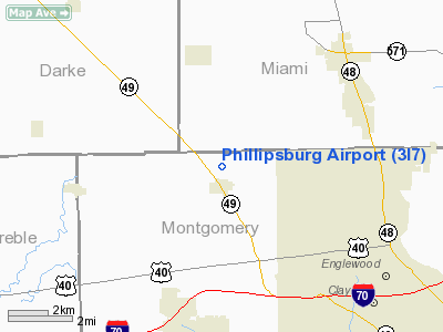
Location & QuickFacts
| FAA Information Effective: | 2008-09-25 |
| Airport Identifier: | 3I7 |
| Airport Status: | Operational |
| Longitude/Latitude: | 084-24-01.4850W/39-54-47.8000N
-84.400413/39.913278 (Estimated) |
| Elevation: | 1031 ft / 314.25 m (Surveyed) |
| Land: | 35 acres |
| From nearest city: | 0 nautical miles N of Phillipsburg, OH |
| Location: | Montgomery County, OH |
| Magnetic Variation: | 04W (1985) |
Owner & Manager
| Ownership: | Privately owned |
| Owner: | Phillipsburg Aviation Inc |
| Address: | 357 Winterset Dr.
Englewood, OH 45322 |
| Phone number: | 937-836-8334 |
| Manager: | Jayne Miller |
| Address: | 53 Airport Loop Extension
Phillipsburg, OH 45354 |
| Phone number: | 937-884-9795 |
Airport Operations and Facilities
| Airport Use: | Open to public |
| Wind indicator: | Yes |
| Segmented Circle: | No |
| Control Tower: | No |
| Lighting Schedule: | DUSK-DAWN |
| Beacon Color: | Clear-Green (lighted land airport) |
| Landing fee charge: | No |
| Sectional chart: | Cincinnati |
| Region: | AGL - Great Lakes |
| Boundary ARTCC: | ZID - Indianapolis |
| Tie-in FSS: | DAY - Dayton |
| FSS on Airport: | No |
| FSS Toll Free: | 1-800-WX-BRIEF |
| NOTAMs Facility: | DAY (NOTAM-d service avaliable) |
| Federal Agreements: | N |
Airport Communications
| CTAF: | 122.700 |
| Unicom: | 122.700 |
Airport Services
| Fuel available: | 100LL |
| Airframe Repair: | MAJOR |
| Power Plant Repair: | MAJOR |
| Bottled Oxygen: | NONE |
| Bulk Oxygen: | NONE |
Runway Information
Runway 03/21
| Dimension: | 3000 x 40 ft / 914.4 x 12.2 m |
| Surface: | ASPH, Good Condition |
| Edge Lights: | Low |
| |
Runway 03 |
Runway 21 |
| Longitude: | 084-24-09.1700W | 084-23-53.8000W |
| Latitude: | 39-54-34.2100N | 39-55-01.3900N |
| Elevation: | 1027.00 ft | 1022.00 ft |
| Alignment: | 24 | 127 |
| Traffic Pattern: | Left | Left |
| Markings: | Nonstandard, Good Condition
RY 03/21 MKGS SMALLER THAN STANDARD SIZE. | Nonstandard, Good Condition |
| Displaced threshold: | 130.00 ft | 0.00 ft |
| Runway End Identifier: | Yes | Yes |
| Centerline Lights: | No | No |
| Touchdown Lights: | No | No |
| Obstruction: | 42 ft tree, 242.0 ft from runway, 92 ft left of centerline, 1:1 slope to clear
APCH SLOPE 5:1 TO DSPLCD THLD DUE TO +35 FT TREES 194 FT FM THLD 159 FT L.
35 FT TREES 64 FT FMN 159 FT L. | 30 ft trees, 201.0 ft from runway, 80 ft right of centerline
+5-33 FT BRUSH & TREES. |
|
Radio Navigation Aids
| ID |
Type |
Name |
Ch |
Freq |
Var |
Dist |
| VES | NDB | Versailles | | 356.00 | 04W | 18.5 nm |
| XEN | NDB | Xenia | | 395.00 | 03W | 24.8 nm |
| HKF | NDB | Hook Field | | 239.00 | 04W | 25.0 nm |
| CCJ | NDB | Clark County | | 341.00 | 04W | 28.8 nm |
| OXD | NDB | Oxford | | 282.00 | 04W | 30.1 nm |
| HAO | NDB | Hamilton | | 260.00 | 04W | 33.4 nm |
| CQA | NDB | Lakefield | | 205.00 | 04W | 35.0 nm |
| EDJ | NDB | Bellefontaine | | 242.00 | 05W | 38.5 nm |
| IL | NDB | Airbo | | 407.00 | 04W | 39.8 nm |
| ISZ | NDB | Cincinnati-blue Ash | | 388.00 | 04W | 39.9 nm |
| HW | NDB | Cubla | | 299.00 | 04W | 41.5 nm |
| MDE | NDB | Madeira | | 379.00 | 04W | 41.6 nm |
| PLD | NDB | Portland | | 257.00 | 03W | 42.1 nm |
| UWL | NDB | New Castle | | 385.00 | 02W | 42.4 nm |
| UYF | NDB | London | | 263.00 | 06W | 43.1 nm |
| LUK | NDB | Cincinnati | | 335.00 | 04W | 45.4 nm |
| RUV | NDB | Rushsylvania | | 326.00 | 05W | 47.0 nm |
| FFO | TACAN | Patterson | 099X | | 04W | 16.9 nm |
| XSF | TACAN | Springfield | 065X | | 04W | 26.2 nm |
| DQN | VOR/DME | Dayton | 092X | 114.50 | 01W | 6.2 nm |
| SGH | VOR/DME | Springfield | 079X | 113.20 | 04W | 26.0 nm |
| MXQ | VOR/DME | Midwest | 076X | 112.90 | 04W | 40.2 nm |
| MIE | VOR/DME | Muncie | 091X | 114.40 | 03W | 49.7 nm |
| RID | VORTAC | Richmond | 043X | 110.60 | 03W | 22.4 nm |
| ROD | VORTAC | Rosewood | 122X | 117.50 | 05W | 27.9 nm |
| DAY | VOT | Dayton J M Cox-day | | 111.00 | | 8.3 nm |
| LUK | VOT | Cincinnati Muni/lunken | | 108.40 | | 47.9 nm |
Remarks
- DO NOT FLY OVER SCHOOL 2100' S OF ARPT IN LINE WITH RWY.
- ARPT CLSD TO HEL TRNG.
- VFR ONLY
Images and information placed above are from
http://www.airport-data.com/airport/3I7/
We thank them for the data!
| General Info
|
| Country |
United States
|
| State |
OHIO
|
| FAA ID |
3I7
|
| Latitude |
39-54-48.391N
|
| Longitude |
084-24-01.112W
|
| Elevation |
1031 feet
|
| Near City |
PHILLIPSBURG
|
We don't guarantee the information is fresh and accurate. The data may
be wrong or outdated.
For more up-to-date information please refer to other sources.
|
|


