 |
|
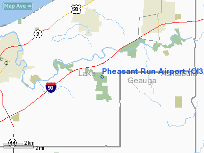
Location & QuickFacts
| FAA Information Effective: | 2008-09-25 |
| Airport Identifier: | OI31 |
| Airport Status: | Operational |
| Longitude/Latitude: | 081-07-29.3540W/41-42-35.1780N
-81.124821/41.709772 (Estimated) |
| Elevation: | 960 ft / 292.61 m (Estimated) |
| Land: | 0 acres |
| From nearest city: | 3 nautical miles S of Leroy, OH |
| Location: | Lake County, OH |
| Magnetic Variation: | 07W (1985) |
Owner & Manager
| Ownership: | Privately owned |
| Owner: | Charles F. Reed |
| Address: | 5782 Trask Road
Madison, OH 44057 |
| Phone number: | 216-298-1314 |
| Manager: | Charles F. Reed |
| Address: | 5782 Trask Road
Madison, OH 44057 |
| Phone number: | 216-298-1314 |
Airport Operations and Facilities
| Airport Use: | Private |
| Wind indicator: | Yes |
| Segmented Circle: | No |
| Control Tower: | No |
| Landing fee charge: | No |
| Sectional chart: | Detroit |
| Region: | AGL - Great Lakes |
| Boundary ARTCC: | ZOB - Cleveland |
| Tie-in FSS: | CLE - Cleveland |
| FSS on Airport: | No |
| FSS Toll Free: | 1-800-WX-BRIEF |
Runway Information
Runway 05/23
| Dimension: | 1900 x 120 ft / 579.1 x 36.6 m |
| Surface: | TURF, |
| |
Runway 05 |
Runway 23 |
| Traffic Pattern: | Left | Left |
| Obstruction: | 40 ft trees, 100.0 ft from runway | , 10.0 ft from runway |
|
Runway 18/36
| Dimension: | 2100 x 120 ft / 640.1 x 36.6 m |
| Surface: | TURF, |
| |
Runway 18 |
Runway 36 |
| Traffic Pattern: | Left | Left |
| Obstruction: | 40 ft trees | 40 ft trees |
|
Radio Navigation Aids
| ID |
Type |
Name |
Ch |
Freq |
Var |
Dist |
| LQL | NDB | Lakeland | | 263.00 | 08W | 11.5 nm |
| BKL | NDB | Burke Lakefront | | 416.00 | 07W | 26.5 nm |
| EZE | NDB | Engel | | 226.00 | 07W | 30.0 nm |
| AK | NDB | Akron | | 362.00 | 07W | 40.3 nm |
| HBD | NDB | Hubbard | | 408.00 | 08W | 42.8 nm |
| CL | NDB | Harri | | 344.00 | 07W | 43.9 nm |
| CXR | VOR/DME | Chardon | 074X | 112.70 | 05W | 11.7 nm |
| LNN | VOR/DME | Lost Nation | 039X | 110.20 | 08W | 12.0 nm |
| JFN | VOR/DME | Jefferson | 099X | 115.20 | 05W | 17.2 nm |
| ACO | VOR/DME | Akron | 091X | 114.40 | 04W | 36.3 nm |
| YNG | VORTAC | Youngstown | 027X | 109.00 | 05W | 30.5 nm |
| ERI | VORTAC | Erie | 031X | 109.40 | 06W | 41.6 nm |
| CLE | VOT | Cleveland | | 110.40 | | 37.2 nm |
| CAK | VOT | Akron/canton Regional | | 110.60 | | 49.8 nm |
Remarks
- AND MARKED TO PROVIDE 20:1 CLEARANCE OVER THE OBSTNS WITH SUFFICIENT REMAINING USABLE RUNWAY LENGTH TO PERMIT SAFE OPERATIONS.
Images and information placed above are from
http://www.airport-data.com/airport/OI31/
We thank them for the data!
| General Info
|
| Country |
United States
|
| State |
OHIO
|
| FAA ID |
OI31
|
| Latitude |
41-42-35.178N
|
| Longitude |
081-07-29.354W
|
| Elevation |
960 feet
|
| Near City |
LEROY
|
We don't guarantee the information is fresh and accurate. The data may
be wrong or outdated.
For more up-to-date information please refer to other sources.
|
|


