 |
|
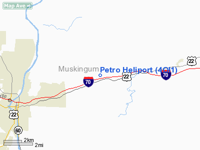
Location & QuickFacts
| FAA Information Effective: | 2008-09-25 |
| Airport Identifier: | 4OI1 |
| Airport Status: | Operational |
| Longitude/Latitude: | 081-53-42.4780W/39-58-18.2500N
-81.895133/39.971736 (Estimated) |
| Elevation: | 808 ft / 246.28 m (Estimated) |
| Land: | 0 acres |
| From nearest city: | 4 nautical miles E of Zanesville, OH |
| Location: | Muskingum County, OH |
| Magnetic Variation: | 06W (1985) |
Owner & Manager
| Ownership: | Privately owned |
| Owner: | Petro Helicopters, Inc. |
| Address: | 4900 Boggs Road
Zanesville, OH 43701 |
| Phone number: | 614-454-3148 |
| Manager: | Terryl Worstall |
| Address: | 4900 Boggs Road
Zanesville, OH 43701 |
| Phone number: | 614-454-3148 |
Airport Operations and Facilities
| Airport Use: | Private |
| Wind indicator: | Yes |
| Segmented Circle: | No |
| Control Tower: | No |
| Landing fee charge: | No |
| Sectional chart: | Cincinnati |
| Region: | AGL - Great Lakes |
| Boundary ARTCC: | ZID - Indianapolis |
| Tie-in FSS: | CLE - Cleveland |
| FSS on Airport: | No |
| FSS Toll Free: | 1-800-WX-BRIEF |
Runway Information
Helipad H1
| Dimension: | 15 x 15 ft / 4.6 x 4.6 m |
| Surface: | CONC, |
| |
Runway H1 |
Runway |
| Traffic Pattern: | Left | Left |
|
Radio Navigation Aids
| ID |
Type |
Name |
Ch |
Freq |
Var |
Dist |
| PKB | FAN MARKER | Marietta Ohio | | | 03W | 41.7 nm |
| HRA | NDB | Zanesville | | 204.00 | 06W | 4.1 nm |
| HEH | NDB | Newark | | 524.00 | 06W | 26.4 nm |
| MLR | NDB | Millersburg/dcmsnd | | 382.00 | 06W | 34.3 nm |
| CM | NDB | Sumie | | 391.00 | 05W | 39.6 nm |
| CFX | NDB | Cadiz | | 239.00 | 07W | 43.6 nm |
| UGS | NDB | University | | 250.00 | 06W | 44.3 nm |
| LCK | TACAN | Rickenbacker | 069X | | 05W | 48.7 nm |
| ZZV | VOR/DME | Zanesville | 051X | 111.40 | 06W | 1.9 nm |
| CTW | VOR/DME | Newcomerstown | 055X | 111.80 | 07W | 24.7 nm |
| TVT | VOR/DME | Tiverton | 112X | 116.50 | 03W | 31.1 nm |
| AIR | VOR/DME | Bellaire | 118X | 117.10 | 07W | 49.7 nm |
| APE | VORTAC | Appleton | 114X | 116.70 | 06W | 33.7 nm |
| JPU | VORTAC | Parkersburg | 023X | 108.60 | 03W | 40.0 nm |
| CMH | VOT | Port Columbus | | 111.00 | | 45.6 nm |
Remarks
- (E111-1) TAKEOFF/LANDING AREA IS APPROPRIATELY MARKED AND LIGHTED; A NON-OBSTRUCTING WIND INDICATOR IS MAINTAINED ADJACENT TO THE TAKEOFF/LANDING AREA.
- PROVIDED ALL APCH/DEPARTURE OPERATIONS ARE CONDUCTED IN AN AREA FROM 060 DEGS CLOCKWISE TO 150 DEGS AND FROM 240 DEGS TO 270 DEGS USING THE TOUCHDOWN PAD AS THE CENTER OF A COMPASS ROSE.
Images and information placed above are from
http://www.airport-data.com/airport/4OI1/
We thank them for the data!
| General Info
|
| Country |
United States
|
| State |
OHIO
|
| FAA ID |
4OI1
|
| Latitude |
39-58-18.250N
|
| Longitude |
081-53-42.478W
|
| Elevation |
808 feet
|
| Near City |
ZANESVILLE
|
We don't guarantee the information is fresh and accurate. The data may
be wrong or outdated.
For more up-to-date information please refer to other sources.
|
|


