 |
|
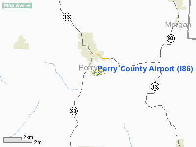
Location & QuickFacts
| FAA Information Effective: | 2008-09-25 |
| Airport Identifier: | I86 |
| Airport Status: | Operational |
| Longitude/Latitude: | 082-11-52.0290W/39-41-29.7480N
-82.197786/39.691597 (Estimated) |
| Elevation: | 1051 ft / 320.34 m (Surveyed) |
| Land: | 53 acres |
| From nearest city: | 2 nautical miles S of New Lexington, OH |
| Location: | Perry County, OH |
| Magnetic Variation: | 03W (1975) |
Owner & Manager
| Ownership: | Publicly owned |
| Owner: | Perry County Airport Authority |
| Address: | Courthouse
New Lexington, OH 43764 |
| Phone number: | 740-342-2045 |
| Manager: | Lawrence Nash |
| Address: | 1870 Arpt Road Se
New Lexington, OH 43764 |
| Phone number: | 740-342-1141 |
Airport Operations and Facilities
| Airport Use: | Open to public |
| Wind indicator: | Yes |
| Segmented Circle: | No |
| Control Tower: | No |
| Lighting Schedule: | DUSK-DAWN
ACTVT MIRL RY 08/26 & REIL RY 26 - 122.8. |
| Beacon Color: | Clear-Green (lighted land airport) |
| Landing fee charge: | No |
| Sectional chart: | Cincinnati |
| Region: | AGL - Great Lakes |
| Boundary ARTCC: | ZID - Indianapolis |
| Tie-in FSS: | CLE - Cleveland |
| FSS on Airport: | No |
| FSS Toll Free: | 1-800-WX-BRIEF |
| NOTAMs Facility: | CLE (NOTAM-d service avaliable) |
| Federal Agreements: | N |
Airport Communications
| CTAF: | 122.800 |
| Unicom: | 122.800 |
Airport Services
| Bottled Oxygen: | NONE |
| Bulk Oxygen: | NONE |
Runway Information
Runway 08/26
| Dimension: | 3498 x 75 ft / 1066.2 x 22.9 m |
| Surface: | ASPH, Good Condition
RY 08/26 HAS 3" TO 4" WIDE CRACKS AT VARIOUS LOCATIONS. |
| Edge Lights: | Medium |
| |
Runway 08 |
Runway 26 |
| Longitude: | 082-12-13.3310W | 082-11-30.7430W |
| Latitude: | 39-41-24.4310N | 39-41-35.0270N |
| Elevation: | 1051.00 ft | 1042.00 ft |
| Alignment: | 72 | 127 |
| Traffic Pattern: | Left | Left |
| Markings: | Numbers only, Poor Condition
RWY 08/26 NRS ONLY MARKING - POOR - WEATHERED. | Numbers only, Poor Condition |
| Runway End Identifier: | No | Yes
OTS INDEFLY. |
| Centerline Lights: | No | No |
| Touchdown Lights: | No | No |
| Obstruction: | 9 ft fence, 318.0 ft from runway, 82 ft right of centerline, 13:1 slope to clear
RWY 08 ROAD 0 FT FROM 250 FT RIGHT. | 50 ft trees, 201.0 ft from runway, 234 ft right of centerline
RWY 26 +33 FT TO +50 FT TREES 0-200 FT FM THLD 234 FT R. |
|
Radio Navigation Aids
| ID |
Type |
Name |
Ch |
Freq |
Var |
Dist |
| PKB | FAN MARKER | Marietta Ohio | | | 03W | 40.7 nm |
| HRA | NDB | Zanesville | | 204.00 | 06W | 18.2 nm |
| HEH | NDB | Newark | | 524.00 | 06W | 23.5 nm |
| UGS | NDB | University | | 250.00 | 06W | 26.3 nm |
| CM | NDB | Sumie | | 391.00 | 05W | 31.2 nm |
| CYO | NDB | Circleville | | 366.00 | 05W | 37.6 nm |
| RZT | NDB | Ross County | | 236.00 | 05W | 41.4 nm |
| CHC | NDB | Grens | | 272.00 | 04W | 42.9 nm |
| EOP | NDB | Waverly | | 385.00 | 06W | 46.4 nm |
| DKG | NDB | Don Scott | | 348.00 | 05W | 46.9 nm |
| BU | NDB | Boutn | | 230.00 | 05W | 47.2 nm |
| LCK | TACAN | Rickenbacker | 069X | | 05W | 34.5 nm |
| XUB | VOR | Yellow Bud | | 112.50 | 05W | 37.5 nm |
| ZZV | VOR/DME | Zanesville | 051X | 111.40 | 06W | 20.6 nm |
| TVT | VOR/DME | Tiverton | 112X | 116.50 | 03W | 46.2 nm |
| CTW | VOR/DME | Newcomerstown | 055X | 111.80 | 07W | 46.4 nm |
| APE | VORTAC | Appleton | 114X | 116.70 | 06W | 33.0 nm |
| JPU | VORTAC | Parkersburg | 023X | 108.60 | 03W | 41.0 nm |
| CMH | VOT | Port Columbus | | 111.00 | | 36.6 nm |
Remarks
- DEER & TURKEY ON & INVOF ARPT.
- PAEW INVOF RY 08/26.
Images and information placed above are from
http://www.airport-data.com/airport/I86/
We thank them for the data!
| General Info
|
| Country |
United States
|
| State |
OHIO
|
| FAA ID |
I86
|
| Latitude |
39-41-29.748N
|
| Longitude |
082-11-52.029W
|
| Elevation |
1051 feet
|
| Near City |
NEW LEXINGTON
|
We don't guarantee the information is fresh and accurate. The data may
be wrong or outdated.
For more up-to-date information please refer to other sources.
|
|


