 |
|
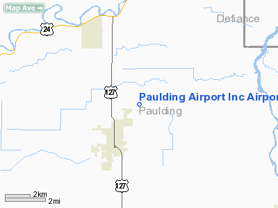
Paulding Airport Inc Airport |
Location & QuickFacts
| FAA Information Effective: | 2008-09-25 |
| Airport Identifier: | 2H8 |
| Airport Status: | Operational |
| Longitude/Latitude: | 084-33-24.8240W/41-10-05.1780N
-84.556896/41.168105 (Estimated) |
| Elevation: | 721 ft / 219.76 m (Surveyed) |
| Land: | 29 acres |
| From nearest city: | 2 nautical miles NE of Paulding, OH |
| Location: | Paulding County, OH |
| Magnetic Variation: | 04W (1985) |
Owner & Manager
| Ownership: | Privately owned |
| Owner: | Jim Calvin |
| Address: | 13961 Rd 162
Paulding, OH 45879 |
| Phone number: | 419-769-7106 |
| Manager: | Ron Weck |
| Address: | 07106 Casebeer Miller Rd
Hicksville, OH 43526 |
| Phone number: | 419-399-5685 |
Airport Operations and Facilities
| Airport Use: | Open to public |
| Wind indicator: | Yes |
| Segmented Circle: | No |
| Control Tower: | No |
| Lighting Schedule: | RDO-CTL
ACTVT LIRL RY 18/36 - 122.9. |
| Landing fee charge: | No |
| Sectional chart: | Detroit |
| Region: | AGL - Great Lakes |
| Traffic Pattern Alt: | 779 ft |
| Boundary ARTCC: | ZOB - Cleveland |
| Responsible ARTCC: | ZAU - Chicago |
| Tie-in FSS: | CLE - Cleveland |
| FSS on Airport: | No |
| FSS Toll Free: | 1-800-WX-BRIEF |
| NOTAMs Facility: | CLE (NOTAM-d service avaliable) |
Airport Communications
Airport Services
| Fuel available: | 100 |
| Airframe Repair: | MAJOR |
| Power Plant Repair: | MAJOR |
| Bottled Oxygen: | LOW |
| Bulk Oxygen: | NONE |
Runway Information
Runway 18/36
| Dimension: | 2861 x 80 ft / 872.0 x 24.4 m |
| Surface: | TURF, Good Condition |
| Edge Lights: | Non-standard lighting system
RY 18/36 NSTD LIRL; THRESHOLD LIGHTS INCORRECT COLOR. |
| |
Runway 18 |
Runway 36 |
| Traffic Pattern: | Left | Left |
| Obstruction: | , 50:1 slope to clear | 13 ft bldg, 293.0 ft from runway, 91 ft left of centerline, 22:1 slope to clear |
|
Radio Navigation Aids
| ID |
Type |
Name |
Ch |
Freq |
Var |
Dist |
| DFI | NDB | Defiance | | 246.00 | 05W | 11.6 nm |
| VFU | NDB | Stanley | | 411.00 | 05W | 18.5 nm |
| BYN | NDB | Bryan | | 260.00 | 04W | 19.2 nm |
| PDR | NDB | Ottawa | | 233.00 | 05W | 27.6 nm |
| USE | NDB | Fulton | | 375.00 | 05W | 32.7 nm |
| LYL | NDB | Lima | | 362.00 | 04W | 36.9 nm |
| ANQ | NDB | Angola | | 347.00 | 05W | 37.1 nm |
| BNR | NDB | Benton Ridge | | 334.00 | 05W | 41.2 nm |
| CQA | NDB | Lakefield | | 205.00 | 04W | 41.2 nm |
| HHG | NDB | Huntington | | 417.00 | 03W | 45.2 nm |
| PLD | NDB | Portland | | 257.00 | 03W | 47.1 nm |
| ADG | NDB | Adrian | | 278.00 | 06W | 47.4 nm |
| TOL | TACAN | Toledo | 072X | | 05W | 42.7 nm |
| AOH | VOR | Allen County | | 108.40 | 04W | 38.5 nm |
| MAH | VOR | Marathon | | 114.90 | 05W | 41.5 nm |
| OLK | VOR | Wolf Lake | | 110.40 | 03W | 42.8 nm |
| VWV | VOR/DME | Waterville | 078X | 113.10 | 02W | 44.8 nm |
| FWA | VORTAC | Fort Wayne | 125X | 117.80 | 00E | 30.8 nm |
| FDY | VORTAC | Findlay | 019X | 108.20 | 02W | 38.5 nm |
| FWA | VOT | Fort Wayne Baer | | 111.00 | | 30.9 nm |
Remarks
- ARPT CLSD INDEFLY.
- PRVDD CLEAR 20:1 APCH & CLEAR OBSTACLE FREE ZONE.
Images and information placed above are from
http://www.airport-data.com/airport/2H8/
We thank them for the data!
| General Info
|
| Country |
United States
|
| State |
OHIO
|
| FAA ID |
2H8
|
| Latitude |
41-10-05.178N
|
| Longitude |
084-33-24.824W
|
| Elevation |
721 feet
|
| Near City |
PAULDING
|
We don't guarantee the information is fresh and accurate. The data may
be wrong or outdated.
For more up-to-date information please refer to other sources.
|
|


