 |
|
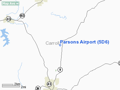
Location & QuickFacts
| FAA Information Effective: | 2008-09-25 |
| Airport Identifier: | 5D6 |
| Airport Status: | Operational |
| Longitude/Latitude: | 081-04-07.3460W/40-38-53.2200N
-81.068707/40.648117 (Estimated) |
| Elevation: | 1290 ft / 393.19 m (Estimated) |
| Land: | 10 acres |
| From nearest city: | 5 nautical miles N of Carrollton, OH |
| Location: | Carroll County, OH |
| Magnetic Variation: | 07W (1985) |
Owner & Manager
| Ownership: | Privately owned |
| Owner: | Donna M Parsons |
| Address: | 5043 Kensington Rd Ne
Carrollton, OH 44615 |
| Phone number: | 330-627-5794 |
| Manager: | L. E. Parsons |
| Address: | 5043 Kensington Rd Ne
Carrollton, OH 44615 |
| Phone number: | 330-627-5794 |
Airport Operations and Facilities
| Airport Use: | Open to public |
| Wind indicator: | Yes |
| Segmented Circle: | No |
| Control Tower: | No |
| Landing fee charge: | No |
| Sectional chart: | Detroit |
| Region: | AGL - Great Lakes |
| Boundary ARTCC: | ZOB - Cleveland |
| Tie-in FSS: | CLE - Cleveland |
| FSS on Airport: | No |
| FSS Toll Free: | 1-800-WX-BRIEF |
| NOTAMs Facility: | CLE (NOTAM-d service avaliable) |
Airport Communications
Airport Services
| Airframe Repair: | MINOR |
| Power Plant Repair: | MINOR |
| Bottled Oxygen: | NONE |
| Bulk Oxygen: | NONE |
Runway Information
Runway 09/27
| Dimension: | 2530 x 75 ft / 771.1 x 22.9 m |
| Surface: | TURF, Good Condition |
| |
Runway 09 |
Runway 27 |
| Longitude: | 081-04-25.7500W | 081-03-52.9200W |
| Latitude: | 40-38-55.1000N | 40-38-55.0900N |
| Elevation: | 1280.00 ft | 1280.00 ft |
| Traffic Pattern: | Left | Left |
| Obstruction: | 51 ft trees, 392.0 ft from runway, 7:1 slope to clear | 25 ft tree, 69.0 ft from runway, 75 ft right of centerline, 2:1 slope to clear |
|
Radio Navigation Aids
| ID |
Type |
Name |
Ch |
Freq |
Var |
Dist |
| TSO | NDB | Tolson | | 395.00 | 07W | 5.2 nm |
| CFX | NDB | Cadiz | | 239.00 | 07W | 24.9 nm |
| AK | NDB | Akron | | 362.00 | 07W | 29.2 nm |
| MLR | NDB | Millersburg/dcmsnd | | 382.00 | 06W | 37.2 nm |
| UCP | NDB | Castle | | 272.00 | 09W | 37.3 nm |
| HBD | NDB | Hubbard | | 408.00 | 08W | 38.9 nm |
| BSV | VOR/DME | Briggs | 071X | 112.40 | 04W | 17.5 nm |
| ACO | VOR/DME | Akron | 091X | 114.40 | 04W | 28.3 nm |
| CTW | VOR/DME | Newcomerstown | 055X | 111.80 | 07W | 31.3 nm |
| HLG | VOR/DME | Wheeling | 059X | 112.20 | 07W | 32.7 nm |
| AIR | VOR/DME | Bellaire | 118X | 117.10 | 07W | 39.6 nm |
| TVT | VOR/DME | Tiverton | 112X | 116.50 | 03W | 49.7 nm |
| EWC | VORTAC | Ellwood City | 105X | 115.80 | 08W | 40.5 nm |
| MMJ | VORTAC | Montour | 057X | 112.00 | 08W | 41.1 nm |
| YNG | VORTAC | Youngstown | 027X | 109.00 | 05W | 44.8 nm |
| CAK | VOT | Akron/canton Regional | | 110.60 | | 23.4 nm |
Remarks
- DEER AND BIRDS ON AND INVOF ARPT.
- BE ALERT: RWY 9-27 SLOPES UP TO THE WEST.
- ACRBT PRACTICE AREA 2280-5000'MSL WI ONE MI RAD OF APT.
- RWY SOFT WHEN WET.
- BE ALERT: NO LINE OF SIGHT BTN RY ENDS.
- VFR ONLY
Images and information placed above are from
http://www.airport-data.com/airport/5D6/
We thank them for the data!
| General Info
|
| Country |
United States
|
| State |
OHIO
|
| FAA ID |
5D6
|
| Latitude |
40-38-53.220N
|
| Longitude |
081-04-07.346W
|
| Elevation |
1290 feet
|
| Near City |
CARROLLTON
|
We don't guarantee the information is fresh and accurate. The data may
be wrong or outdated.
For more up-to-date information please refer to other sources.
|
|


