|
|
 |
(Click on the photo to enlarge) |
Location & QuickFacts
| FAA Information Effective: | 2008-09-25 |
| Airport Identifier: | 42I |
| Airport Status: | Operational |
| Longitude/Latitude: | 082-00-44.4890W/40-00-25.2420N
-82.012358/40.007012 (Estimated) |
| Elevation: | 790 ft / 240.79 m (Estimated) |
| Land: | 32 acres |
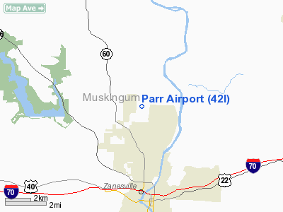
| From nearest city: | 5 nautical miles N of Zanesville, OH |
| Location: | Muskingum County, OH |
| Magnetic Variation: | 06W (1985) |
Owner & Manager
| Ownership: | Privately owned |
| Owner: | C E Norman |
| Address: | 1200 Fairview Rd
Zanesville, OH 43701 |
| Phone number: | 614-454-1615 |
| Manager: | C. E. Norman |
| Address: | 1200 Fairview Rd
Zanesville, OH 43701 |
| Phone number: | 614-454-1615 |
Airport Operations and Facilities
| Airport Use: | Open to public |
| Wind indicator: | Yes |
| Segmented Circle: | No |
| Control Tower: | No |
| Lighting Schedule: | RDO-CTL
FOR LIRL RY 10/28 KEY 122.8 FIVE TIMES ON; EIGHT TIMES SLOWLY TO DEACTIVATE. |
| Sectional chart: | Detroit |
| Region: | AGL - Great Lakes |
| Boundary ARTCC: | ZID - Indianapolis |
| Tie-in FSS: | CLE - Cleveland |
| FSS on Airport: | No |
| FSS Toll Free: | 1-800-WX-BRIEF |
| NOTAMs Facility: | CLE (NOTAM-d service avaliable) |
Airport Communications
| CTAF: | 122.800 |
| Unicom: | 122.800 |
Airport Services
| Fuel available: | 100LL80 |
| Airframe Repair: | MAJOR |
| Power Plant Repair: | MAJOR |
| Bottled Oxygen: | NONE |
| Bulk Oxygen: | NONE |
Runway Information
Runway 10/28
| Dimension: | 3100 x 26 ft / 944.9 x 7.9 m
81 FT GRASS STWY EAST END OF RY. |
| Surface: | ASPH, Good Condition |
| Weight Limit: | Single wheel: 10000 lbs. |
| Edge Lights: | Low |
| |
Runway 10 |
Runway 28 |
| Longitude: | 082-01-08.4000W | 082-00-28.6500W |
| Latitude: | 40-00-27.2700N | 40-00-25.2300N |
| Elevation: | 780.00 ft | 790.00 ft |
| Traffic Pattern: | Left | Right |
| Markings: | Nonstandard, Fair Condition
RY 28 HAS SOLID WHITE LINE UNDER RY NUMBERS. | Nonstandard, Good Condition
RWY 10 RY 28 HAS SOLID WHITE LINE UNDER RY NUMBERS. |
| Displaced threshold: | 0.00 ft | 61.00 ft |
| Runway End Identifier: | No | No |
| Obstruction: | 74 ft trees, 965.0 ft from runway, 60 ft right of centerline, 10:1 slope to clear | 50 ft trees, 351.0 ft from runway, 70 ft right of centerline, 3:1 slope to clear
9:1 TO DISPLACED THRESHOLD.
RWY 28 +83 FT TREES 0 FT-130 FT FM RY END 70 FT R-125 FT R. |
|
Radio Navigation Aids
| ID |
Type |
Name |
Ch |
Freq |
Var |
Dist |
| PKB | FAN MARKER | Marietta Ohio | | | 03W | 46.5 nm |
| HRA | NDB | Zanesville | | 204.00 | 06W | 7.4 nm |
| HEH | NDB | Newark | | 524.00 | 06W | 20.8 nm |
| MLR | NDB | Millersburg/dcmsnd | | 382.00 | 06W | 32.8 nm |
| CM | NDB | Sumie | | 391.00 | 05W | 34.2 nm |
| UGS | NDB | University | | 250.00 | 06W | 45.4 nm |
| CHC | NDB | Grens | | 272.00 | 04W | 46.8 nm |
| CFX | NDB | Cadiz | | 239.00 | 07W | 48.0 nm |
| DKG | NDB | Don Scott | | 348.00 | 05W | 49.3 nm |
| MF | NDB | Manns | | 372.00 | 06W | 49.7 nm |
| LCK | TACAN | Rickenbacker | 069X | | 05W | 43.9 nm |
| ZZV | VOR/DME | Zanesville | 051X | 111.40 | 06W | 6.8 nm |
| TVT | VOR/DME | Tiverton | 112X | 116.50 | 03W | 27.6 nm |
| CTW | VOR/DME | Newcomerstown | 055X | 111.80 | 07W | 28.0 nm |
| APE | VORTAC | Appleton | 114X | 116.70 | 06W | 27.9 nm |
| JPU | VORTAC | Parkersburg | 023X | 108.60 | 03W | 45.0 nm |
| CMH | VOT | Port Columbus | | 111.00 | | 40.2 nm |
Remarks
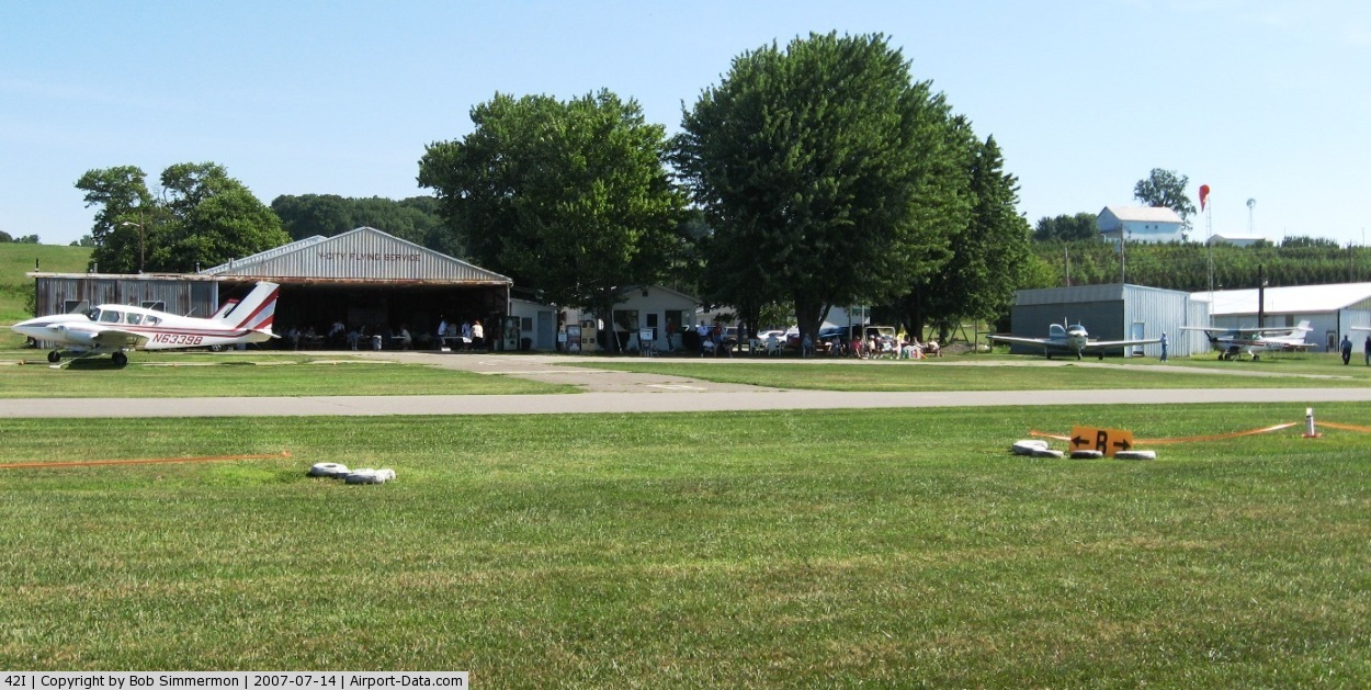
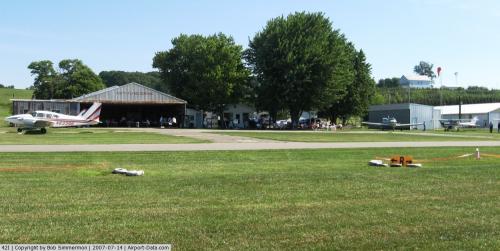
Images and information placed above are from
http://www.airport-data.com/airport/42I/
We thank them for the data!
| General Info
|
| Country |
United States
|
| State |
OHIO
|
| FAA ID |
42I
|
| Latitude |
40-00-25.242N
|
| Longitude |
082-00-44.489W
|
| Elevation |
790 feet
|
| Near City |
ZANESVILLE
|
We don't guarantee the information is fresh and accurate. The data may
be wrong or outdated.
For more up-to-date information please refer to other sources.
|
|