 |
|
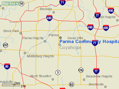
Parma Community Hospital Heliport |
Location & QuickFacts
| FAA Information Effective: | 2008-09-25 |
| Airport Identifier: | 62OI |
| Airport Status: | Operational |
| Longitude/Latitude: | 081-43-54.4710W/41-22-52.1880N
-81.731797/41.381163 (Estimated) |
| Elevation: | 931 ft / 283.77 m (Estimated) |
| Land: | 0 acres |
| From nearest city: | 0 nautical miles N of Parma, OH |
| Location: | Cuyahoga County, OH |
| Magnetic Variation: | 06W (1980) |
Owner & Manager
| Ownership: | Privately owned |
| Owner: | Parma Community Gen Hospital |
| Address: | 7007 Powers Blvd
Parma, OH 44129 |
| Phone number: | 216-888-1800 |
| Manager: | Harold K. Robbins |
| Address: | 7007 Powers Blvd
Parma, OH 44129 |
| Phone number: | 216-888-1800 |
Airport Operations and Facilities
| Airport Use: | Private
MEDICAL USE. |
| Wind indicator: | Yes |
| Segmented Circle: | No |
| Control Tower: | No |
| Sectional chart: | Detroit |
| Region: | AGL - Great Lakes |
| Boundary ARTCC: | ZOB - Cleveland |
| Tie-in FSS: | CLE - Cleveland |
| FSS Toll Free: | 1-800-WX-BRIEF |
Runway Information
Helipad H1
| Dimension: | 36 x 36 ft / 11.0 x 11.0 m |
| Surface: | ASPH, |
| |
Runway H1 |
Runway |
| Traffic Pattern: | Left | Left |
|
Radio Navigation Aids
| ID |
Type |
Name |
Ch |
Freq |
Var |
Dist |
| EZE | NDB | Engel | | 226.00 | 07W | 6.5 nm |
| BKL | NDB | Burke Lakefront | | 416.00 | 07W | 9.4 nm |
| CL | NDB | Harri | | 344.00 | 07W | 10.8 nm |
| LQL | NDB | Lakeland | | 263.00 | 08W | 24.1 nm |
| AK | NDB | Akron | | 362.00 | 07W | 24.3 nm |
| AAU | NDB | Ashland | | 329.00 | 07W | 34.5 nm |
| PT | NDB | Pelee Island | | 283.00 | 05W | 48.5 nm |
| MF | NDB | Manns | | 372.00 | 06W | 49.1 nm |
| DJB | VOR/DME | Dryer | 083X | 113.60 | 05W | 19.5 nm |
| LNN | VOR/DME | Lost Nation | 039X | 110.20 | 08W | 23.9 nm |
| CXR | VOR/DME | Chardon | 074X | 112.70 | 05W | 26.9 nm |
| ACO | VOR/DME | Akron | 091X | 114.40 | 04W | 29.1 nm |
| BSV | VOR/DME | Briggs | 071X | 112.40 | 04W | 40.8 nm |
| SKY | VOR/DME | Sandusky | 029X | 109.20 | 04W | 41.7 nm |
| JFN | VOR/DME | Jefferson | 099X | 115.20 | 05W | 49.8 nm |
| YNG | VORTAC | Youngstown | 027X | 109.00 | 05W | 47.8 nm |
| MFD | VORTAC | Mansfield | 025X | 108.80 | 03W | 49.6 nm |
| CLE | VOT | Cleveland | | 110.40 | | 5.6 nm |
| CAK | VOT | Akron/canton Regional | | 110.60 | | 30.9 nm |
Remarks
- 92' BLDG 135' S; 84' TREES 25' E & N; 48' POLES 30' NW.
- PRVDD OPNS CONDUCTED FM 010 DEG TO 100 DEG & FM 260 DEG TO 280 DEG; AREA MKD; WIND INDICATOR MNTD.
Images and information placed above are from
http://www.airport-data.com/airport/62OI/
We thank them for the data!
| General Info
|
| Country |
United States
|
| State |
OHIO
|
| FAA ID |
62OI
|
| Latitude |
41-22-52.188N
|
| Longitude |
081-43-54.471W
|
| Elevation |
931 feet
|
| Near City |
PARMA
|
We don't guarantee the information is fresh and accurate. The data may
be wrong or outdated.
For more up-to-date information please refer to other sources.
|
|


