 |
|
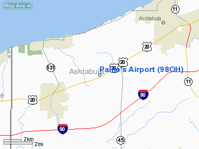
Location & QuickFacts
| FAA Information Effective: | 2008-09-25 |
| Airport Identifier: | 98OH |
| Airport Status: | Operational |
| Longitude/Latitude: | 080-52-59.3250W/41-49-30.1930N
-80.883146/41.825054 (Estimated) |
| Elevation: | 660 ft / 201.17 m (Estimated) |
| Land: | 9 acres |
| From nearest city: | 3 nautical miles SE of Geneva, OH |
| Location: | Ashtabula County, OH |
| Magnetic Variation: | 07W (1985) |
Owner & Manager
| Ownership: | Privately owned |
| Owner: | Damon A. Paine |
| Address: | 6943 Rd 4
Geneva, OH 44041 |
| Phone number: | 216-466-2888 |
| Manager: | Damon A. Paine |
| Address: | 6943 Rd 4
Geneva, OH 44041 |
| Phone number: | 216-466-2888 |
Airport Operations and Facilities
| Airport Use: | Private
PERSONAL USE. |
| Wind indicator: | Yes |
| Segmented Circle: | No |
| Control Tower: | No |
| Landing fee charge: | No |
| Sectional chart: | Detroit |
| Region: | AGL - Great Lakes |
| Boundary ARTCC: | ZOB - Cleveland |
| Tie-in FSS: | CLE - Cleveland |
| FSS on Airport: | No |
| FSS Toll Free: | 1-800-WX-BRIEF |
Runway Information
Runway 18/36
| Dimension: | 2400 x 130 ft / 731.5 x 39.6 m |
| Surface: | TURF, |
| |
Runway 18 |
Runway 36 |
| Traffic Pattern: | Left | Right |
| Obstruction: | 60 ft trees | 30 ft pline |
|
Radio Navigation Aids
| ID |
Type |
Name |
Ch |
Freq |
Var |
Dist |
| LQL | NDB | Lakeland | | 263.00 | 08W | 23.8 nm |
| CQD | NDB | Cascade | | 372.00 | 08W | 39.0 nm |
| BKL | NDB | Burke Lakefront | | 416.00 | 07W | 39.3 nm |
| EZE | NDB | Engel | | 226.00 | 07W | 42.8 nm |
| HBD | NDB | Hubbard | | 408.00 | 08W | 43.4 nm |
| JFN | VOR/DME | Jefferson | 099X | 115.20 | 05W | 7.2 nm |
| CXR | VOR/DME | Chardon | 074X | 112.70 | 05W | 22.4 nm |
| LNN | VOR/DME | Lost Nation | 039X | 110.20 | 08W | 24.2 nm |
| ACO | VOR/DME | Akron | 091X | 114.40 | 04W | 45.4 nm |
| ERI | VORTAC | Erie | 031X | 109.40 | 06W | 28.8 nm |
| YNG | VORTAC | Youngstown | 027X | 109.00 | 05W | 31.1 nm |
Remarks
- VFR PVT USE. RIGHT TFC RWY 36 LEFT TFC RWY 18.
Images and information placed above are from
http://www.airport-data.com/airport/98OH/
We thank them for the data!
| General Info
|
| Country |
United States
|
| State |
OHIO
|
| FAA ID |
98OH
|
| Latitude |
41-49-30.193N
|
| Longitude |
080-52-59.325W
|
| Elevation |
660 feet
|
| Near City |
GENEVA
|
We don't guarantee the information is fresh and accurate. The data may
be wrong or outdated.
For more up-to-date information please refer to other sources.
|
|


