 |
|
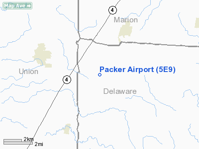
Location & QuickFacts
| FAA Information Effective: | 2008-09-25 |
| Airport Identifier: | 5E9 |
| Airport Status: | Operational |
| Longitude/Latitude: | 083-13-09.6960W/40-24-28.7150N
-83.219360/40.407976 (Estimated) |
| Elevation: | 918 ft / 279.81 m (Estimated) |
| Land: | 15 acres |
| From nearest city: | 3 nautical miles NW of Radnor, OH |
| Location: | Delaware County, OH |
| Magnetic Variation: | 05W (1985) |
Owner & Manager
| Ownership: | Privately owned |
| Owner: | Richard L. Packer |
| Address: | 5266 Mooney Road
Radnor, OH 43066 |
| Phone number: | 740-494-2554 |
| Manager: | Linda Sue Packer |
| Address: | 5266 Mooney Road
Radnor, OH 43066 |
| Phone number: | 740-494-2554 |
Airport Operations and Facilities
| Airport Use: | Open to public |
| Wind indicator: | Yes |
| Segmented Circle: | No |
| Control Tower: | No |
| Landing fee charge: | No |
| Sectional chart: | Detroit |
| Region: | AGL - Great Lakes |
| Traffic Pattern Alt: | 900 ft |
| Boundary ARTCC: | ZID - Indianapolis |
| Tie-in FSS: | DAY - Dayton |
| FSS on Airport: | No |
| FSS Toll Free: | 1-800-WX-BRIEF |
| NOTAMs Facility: | DAY (NOTAM-d service avaliable) |
Airport Communications
Airport Services
| Fuel available: | 100LL |
| Airframe Repair: | MAJOR |
| Power Plant Repair: | MAJOR |
Runway Information
Runway 09/27
| Dimension: | 3470 x 90 ft / 1057.7 x 27.4 m |
| Surface: | TURF, Good Condition |
| |
Runway 09 |
Runway 27 |
| Traffic Pattern: | Left | Left |
| Displaced threshold: | 120.00 ft | 0.00 ft |
| Obstruction: | 18 ft road, 240.0 ft from runway, 13:1 slope to clear
APCH RATIO 20:1 TO DSPLCD THLD. | 73 ft trees, 3224.0 ft from runway, 44:1 slope to clear |
|
Radio Navigation Aids
| ID |
Type |
Name |
Ch |
Freq |
Var |
Dist |
| DLZ | NDB | Delaware | | 215.00 | 06W | 9.5 nm |
| MRT | NDB | Marysville | | 403.00 | 05W | 12.4 nm |
| MNN | NDB | Marion | | 201.00 | 05W | 14.3 nm |
| OS | NDB | Fuler | | 515.00 | 05W | 20.1 nm |
| DKG | NDB | Don Scott | | 348.00 | 05W | 20.7 nm |
| RUV | NDB | Rushsylvania | | 326.00 | 05W | 20.8 nm |
| CHC | NDB | Grens | | 272.00 | 04W | 25.5 nm |
| EDJ | NDB | Bellefontaine | | 242.00 | 05W | 27.3 nm |
| UYF | NDB | London | | 263.00 | 06W | 30.7 nm |
| CM | NDB | Sumie | | 391.00 | 05W | 33.1 nm |
| BU | NDB | Boutn | | 230.00 | 05W | 35.4 nm |
| LYL | NDB | Lima | | 362.00 | 04W | 40.8 nm |
| CCJ | NDB | Clark County | | 341.00 | 04W | 41.1 nm |
| MF | NDB | Manns | | 372.00 | 06W | 41.4 nm |
| TII | NDB | Tiffin | | 269.00 | 05W | 41.5 nm |
| HEH | NDB | Newark | | 524.00 | 06W | 41.6 nm |
| BNR | NDB | Benton Ridge | | 334.00 | 05W | 42.2 nm |
| FZI | NDB | Fostoria | | 379.00 | 05W | 47.6 nm |
| CSS | NDB | Court House | | 414.00 | 05W | 49.2 nm |
| LCK | TACAN | Rickenbacker | 069X | | 05W | 38.4 nm |
| XSF | TACAN | Springfield | 065X | | 04W | 44.6 nm |
| BUD | VOR | Buckeye | | 109.80 | 05W | 14.4 nm |
| AOH | VOR | Allen County | | 108.40 | 04W | 38.6 nm |
| MAH | VOR | Marathon | | 114.90 | 05W | 41.7 nm |
| SGH | VOR/DME | Springfield | 079X | 113.20 | 04W | 44.8 nm |
| APE | VORTAC | Appleton | 114X | 116.70 | 06W | 32.8 nm |
| ROD | VORTAC | Rosewood | 122X | 117.50 | 05W | 38.4 nm |
| MFD | VORTAC | Mansfield | 025X | 108.80 | 03W | 39.9 nm |
| FDY | VORTAC | Findlay | 019X | 108.20 | 02W | 41.0 nm |
| CMH | VOT | Port Columbus | | 111.00 | | 29.2 nm |
Remarks
- PROVIDED RWY THRS ARE LCTD SO AS TO PRVD A MIN 20:1 OBSTN CLRNC OVER ANY OBSTACLES. MOONEY ROAD CONSIDERED A 15' OBSTACLE.
Images and information placed above are from
http://www.airport-data.com/airport/5E9/
We thank them for the data!
| General Info
|
| Country |
United States
|
| State |
OHIO
|
| FAA ID |
5E9
|
| Latitude |
40-24-28.715N
|
| Longitude |
083-13-09.696W
|
| Elevation |
918 feet
|
| Near City |
RADNOR
|
We don't guarantee the information is fresh and accurate. The data may
be wrong or outdated.
For more up-to-date information please refer to other sources.
|
|


