|
 |
|
||||
|
Coordinates: 39°12′43″N 082°13′45″W / 39.21194°N 82.22917°W
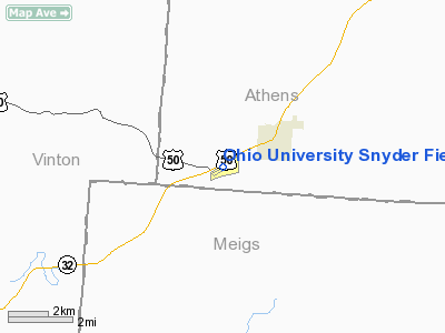
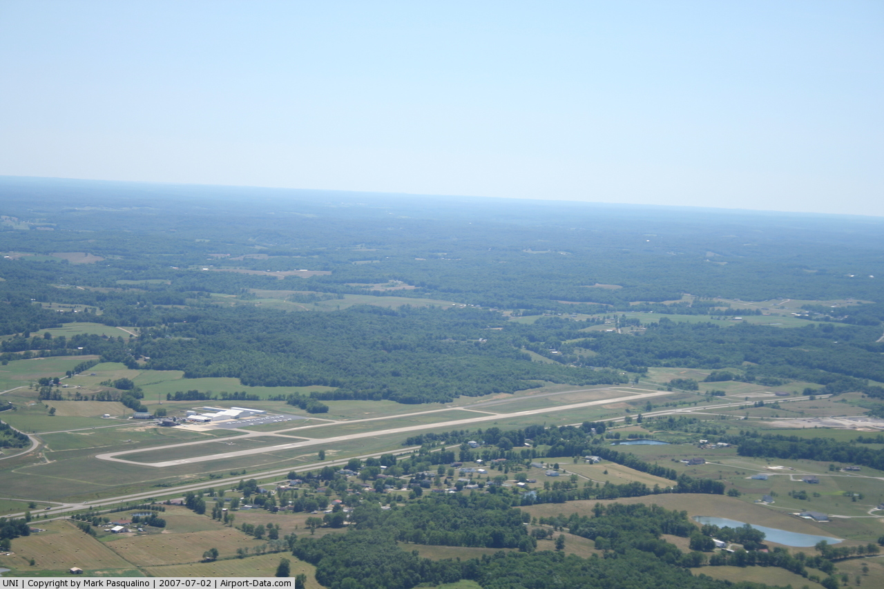
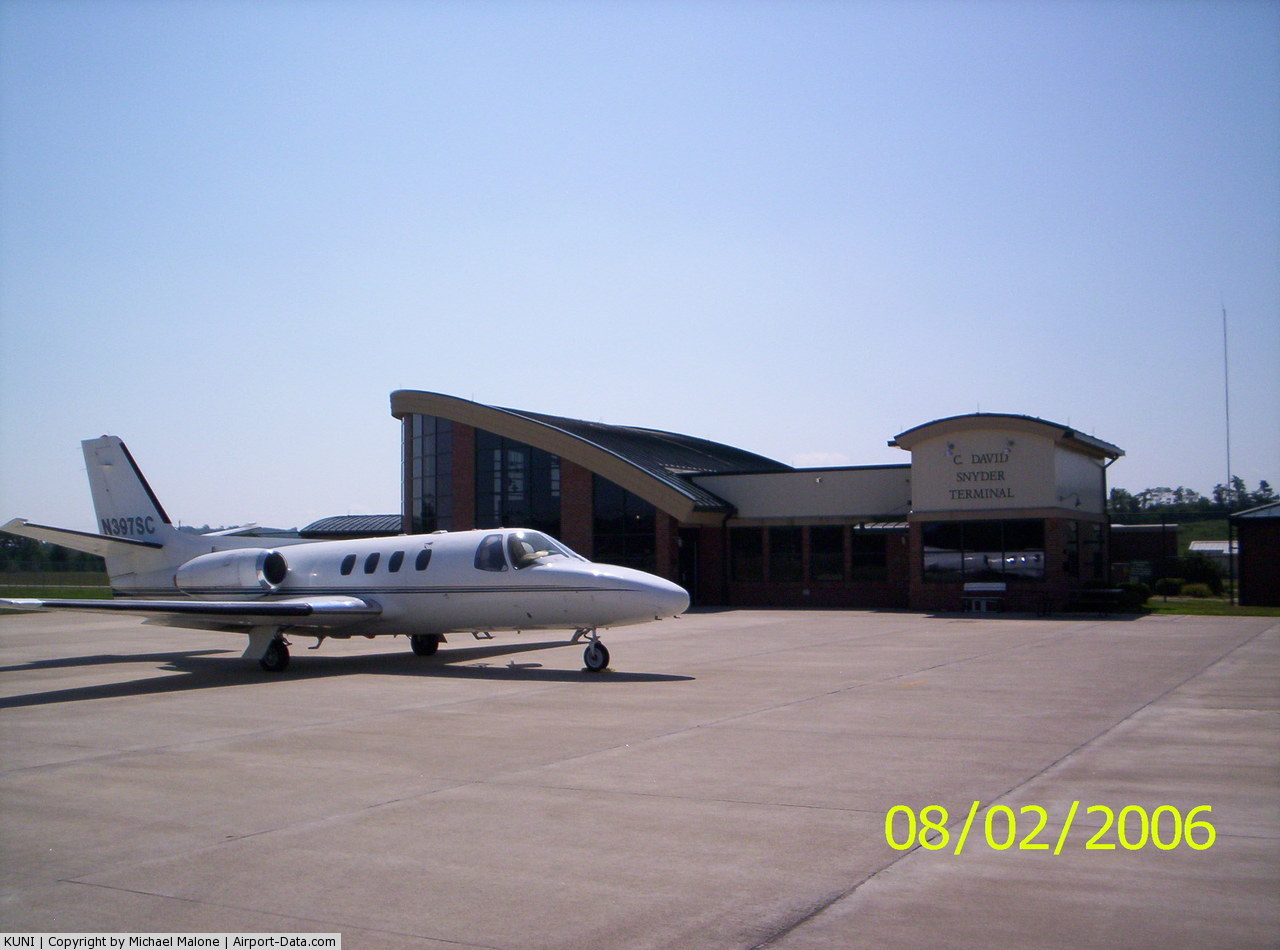
Ohio University Airport or Gordon K. Bush Airport (IATA: ATO, ICAO: KUNI, FAA LID: UNI), also known as Snyder Field, is a public-use airport located on State Route 32/U.S. 50 in the village of Albany, about ten miles (16 km) southwest of city of Athens, in Athens County, Ohio, United States. The airport is owned by Ohio University in Athens, not to be confused with Ohio State University in Columbus, which owns the Ohio State University Airport (IATA/FAA: OSU). Although most U.S. airports use the same three-letter location identifier for the FAA and IATA, Ohio University Airport is assigned UNI by the FAA and ATO by the IATA (which assigned UNI to the airport on Union Island in Saint Vincent and the Grenadines). HistoryAthens County's first airport was located just a few miles east of Athens on U.S. 50. The Rowland Family used to own that airport until Ohio University purchased it in 1943. The airport at the time was used for civilian aviation and the university's flying program. In the 1960s, the Athens Bypass was in planning stages and would have gone through the airport's land. With this, the university decided to look for a new location. The university finally chose a location just west of Albany and the airport was constructed in the early 1970s and opened around 1972. The airport boasted a 4,200-foot (1,300 m) runway and a couple of hangars. The airport was renamed for university trustee and aviation supporter, Gordon K. Bush. In order to bring economic expansion to Athens County, major construction began on the airport in 2002 with the construction of the C. David Snyder Terminal and the extension of the runway to 5600 feet. Facilities and aircraftOhio University Airport covers an area of 308 acres (125 ha) which contains one asphalt paved runway (7/25) measuring 5,600 x 100 ft. (1,707 x 30 m). The airport offers fuel services, pilot snooze room, flight training, and mechanics on site. For the 12-month period ending December 31, 2005, the airport had 51,600 aircraft operations, an average of 141 per day: 99% general aviation, <1% air taxi and <1% military. There are 48 aircraft based at this airport: 88% single-engine, 10% multi-engine and 2% jet. Aviation ProgramThe aviation program started training pilots in 1939. Today the students can train in state of the art glass paneled aircraft. The aircraft were purchased in the summer of 2004. The chairman of the program is B.J. Galloway, he is also an Associate Professor, teaching students from basic private pilot to full on flight instructors. The chief flight instructor is Ron Faliszek. Mr. Faliszek also trains students in classrooms providing some of the ground school education before the students enter a plane. The training aircraft consist of 7 Piper Warrior 3's, 2 Piper Arrow 3's, 2 Cessna 152's, 1 Beachcraft Bonanza F33A, and 1 Beachcraft Baron. The students willlearn private pilot through multi-engine instructor on these planes. Charter airline
The above content comes from Wikipedia and is published under free licenses – click here to read more.
Location & QuickFacts
Owner & Manager
Airport Operations and Facilities
Airport Communications
Airport Services
Runway InformationRunway 07/25
Radio Navigation Aids
Remarks
Images and information placed above are from We thank them for the data!
We don't guarantee the information is fresh and accurate. The data may
be wrong or outdated.
|
||||||||||||||||||||||||||||||||||||||||||||||||||||||||||||||||||||||||||||||||||||||||||||||||||||||||||||||||||||||||||||||||||||||||||||||||||||||||||||||||||||||||||||||||||||||||||||||||||||||||||||||||||||||||||||||||||||||||||||||||||||||||||||||||||||||||||||||||||||||||||||||||||||||||||||||||||||||||||||||||||||||||||||||||||||||||||||||||||

 |
|
Copyright 2004-2026 © by Airports-Worldwide.com, Vyshenskoho st. 36, Lviv 79010, Ukraine Legal Disclaimer |