|
|
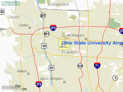
Ohio State University Airport |
Coordinates: 40°04′47″N 083°04′23″W / 40.07972°N 83.07306°W / 40.07972; -83.07306
| Ohio State University Airport |
| IATA: OSU – ICAO: KOSU – FAA LID: OSU |
| Summary |
| Airport type |
Public |
| Owner |
Ohio State University |
| Location |
Columbus, Ohio |
| Elevation AMSL |
905 ft / 276 m |
| Website |
www.osuairport.org |
| Runways |
| Direction |
Length |
Surface |
| ft |
m |
| 5/23 |
3,555 |
1,084 |
Asphalt |
| 9L/27R |
2,994 |
913 |
Asphalt |
| 9R/27L |
5,004 |
1,525 |
Asphalt |
| 14/32 |
3,438 |
1,048 |
Asphalt |
| Helipads |
| Number |
Length |
Surface |
| ft |
m |
| H1 |
40 |
12 |
Asphalt |
| Statistics (2005) |
| Aircraft operations |
94,098 |
| Based aircraft |
216 |
| Sources: FAA, airport website |
Ohio State University Airport (IATA: OSU, ICAO: KOSU, FAA LID: OSU) is a public airport located six miles (10 km) northwest of the central business district of Columbus, a city in Franklin County, Ohio, United States. It is nationally ranked the 88th general aviation airport.
The airport is operated by The Ohio State University in Columbus, not to be confused with Ohio University in Athens, which owns the Ohio University Airport (IATA: ATO, ICAO: KUNI, FAA LID: UNI). Its nickname is OSU Don Scott Airport after Donald E. Scott, an OSU alumnus who died during his training as a pilot in England during World War II.
The Ohio State University Airport (OSU) is one of the leading general aviation facilities in the nation, providing educational opportunities to the universitys students and aircraft services to many of central Ohios pilots and businesses.
The OSU Airport began in 1943 as a flight training facility for military and civilian pilots, operated by the OSU School of Aviation. The OSU Airport now operates as a self-supporting entity of The Ohio State University through the Department of Aerospace Engineering & Aviation.
The Department oversees all aspects of the Airport from Airport Management, to Fixed Base Operations, to Airport Maintenance.
Today, the OSU Airport serves as a general aviation reliever for Port Columbus International Airport. Its status as a Part 139 Certificated Airport assures the aviation community that the facility will meet specific standards in terms of operations and maintenance.
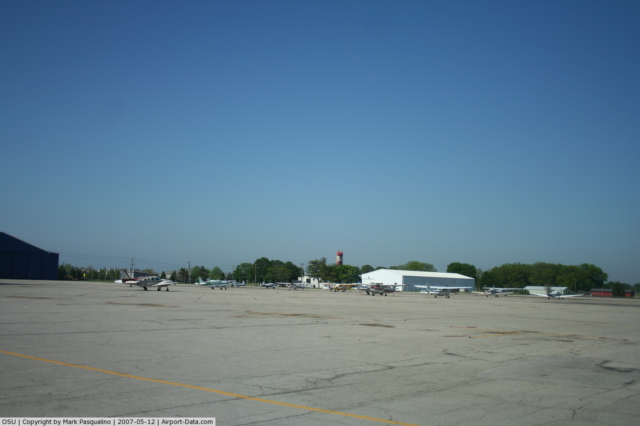
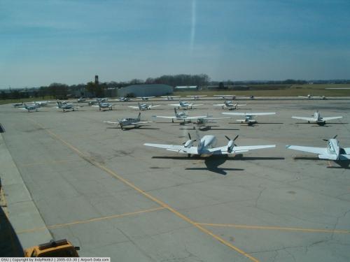
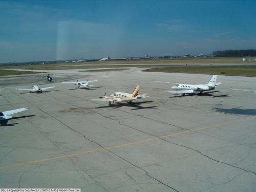
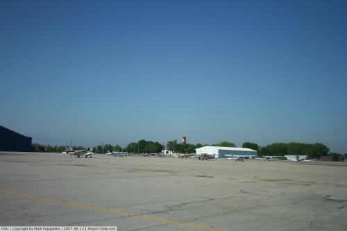
The OSU Airport is home to 230 aircraft, including single- and multi-engine, piston and turbine engine aircraft and rotorcraft. The OSU Airport oversees an estimated 100,000 operations per year, including corporate activity, student training, and pleasure flying. By comparison, the OSU Airport generally ranks in the top five airports in Ohio in the number of take-offs and landings with Cleveland Hopkins, Port Columbus, Dayton, and Cincinnati Lunken.
Primary users of the facility include local businesses and residents; as well as, transient users. The Airport is also home to the OSU Department of Aerospace Engineering & Aviation Gas Turbine Laboratory, several facilities operated by the OSU College of Agriculture, the Ohio Department of Transportations Office of Aviation, fourteen corporate flight departments, and four flying clubs.
Serving the Business Community The availability of the Airport to current and future users is important when one realizes that airports, even general aviation facilities, are a great generator of economic development. In fact, economic impact studies being conducted across the country indicate that major employers rank the proximity to a general aviation airport fifth behind labor supplies, highway access, commercial service airports, and urban centers when selecting a site to locate.
The Airport is strategically located to serve the rapidly expanding north outerbelt of Columbus, as well as the new commercial centers in Worthington, Dublin, and Hilliard.
Nationally, the Airport serves as a vital link between the central Ohio business community and their principal destination. Businesses benefit from a brief two-hour flight to 60% of the nations population, 60% of the nations manufacturing, and 60% of the nations purchasing power.
Based on a recent study, the OSU Airport is estimated to contribute roughly $103.6 million annually to the communitys economy through direct and indirect means. Direct impacts include the payroll of airport personnel, revenues and taxes received through the sale of aviation fuel and pilot supplies, and revenues generated by the leasing of airport property. Indirect impacts are generated when airport users visit local restaurants, stay at local hotels, and rent cars for off-airport travel.
The above content comes from Wikipedia and is published under free licenses – click here to read more.
 |
(Click on the photo to enlarge) |
 |
(Click on the photo to enlarge) |
 |
(Click on the photo to enlarge) |
 |
(Click on the photo to enlarge) |
 |
(Click on the photo to enlarge) |
 |
(Click on the photo to enlarge) |
Location & QuickFacts
| FAA Information Effective: | 2008-09-25 |
| Airport Identifier: | OSU |
| Airport Status: | Operational |
| Longitude/Latitude: | 083-04-22.9000W/40-04-47.2000N
-83.073028/40.079778 (Estimated) |
| Elevation: | 905 ft / 275.84 m (Surveyed) |
| Land: | 1080 acres |
| From nearest city: | 10 nautical miles NW of Columbus, OH |
| Location: | Franklin County, OH |
| Magnetic Variation: | 05W (1990) |
Owner & Manager
| Ownership: | Publicly owned |
| Owner: | Ohio State University |
| Address: | Ohio State Univ Airport, 2160 W. Case Rd
Columbus, OH 43235 |
| Phone number: | 614-292-5460 |
| Manager: | Douglas E. Hammon |
| Address: | Ohio State Univ Airport, 2160 W. Case Rd
Columbus, OH 43235 |
| Phone number: | 614-292-5460
FOR ARPT OPNS CALL 614-292-5580 |
Airport Operations and Facilities
| Airport Use: | Open to public |
| Wind indicator: | Yes |
| Segmented Circle: | No |
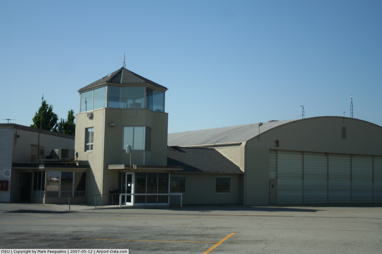
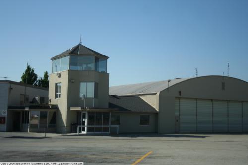
| Control Tower: | Yes |
| Lighting Schedule: | DUSK-DAWN
ACTVT MALSR RY 09R - CTAF. WHEN ATCT CLSD HIRL RY 09R/27L MIRL RY 14/32 PRESET MED INTST & MIRL RYS 09L/27R & O5/23 NOT AVBL. |
| Beacon Color: | Clear-Green (lighted land airport) |
| Landing fee charge: | No |
| Sectional chart: | Detroit |
| Region: | AGL - Great Lakes |
| Boundary ARTCC: | ZID - Indianapolis |
| Tie-in FSS: | DAY - Dayton |
| FSS on Airport: | No |
| FSS Toll Free: | 1-800-WX-BRIEF |
| NOTAMs Facility: | OSU (NOTAM-d service avaliable) |
| Certification type/date: | IV A U 09/197
CLSD TO SCHEDULED ACR OPNS WITH GREATER THAN 9 PSGR SEATS & UNSCHEDULED ACR OPS GREATER THAN 30 PSGR SEATS. 90-DAY PP R; CALL AMGR 614-292-5460. |
| Federal Agreements: | NGY |
Airport Communications
| CTAF: | 118.800 |
| Unicom: | 122.950 |
Airport Services
| Fuel available: | 100LLA1+ |
| Airframe Repair: | MAJOR |
| Power Plant Repair: | MAJOR |
| Bottled Oxygen: | NONE |
| Bulk Oxygen: | HIGH/LOW |
Runway Information
Runway 05/23
| Dimension: | 3555 x 100 ft / 1083.6 x 30.5 m
HELIPAD RELOCATED NORTH SIDE OF AIRFIELD, NEAR AIR GUARD RAMP. |
| Surface: | ASPH, Fair Condition |
| Weight Limit: | Single wheel: 21000 lbs.
Dual wheel: 32000 lbs. |
| Edge Lights: | Medium |
| |
Runway 05 |
Runway 23 |
| Longitude: | 083-04-42.3898W | 083-04-08.0161W |
| Latitude: | 40-04-34.6524N | 40-04-57.8162N |
| Elevation: | 903.00 ft | 893.00 ft |
| Alignment: | 49 | 127 |
| Traffic Pattern: | Left | Left |
| Markings: | Basic, Good Condition | Basic, Good Condition |
| Obstruction: | 37 ft trees, 780.0 ft from runway, 200 ft right of centerline, 15:1 slope to clear | 60 ft trees, 1422.0 ft from runway, 50L/ ft right of centerline, 20:1 slope to clear |
|
Runway 09L/27R
| Dimension: | 2994 x 100 ft / 912.6 x 30.5 m
HELIPAD RELOCATED NORTH SIDE OF AIRFIELD, NEAR AIR GUARD RAMP. |
| Surface: | ASPH, Fair Condition |
| Weight Limit: | Single wheel: 25200 lbs. |
| Edge Lights: | Medium |
| |
Runway 09L |
Runway 27R |
| Longitude: | 083-04-44.0529W | 083-04-05.5856W |
| Latitude: | 40-04-57.7002N | 40-04-59.2111N |
| Elevation: | 904.00 ft | 904.00 ft |
| Alignment: | 87 | 127 |
| Traffic Pattern: | Left | Left |
| Markings: | Basic, Good Condition | Basic, Good Condition |
| Crossing Height: | 29.00 ft | 42.00 ft |
| VASI: | 2-box on left side | 2-box on left side |
| Visual Glide Angle: | 3.00° | 3.00° |
| Obstruction: | 66 ft silo, 2474.0 ft from runway, 90 ft right of centerline, 34:1 slope to clear | 72 ft trees, 1545.0 ft from runway, 122 ft right of centerline, 18:1 slope to clear |
|
Runway 09R/27L
| Dimension: | 5004 x 100 ft / 1525.2 x 30.5 m
HELIPAD RELOCATED NORTH SIDE OF AIRFIELD, NEAR AIR GUARD RAMP. |
| Surface: | ASPH, Fair Condition |
| Surface Treatment: | Saw-cut or plastic Grooved |
| Weight Limit: | Single wheel: 45000 lbs.
Dual wheel: 60000 lbs. |
| Edge Lights: | High |
| |
Runway 09R |
Runway 27L |
| Longitude: | 083-04-53.7770W | 083-03-49.4930W |
| Latitude: | 40-04-37.7371N | 40-04-40.2607N |
| Elevation: | 901.00 ft | 889.00 ft |
| Alignment: | 87 | 127 |
| ILS Type: | ILS
| |
| Traffic Pattern: | Left | Left |
| Markings: | Precision instrument, Good Condition | Precision instrument, Good Condition |
| Crossing Height: | 31.00 ft | 40.00 ft |
| VASI: | 4-box on left side | 4-box on left side |
| Visual Glide Angle: | 3.00° | 3.00° |
| Approach lights: | MALSR | |
| Runway End Identifier: | | Yes |
| Obstruction: | 1646 ft pole, 1696.0 ft from runway, 612 ft left of centerline, 35:1 slope to clear | 53 ft tree, 2470.0 ft from runway, 714 ft right of centerline, 42:1 slope to clear |
|
Runway 14/32
| Dimension: | 3437 x 100 ft / 1047.6 x 30.5 m
HELIPAD RELOCATED NORTH SIDE OF AIRFIELD, NEAR AIR GUARD RAMP. |
| Surface: | ASPH, Fair Condition |
| Weight Limit: | Single wheel: 32500 lbs.
Dual wheel: 42000 lbs.
Dual tandem wheel: 61000 lbs. |
| Edge Lights: | Medium |
| |
Runway 14 |
Runway 32 |
| Longitude: | 083-04-36.1077W | 083-04-05.5229W |
| Latitude: | 40-05-02.5296N | 40-04-37.9961N |
| Elevation: | 900.00 ft | 893.00 ft |
| Alignment: | 127 | 127 |
| Traffic Pattern: | Left | Left |
| Markings: | Basic, Good Condition | Basic, Good Condition |
| Obstruction: | 95 ft trees, 2566.0 ft from runway, 212 ft right of centerline, 24:1 slope to clear | 85 ft trees, 2073.0 ft from runway, 292 ft left of centerline, 22:1 slope to clear |
|
Helipad H1
| Dimension: | 40 x 40 ft / 12.2 x 12.2 m
HELIPAD RELOCATED NORTH SIDE OF AIRFIELD, NEAR AIR GUARD RAMP. |
| Surface: | ASPH, Good Condition |
| |
Runway H1 |
Runway |
| Traffic Pattern: | Left | Left |
|
Radio Navigation Aids
| ID |
Type |
Name |
Ch |
Freq |
Var |
Dist |
| DKG | NDB | Don Scott | | 348.00 | 05W | 0.3 nm |
| CHC | NDB | Grens | | 272.00 | 04W | 4.7 nm |
| OS | NDB | Fuler | | 515.00 | 05W | 5.8 nm |
| DLZ | NDB | Delaware | | 215.00 | 06W | 11.9 nm |
| MRT | NDB | Marysville | | 403.00 | 05W | 15.5 nm |
| CM | NDB | Sumie | | 391.00 | 05W | 15.7 nm |
| BU | NDB | Boutn | | 230.00 | 05W | 16.8 nm |
| UYF | NDB | London | | 263.00 | 06W | 20.1 nm |
| HEH | NDB | Newark | | 524.00 | 06W | 28.2 nm |
| MNN | NDB | Marion | | 201.00 | 05W | 32.3 nm |
| CSS | NDB | Court House | | 414.00 | 05W | 32.3 nm |
| CYO | NDB | Circleville | | 366.00 | 05W | 33.7 nm |
| CCJ | NDB | Clark County | | 341.00 | 04W | 34.8 nm |
| RUV | NDB | Rushsylvania | | 326.00 | 05W | 35.6 nm |
| EDJ | NDB | Bellefontaine | | 242.00 | 05W | 38.2 nm |
| RZT | NDB | Ross County | | 236.00 | 05W | 38.6 nm |
| XEN | NDB | Xenia | | 395.00 | 03W | 45.2 nm |
| IL | NDB | Airbo | | 407.00 | 04W | 46.8 nm |
| LCK | TACAN | Rickenbacker | 069X | | 05W | 17.6 nm |
| XSF | TACAN | Springfield | 065X | | 04W | 38.2 nm |
| FFO | TACAN | Patterson | 099X | | 04W | 47.9 nm |
| BUD | VOR | Buckeye | | 109.80 | 05W | 32.3 nm |
| XUB | VOR | Yellow Bud | | 112.50 | 05W | 33.5 nm |
| SGH | VOR/DME | Springfield | 079X | 113.20 | 04W | 38.5 nm |
| TVT | VOR/DME | Tiverton | 112X | 116.50 | 03W | 49.0 nm |
| APE | VORTAC | Appleton | 114X | 116.70 | 06W | 22.7 nm |
| ROD | VORTAC | Rosewood | 122X | 117.50 | 05W | 46.3 nm |
| CMH | VOT | Port Columbus | | 111.00 | | 10.0 nm |
Remarks
- NOISE SENSITIVE AREA WITHIN 4 MILES TO THE NORTH AND NORTHEAST. NOISE ABATEMENT RSTRNS: NO TGL OR RPTD TKOF/LNDG 2300-0700 DLY.
- BIRDS & DEER ON AND INVOF ARPT.
- ALL MOVEMENT AREA N OF RY 09R/27L ARE NOT AVBL FOR ACR OPNS WITH MORE THAN 30 PSGR SEATS.
- SNOW REMOVAL OPERATING PROCEDURES: WHEN TWR CLSD ANNOUNCE ARRIVAL ON FREQ 118.8.
- HELIPORT LOCATED NORTH SIDE AIRFIELD, ADJACENT AIR GUARD RAMP, TWY G.
- ALL APP/DEP HELI RTE OPNS ARE CONDD IN AN AREA 130-110 DEG CLKWS USING TD PAD AS CNTR OF A COMPASS ROSE.
Images and information placed above are from
http://www.airport-data.com/airport/OSU/
We thank them for the data!
| General Info
|
| Country |
United States
|
| State |
OHIO
|
| FAA ID |
OSU
|
| Latitude |
40-04-47.200N
|
| Longitude |
083-04-22.900W
|
| Elevation |
905 feet
|
| Near City |
COLUMBUS
|
We don't guarantee the information is fresh and accurate. The data may
be wrong or outdated.
For more up-to-date information please refer to other sources.
|
|