 |
|
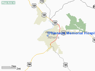
O'bleness Memorial Hospital Heliport |
Location & QuickFacts
| FAA Information Effective: | 2008-09-25 |
| Airport Identifier: | OH23 |
| Airport Status: | Operational |
| Longitude/Latitude: | 082-06-51.5210W/39-19-36.2620N
-82.114311/39.326739 (Estimated) |
| Elevation: | 720 ft / 219.46 m (Estimated) |
| Land: | 0 acres |
| From nearest city: | 0 nautical miles W of Athens, OH |
| Location: | Athens County, OH |
| Magnetic Variation: | 06W (1990) |
Owner & Manager
| Ownership: | Privately owned |
| Owner: | Sheltering Arms Hosp |
| Address: | 55 Hospital Drive
Athens, OH 45701 |
| Phone number: | 614-593-5551 |
| Manager: | Basil Cullison |
| Address: | 55 Hospital Drive
Athens, OH 45701 |
| Phone number: | 614-592-9261 |
Airport Operations and Facilities
| Airport Use: | Private
MEDICAL USE. |
| Wind indicator: | Yes |
| Segmented Circle: | No |
| Control Tower: | No |
| Sectional chart: | Cincinnati |
| Region: | AGL - Great Lakes |
| Boundary ARTCC: | ZID - Indianapolis |
| Tie-in FSS: | DAY - Dayton |
| FSS Toll Free: | 1-800-WX-BRIEF |
Runway Information
Helipad H1
| Dimension: | 40 x 40 ft / 12.2 x 12.2 m |
| Surface: | CONC, |
| |
Runway H1 |
Runway |
| Traffic Pattern: | Left | Left |
|
Radio Navigation Aids
| ID |
Type |
Name |
Ch |
Freq |
Var |
Dist |
| PKB | FAN MARKER | Marietta Ohio | | | 03W | 32.7 nm |
| UGS | NDB | University | | 250.00 | 06W | 4.2 nm |
| GAS | NDB | Gallipolis | | 420.00 | 07W | 29.7 nm |
| HRA | NDB | Zanesville | | 204.00 | 06W | 36.0 nm |
| EOP | NDB | Waverly | | 385.00 | 06W | 39.3 nm |
| CYO | NDB | Circleville | | 366.00 | 05W | 41.9 nm |
| RZT | NDB | Ross County | | 236.00 | 05W | 43.0 nm |
| HEH | NDB | Newark | | 524.00 | 06W | 45.0 nm |
| PMH | NDB | Portsmouth | | 373.00 | 04W | 47.3 nm |
| CM | NDB | Sumie | | 391.00 | 05W | 49.5 nm |
| LCK | TACAN | Rickenbacker | 069X | | 05W | 47.6 nm |
| XUB | VOR | Yellow Bud | | 112.50 | 05W | 41.9 nm |
| ZZV | VOR/DME | Zanesville | 051X | 111.40 | 06W | 38.3 nm |
| HNN | VORTAC | Henderson | 106X | 115.90 | 03W | 34.7 nm |
| JPU | VORTAC | Parkersburg | 023X | 108.60 | 03W | 35.0 nm |
Remarks
- OPERS COND FM 120 TO 330 DEG; AREA IS MKD; WIND IND IS MAINTAINED; NO NIGHT USE UNLESS LIGHTED; USERS INFORMED OF SAFETY PRECAUTIONS; FIRE PROTECTION PROVIDED; UNAUTRHORIZED PERSONS BE RESTRICTED; FAR PART 91 IS COMPLIED WITH.
Images and information placed above are from
http://www.airport-data.com/airport/OH23/
We thank them for the data!
| General Info
|
| Country |
United States
|
| State |
OHIO
|
| FAA ID |
OH23
|
| Latitude |
39-19-36.262N
|
| Longitude |
082-06-51.521W
|
| Elevation |
720 feet
|
| Near City |
ATHENS
|
We don't guarantee the information is fresh and accurate. The data may
be wrong or outdated.
For more up-to-date information please refer to other sources.
|
|


