 |
|
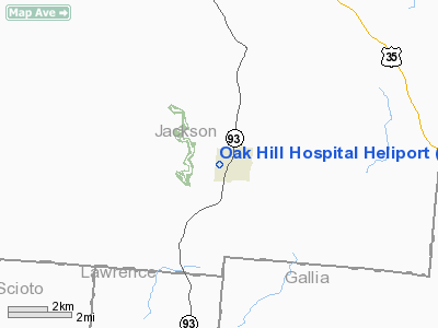
Oak Hill Hospital Heliport |
Location & QuickFacts
| FAA Information Effective: | 2008-09-25 |
| Airport Identifier: | OH72 |
| Airport Status: | Operational |
| Longitude/Latitude: | 082-34-37.5820W/38-53-45.2720N
-82.577106/38.895909 (Estimated) |
| Elevation: | 730 ft / 222.50 m (Estimated) |
| Land: | 0 acres |
| From nearest city: | 1 nautical miles SW of Oak Hill, OH |
| Location: | Jackson County, OH |
| Magnetic Variation: | 05W (1985) |
Owner & Manager
| Ownership: | Privately owned |
| Owner: | Oak Hill Hospital |
| Address: | 350 Charlotte Ave
Oak Hill, OH 45656 |
| Phone number: | 614-682-7717 |
| Manager: | William Crabtree |
| Address: | 350 Charlotte Ave
Oak Hill, OH 45656 |
| Phone number: | 614-682-7717 |
Airport Operations and Facilities
| Airport Use: | Private
MEDICAL USE. |
| Wind indicator: | Yes |
| Segmented Circle: | No |
| Control Tower: | No |
| Lighting Schedule: | DUSK-DAWN |
| Beacon Color: | Clear-Green-Yellow (heliport) |
| Sectional chart: | Detroit |
| Region: | AGL - Great Lakes |
| Boundary ARTCC: | ZID - Indianapolis |
| Tie-in FSS: | DAY - Dayton |
| FSS Toll Free: | 1-800-WX-BRIEF |
Runway Information
Helipad H1
| Dimension: | 60 x 60 ft / 18.3 x 18.3 m |
| Surface: | ASPH, |
| |
Runway H1 |
Runway |
| Traffic Pattern: | Left | Left |
|
Radio Navigation Aids
| ID |
Type |
Name |
Ch |
Freq |
Var |
Dist |
| AJY | FAN MARKER | Ashland | | | 03W | 22.8 nm |
| PMH | NDB | Portsmouth | | 373.00 | 04W | 14.3 nm |
| GAS | NDB | Gallipolis | | 420.00 | 07W | 19.8 nm |
| EOP | NDB | Waverly | | 385.00 | 06W | 23.2 nm |
| UGS | NDB | University | | 250.00 | 06W | 30.2 nm |
| PZO | NDB | Peebles | | 329.00 | 02W | 35.1 nm |
| RZT | NDB | Ross County | | 236.00 | 05W | 38.8 nm |
| CYO | NDB | Circleville | | 366.00 | 05W | 42.1 nm |
| AMT | NDB | West Union | | 359.00 | 04W | 46.2 nm |
| HOC | NDB | Hillsboro | | 278.00 | 05W | 48.3 nm |
| XUB | VOR | Yellow Bud | | 112.50 | 05W | 42.3 nm |
| YRK | VORTAC | York | 075X | 112.80 | 05W | 24.1 nm |
| HNN | VORTAC | Henderson | 106X | 115.90 | 03W | 27.2 nm |
| ECB | VORTAC | Newcombe | 041X | 110.40 | 02W | 47.0 nm |
Remarks
- PROVIDED APP/DEP FROM 180 TO 220 & 280 TO 360; AREA IS MARKED; TREE EAST OF PAD IS REMOVED; WIND INDCATOR IS MAINTAINED.
Images and information placed above are from
http://www.airport-data.com/airport/OH72/
We thank them for the data!
| General Info
|
| Country |
United States
|
| State |
OHIO
|
| FAA ID |
OH72
|
| Latitude |
38-53-45.272N
|
| Longitude |
082-34-37.582W
|
| Elevation |
730 feet
|
| Near City |
OAK HILL
|
We don't guarantee the information is fresh and accurate. The data may
be wrong or outdated.
For more up-to-date information please refer to other sources.
|
|


