 |
|
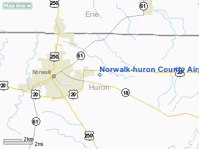
Norwalk-huron County Airport |
Location & QuickFacts
| FAA Information Effective: | 2008-09-25 |
| Airport Identifier: | 5A1 |
| Airport Status: | Operational |
| Longitude/Latitude: | 082-33-04.4180W/41-14-41.1570N
-82.551227/41.244766 (Estimated) |
| Elevation: | 852 ft / 259.69 m (Surveyed) |
| Land: | 160 acres |
| From nearest city: | 3 nautical miles E of Norwalk, OH |
| Location: | Huron County, OH |
| Magnetic Variation: | 06W (1995) |
Owner & Manager
| Ownership: | Publicly owned |
| Owner: | Huron Co Commissioners |
| Address: | Norwalk Oh 44857
Norwalk, OH 44857 |
| Phone number: | 419-668-3092 |
| Manager: | Sandra Gordley |
| Address: | 961 Us Rte 20 E
Norwalk, OH 44857 |
| Phone number: | 419-668-5400 |
Airport Operations and Facilities
| Airport Use: | Open to public |
| Wind indicator: | Yes |
| Segmented Circle: | No |
| Control Tower: | No |
| Lighting Schedule: | DUSK-DAWN
ACTVT MIRL RY 10/28 - CTAF. |
| Beacon Color: | Clear-Green (lighted land airport) |
| Landing fee charge: | No |
| Sectional chart: | Detroit |
| Region: | AGL - Great Lakes |
| Boundary ARTCC: | ZOB - Cleveland |
| Tie-in FSS: | CLE - Cleveland |
| FSS on Airport: | No |
| FSS Toll Free: | 1-800-WX-BRIEF |
| NOTAMs Facility: | CLE (NOTAM-d service avaliable) |
| Federal Agreements: | N |
Airport Communications
| CTAF: | 122.800 |
| Unicom: | 122.800 |
Airport Services
Runway Information
Runway 10/28
| Dimension: | 4210 x 75 ft / 1283.2 x 22.9 m |
| Surface: | ASPH, Good Condition |
| Edge Lights: | Medium |
| |
Runway 10 |
Runway 28 |
| Longitude: | 082-33-31.9550W | 082-32-36.8520W |
| Latitude: | 41-14-41.2130N | 41-14-41.0780N |
| Elevation: | 834.00 ft | 852.00 ft |
| Alignment: | 90 | 127 |
| Traffic Pattern: | Left | Left |
| Markings: | Basic, Good Condition | Basic, Good Condition |
| Displaced threshold: | 240.00 ft | 668.00 ft |
| Runway End Identifier: | No | No |
| Centerline Lights: | No | No |
| Touchdown Lights: | No | No |
| Obstruction: | 84 ft trees, 230.0 ft from runway, 236 ft right of centerline
RWY 10 APCH RATIO 1:1 DUE TO ADDITIONAL OBSTRUCTION +82 FT TREES 100 FT FM DISPLACED THLD 240 FT R.
RY 10 100-84 FT TREEES 45 FT FM + 200 FT 239 FT R; 18 FT BRUSH 45 FT FM 200 FT FM 120 FT L. | 17 ft road, 201.0 ft from runway, 242 ft left of centerline
RWY 28 APCH RATIO 0:1 DUE TO ADDITIONAL OBSTRUCTION +84FT TREES 0 FT FM DISPLACED THLD 250 FT L.
RY 28 17 FT DRAG STRIP 152 FT FM RY END EXTENDING TO 200 FT FM RY END 243 FT L OF CNTRLN. |
|
Radio Navigation Aids
| ID |
Type |
Name |
Ch |
Freq |
Var |
Dist |
| AAU | NDB | Ashland | | 329.00 | 07W | 21.6 nm |
| PCW | NDB | Port Clinton | | 423.00 | 06W | 21.8 nm |
| CL | NDB | Harri | | 344.00 | 07W | 27.1 nm |
| MF | NDB | Manns | | 372.00 | 06W | 29.2 nm |
| TII | NDB | Tiffin | | 269.00 | 05W | 31.0 nm |
| PT | NDB | Pelee Island | | 283.00 | 05W | 32.6 nm |
| FZI | NDB | Fostoria | | 379.00 | 05W | 38.4 nm |
| EZE | NDB | Engel | | 226.00 | 07W | 40.1 nm |
| BKL | NDB | Burke Lakefront | | 416.00 | 07W | 43.5 nm |
| MNN | NDB | Marion | | 201.00 | 05W | 44.5 nm |
| BUD | VOR | Buckeye | | 109.80 | 05W | 44.4 nm |
| SKY | VOR/DME | Sandusky | 029X | 109.20 | 04W | 12.3 nm |
| DJB | VOR/DME | Dryer | 083X | 113.60 | 05W | 18.9 nm |
| MFD | VORTAC | Mansfield | 025X | 108.80 | 03W | 22.7 nm |
| CLE | VOT | Cleveland | | 110.40 | | 33.2 nm |
Remarks
- DRAG STRIP AT E END OF RWY RUNNING NORTH-SOUTH.
- VFR USE ONLY.
Images and information placed above are from
http://www.airport-data.com/airport/5A1/
We thank them for the data!
| General Info
|
| Country |
United States
|
| State |
OHIO
|
| FAA ID |
5A1
|
| Latitude |
41-14-41.157N
|
| Longitude |
082-33-04.418W
|
| Elevation |
852 feet
|
| Near City |
NORWALK
|
We don't guarantee the information is fresh and accurate. The data may
be wrong or outdated.
For more up-to-date information please refer to other sources.
|
|


