 |
|
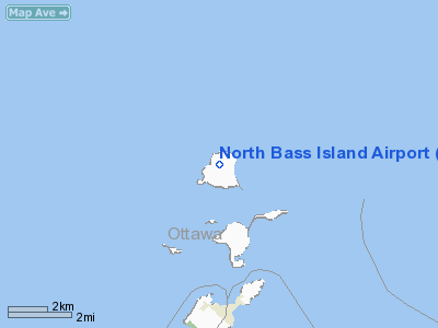
North Bass Island Airport |
Location & QuickFacts
| FAA Information Effective: | 2008-09-25 |
| Airport Identifier: | 3X5 |
| Airport Status: | Operational |
| Longitude/Latitude: | 082-49-16.0000W/41-43-04.8000N
-82.821111/41.718000 (Estimated) |
| Elevation: | 594 ft / 181.05 m (Estimated) |
| Land: | 33 acres |
| From nearest city: | 0 nautical miles NW of North Bass Island, OH |
| Location: | Ottawa County, OH |
| Magnetic Variation: | 06W (1985) |
Owner & Manager
| Ownership: | Publicly owned |
| Owner: | Put In Bay Township Port Auth
PORT AUTHORITY |
| Address: | Po Box 278
Put In Bay, OH 43456 |
| Phone number: | 419-285-3371 |
| Manager: | Monica Drake |
| Address: | P.o. Box 278
Put In Bay, OH 43456 |
| Phone number: | 419-285-3371 |
Airport Operations and Facilities
| Airport Use: | Open to public |
| Wind indicator: | Yes |
| Segmented Circle: | No |
| Control Tower: | No |
| Landing fee charge: | No |
| Sectional chart: | Detroit |
| Region: | AGL - Great Lakes |
| Boundary ARTCC: | ZOB - Cleveland |
| Tie-in FSS: | CLE - Cleveland |
| FSS on Airport: | No |
| FSS Toll Free: | 1-800-WX-BRIEF |
| NOTAMs Facility: | CLE (NOTAM-d service avaliable) |
| Federal Agreements: | NGY |
Airport Communications
| CTAF: | 122.800 |
| Unicom: | 122.800 |
Airport Services
| Airframe Repair: | NONE |
| Power Plant Repair: | NONE |
Runway Information
Runway 01/19
| Dimension: | 1804 x 60 ft / 549.9 x 18.3 m |
| Surface: | ASPH, Good Condition |
| |
Runway 01 |
Runway 19 |
| Longitude: | 082-49-16.5042W | 082-49-15.4991W |
| Latitude: | 41-42-55.8899N | 41-43-13.6993N |
| Elevation: | 594.00 ft | 587.00 ft |
| Alignment: | 2 | 127 |
| Traffic Pattern: | Left | Right |
| Markings: | Basic, Good Condition | Basic, Good Condition |
| Obstruction: | 15 ft tree, 450.0 ft from runway, 30 ft right of centerline, 16:1 slope to clear | 46 ft trees, 982.0 ft from runway, 193 ft left of centerline, 17:1 slope to clear |
|
Runway 08/26
| Dimension: | 1900 x 150 ft / 579.1 x 45.7 m |
| Surface: | TURF, Poor Condition |
| |
Runway 08 |
Runway 26 |
| Alignment: | 22 | 127 |
| Traffic Pattern: | Left | Left |
|
Radio Navigation Aids
| ID |
Type |
Name |
Ch |
Freq |
Var |
Dist |
| PT | NDB | Pelee Island | | 283.00 | 05W | 7.7 nm |
| PCW | NDB | Port Clinton | | 423.00 | 06W | 12.2 nm |
| RYS | NDB | Grosse Ile | | 419.00 | 06W | 27.4 nm |
| G | NDB | Golf | | 398.00 | 05W | 33.2 nm |
| QG | NDB | Windsor | | 353.00 | 06W | 35.8 nm |
| VQ | NDB | Cargl | | 230.00 | 05W | 38.8 nm |
| FZI | NDB | Fostoria | | 379.00 | 05W | 41.0 nm |
| TII | NDB | Tiffin | | 269.00 | 05W | 41.1 nm |
| CL | NDB | Harri | | 344.00 | 07W | 44.8 nm |
| 4L | NDB | Chatham | | 236.00 | 06W | 48.8 nm |
| TOL | TACAN | Toledo | 072X | | 05W | 44.6 nm |
| SKY | VOR/DME | Sandusky | 029X | 109.20 | 04W | 18.6 nm |
| YQG | VOR/DME | Windsor | 085X | 113.80 | 06W | 32.0 nm |
| DJB | VOR/DME | Dryer | 083X | 113.60 | 05W | 36.7 nm |
| DXO | VOR/DME | Detroit | 081X | 113.40 | 06W | 38.5 nm |
| VWV | VOR/DME | Waterville | 078X | 113.10 | 02W | 40.1 nm |
| CRL | VORTAC | Carleton | 104X | 115.70 | 03W | 34.7 nm |
| DTW | VOT | Detroit Met Wayne | | 109.80 | | 39.1 nm |
| DET | VOT | Detroit City | | 111.60 | | 42.2 nm |
| YIP | VOT | Willow Run | | 112.00 | | 44.1 nm |
| CLE | VOT | Cleveland | | 110.40 | | 47.5 nm |
Remarks
- NO OPNS DUSK-DAWN.
- NO TGLS & NO STUDENT TRNG.
Images and information placed above are from
http://www.airport-data.com/airport/3X5/
We thank them for the data!
| General Info
|
| Country |
United States
|
| State |
OHIO
|
| FAA ID |
3X5
|
| Latitude |
41-43-04.800N
|
| Longitude |
082-49-16.000W
|
| Elevation |
594 feet
|
| Near City |
NORTH BASS ISLAND
|
We don't guarantee the information is fresh and accurate. The data may
be wrong or outdated.
For more up-to-date information please refer to other sources.
|
|


