 |
|
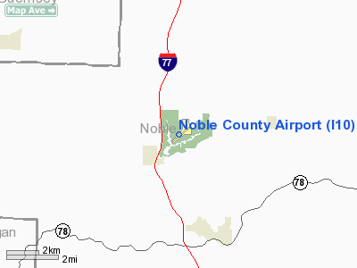
Location & QuickFacts
| FAA Information Effective: | 2008-09-25 |
| Airport Identifier: | I10 |
| Airport Status: | Operational |
| Longitude/Latitude: | 081-32-10.7680W/39-48-03.4950N
-81.536324/39.800971 (Estimated) |
| Elevation: | 879 ft / 267.92 m (Surveyed) |
| Land: | 60 acres |
| From nearest city: | 3 nautical miles N of Caldwell, OH |
| Location: | Noble County, OH |
| Magnetic Variation: | 07W (1990) |
Owner & Manager
| Ownership: | Publicly owned |
| Owner: | Noble Co. Arpt Auth. |
| Address: | 48535 Coldwater Creek Road
Caldwell, OH 43724 |
| Phone number: | 740-732-7387 |
| Manager: | Ed Crock |
| Address: | 48535 Coldwater Creek Road
Caldwell, OH 43724 |
| Phone number: | 740-732-2306
ADDL EMERGENCY PHONE AFT HRS 740-581-1167 OR 740-581-0557 |
Airport Operations and Facilities
| Airport Use: | Open to public |
| Wind indicator: | Yes |
| Segmented Circle: | No |
| Control Tower: | No |
| Lighting Schedule: | RDO-CTL
ACTVT MIRL RY 05/23 & ROTG BCN - 122.7. |
| Beacon Color: | Clear-Green (lighted land airport) |
| Landing fee charge: | No |
| Sectional chart: | Cincinnati |
| Region: | AGL - Great Lakes |
| Boundary ARTCC: | ZOB - Cleveland |
| Tie-in FSS: | CLE - Cleveland |
| FSS on Airport: | No |
| FSS Toll Free: | 1-800-WX-BRIEF |
| NOTAMs Facility: | CLE (NOTAM-d service avaliable) |
Airport Communications
| CTAF: | 122.800 |
| Unicom: | 122.800 |
Airport Services
| Fuel available: | 100LL
FOR FUEL AFTER HOURS CALL 740-525-9901 OR 740-581-1167. |
Runway Information
Runway 05/23
| Dimension: | 3811 x 65 ft / 1161.6 x 19.8 m |
| Surface: | ASPH, Good Condition |
| Weight Limit: | Single wheel: 12500 lbs. |
| Edge Lights: | Medium |
| |
Runway 05 |
Runway 23 |
| Longitude: | 081-32-26.6110W | 081-31-54.8810W |
| Latitude: | 39-47-49.1790N | 39-48-17.8070N |
| Elevation: | 876.00 ft | 879.00 ft |
| Alignment: | 41 | 127 |
| Traffic Pattern: | Left | Left |
| Markings: | Basic, Good Condition | Basic, Good Condition |
| Displaced threshold: | 0.00 ft | 413.00 ft |
| VASI: | 2-light PAPI on left side | 2-light PAPI on left side |
| Obstruction: | 62 ft trees, 1043.0 ft from runway, 240 ft left of centerline, 13:1 slope to clear
RWY 05 +0 FT TO 24 FT TREES 0 FT TO 200 FT FM 100 FT L AND +24 FT TREES 65 FT FM 205 FT R. | 53 ft trees, 201.0 ft from runway, 138 ft right of centerline
RWY 23 APCH SLOPE 3:1 TO DSPLCD THLD OVER +37 FT TREES 140 FT FM 127 FT R.
RWY 23 +53 FT TREES 0 FT TO 200 FT FM 100 FT R. |
|
Radio Navigation Aids
| ID |
Type |
Name |
Ch |
Freq |
Var |
Dist |
| PKB | FAN MARKER | Marietta Ohio | | | 03W | 25.6 nm |
| HRA | NDB | Zanesville | | 204.00 | 06W | 18.8 nm |
| CFX | NDB | Cadiz | | 239.00 | 07W | 35.6 nm |
| UGS | NDB | University | | 250.00 | 06W | 42.6 nm |
| HEH | NDB | Newark | | 524.00 | 06W | 44.8 nm |
| MLR | NDB | Millersburg/dcmsnd | | 382.00 | 06W | 47.1 nm |
| ZZV | VOR/DME | Zanesville | 051X | 111.40 | 06W | 18.5 nm |
| CTW | VOR/DME | Newcomerstown | 055X | 111.80 | 07W | 25.9 nm |
| AIR | VOR/DME | Bellaire | 118X | 117.10 | 07W | 35.6 nm |
| TVT | VOR/DME | Tiverton | 112X | 116.50 | 03W | 47.9 nm |
| JPU | VORTAC | Parkersburg | 023X | 108.60 | 03W | 22.9 nm |
Remarks
- RED OBSTN LGTS MARK 56 FT HILL 947 FT FM AER 23.
- MODEL ACFT ACTIVITY ON ARPT - SUNDAYS.
- VFR ONLY
Images and information placed above are from
http://www.airport-data.com/airport/I10/
We thank them for the data!
| General Info
|
| Country |
United States
|
| State |
OHIO
|
| FAA ID |
I10
|
| Latitude |
39-48-03.495N
|
| Longitude |
081-32-10.768W
|
| Elevation |
879 feet
|
| Near City |
CALDWELL
|
We don't guarantee the information is fresh and accurate. The data may
be wrong or outdated.
For more up-to-date information please refer to other sources.
|
|


