 |
|
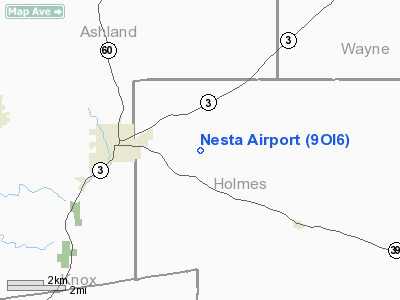
Location & QuickFacts
| FAA Information Effective: | 2008-09-25 |
| Airport Identifier: | 9OI6 |
| Airport Status: | Operational |
| Longitude/Latitude: | 082-10-36.5610W/40-37-58.2170N
-82.176823/40.632838 (Estimated) |
| Elevation: | 950 ft / 289.56 m (Estimated) |
| Land: | 0 acres |
| From nearest city: | 3 nautical miles E of Loudenville, OH |
| Location: | Holmes County, OH |
| Magnetic Variation: | 06W (1985) |
Owner & Manager
| Ownership: | Privately owned |
| Owner: | R. V. Nesta |
| Address: | 220 S Park St
Mansfield, OH 44902 |
| Phone number: | 419-522-1342 |
| Address: |
|
Airport Operations and Facilities
| Airport Use: | Private |
| Segmented Circle: | No |
| Control Tower: | No |
| Sectional chart: | Detroit |
| Region: | AGL - Great Lakes |
| Boundary ARTCC: | ZOB - Cleveland |
| Tie-in FSS: | CLE - Cleveland |
| FSS on Airport: | No |
| FSS Toll Free: | 1-800-WX-BRIEF |
Runway Information
Runway 17/35
| Dimension: | 2000 x 75 ft / 609.6 x 22.9 m |
| Surface: | TURF, |
| |
Runway 17 |
Runway 35 |
| Traffic Pattern: | Left | Left |
| Obstruction: | , 300.0 ft from runway | 200 ft trees |
|
Radio Navigation Aids
| ID |
Type |
Name |
Ch |
Freq |
Var |
Dist |
| MF | NDB | Manns | | 372.00 | 06W | 14.6 nm |
| MLR | NDB | Millersburg/dcmsnd | | 382.00 | 06W | 14.9 nm |
| AAU | NDB | Ashland | | 329.00 | 07W | 20.2 nm |
| HEH | NDB | Newark | | 524.00 | 06W | 38.8 nm |
| MNN | NDB | Marion | | 201.00 | 05W | 40.8 nm |
| CL | NDB | Harri | | 344.00 | 07W | 43.5 nm |
| AK | NDB | Akron | | 362.00 | 07W | 44.5 nm |
| HRA | NDB | Zanesville | | 204.00 | 06W | 45.2 nm |
| CM | NDB | Sumie | | 391.00 | 05W | 47.0 nm |
| DLZ | NDB | Delaware | | 215.00 | 06W | 47.5 nm |
| BUD | VOR | Buckeye | | 109.80 | 05W | 40.5 nm |
| TVT | VOR/DME | Tiverton | 112X | 116.50 | 03W | 10.8 nm |
| BSV | VOR/DME | Briggs | 071X | 112.40 | 04W | 34.6 nm |
| CTW | VOR/DME | Newcomerstown | 055X | 111.80 | 07W | 40.2 nm |
| ZZV | VOR/DME | Zanesville | 051X | 111.40 | 06W | 43.6 nm |
| DJB | VOR/DME | Dryer | 083X | 113.60 | 05W | 43.6 nm |
| MFD | VORTAC | Mansfield | 025X | 108.80 | 03W | 23.6 nm |
| APE | VORTAC | Appleton | 114X | 116.70 | 06W | 34.5 nm |
| CAK | VOT | Akron/canton Regional | | 110.60 | | 37.5 nm |
| CLE | VOT | Cleveland | | 110.40 | | 49.0 nm |
Remarks
- OBJECT EXISTS WITHIN THE AIRSPACE THAT PRECLUDES SAFETY IN LNDG/TKOF.
Images and information placed above are from
http://www.airport-data.com/airport/9OI6/
We thank them for the data!
| General Info
|
| Country |
United States
|
| State |
OHIO
|
| FAA ID |
9OI6
|
| Latitude |
40-37-58.217N
|
| Longitude |
082-10-36.561W
|
| Elevation |
950 feet
|
| Near City |
LOUDENVILLE
|
We don't guarantee the information is fresh and accurate. The data may
be wrong or outdated.
For more up-to-date information please refer to other sources.
|
|


