 |
|
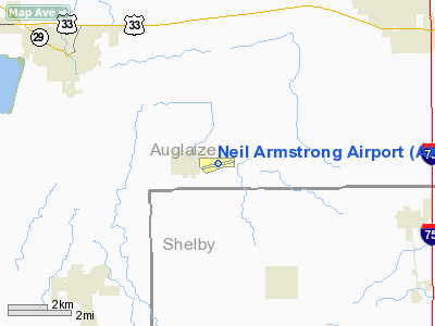
Location & QuickFacts
| FAA Information Effective: | 2008-09-25 |
| Airport Identifier: | AXV |
| Airport Status: | Operational |
| Longitude/Latitude: | 084-17-53.1000W/40-29-36.8000N
-84.298083/40.493556 (Estimated) |
| Elevation: | 913 ft / 278.28 m (Surveyed) |
| Land: | 140 acres |
| From nearest city: | 8 nautical miles SW of Wapakoneta, OH |
| Location: | Auglaize County, OH |
| Magnetic Variation: | 04W (1985) |
Owner & Manager
| Ownership: | Publicly owned |
| Owner: | Auglaize Co Arpt Auth |
| Address: | Box 400
New Knoxville, OH 45871 |
| Phone number: | 419-739-6710 |
| Manager: | Gary Katterheinrich |
| Address: | Box 400
New Knoxville, OH 45871 |
| Phone number: | 419-753-2810 |
Airport Operations and Facilities
| Airport Use: | Open to public |
| Wind indicator: | Yes |
| Segmented Circle: | No |
| Control Tower: | No |
| Lighting Schedule: | DUSK-DAWN
ACTVT MIRL RY 08/26 & REIL RY 26 - 122.7. |
| Beacon Color: | Clear-Green (lighted land airport) |
| Landing fee charge: | No |
| Sectional chart: | Detroit |
| Region: | AGL - Great Lakes |
| Traffic Pattern Alt: | 990 ft |
| Boundary ARTCC: | ZID - Indianapolis |
| Tie-in FSS: | DAY - Dayton |
| FSS on Airport: | No |
| FSS Toll Free: | 1-800-WX-BRIEF |
| NOTAMs Facility: | DAY (NOTAM-d service avaliable) |
| Federal Agreements: | NGY |
Airport Communications
| CTAF: | 122.800 |
| Unicom: | 122.800 |
Airport Services
| Fuel available: | 100LLA1+ |
| Airframe Repair: | MINOR |
| Power Plant Repair: | MINOR |
| Bottled Oxygen: | HIGH |
| Bulk Oxygen: | NONE |
Runway Information
Runway 08/26
| Dimension: | 5500 x 100 ft / 1676.4 x 30.5 m |
| Surface: | ASPH, Good Condition
SFC ROUGH & UNEVEN. |
| Surface Treatment: | Saw-cut or plastic Grooved |
| Edge Lights: | Medium |
| |
Runway 08 |
Runway 26 |
| Longitude: | 084-18-27.6966W | 084-17-18.4485W |
| Latitude: | 40-29-30.4675N | 40-29-43.0738N |
| Elevation: | 908.00 ft | 908.00 ft |
| Alignment: | 77 | 127 |
| ILS Type: | | LOC/DME
|
| Traffic Pattern: | Left | Left |
| Markings: | Basic, Good Condition | Non-precision instrument, Good Condition |
| Crossing Height: | 0.00 ft | 53.00 ft |
| Displaced threshold: | 700.00 ft | 237.00 ft |
| VASI: | | 2-box on left side
RY 26 VASI OTS INDEFLY. |
| Visual Glide Angle: | 0.00° | 3.00° |
| Runway End Identifier: | | Yes
RY 26 REIL OTS INDEFLY. |
| Centerline Lights: | No | No |
| Touchdown Lights: | No | No |
| Obstruction: | 82 ft trees, 455.0 ft from runway, 270 ft left of centerline, 3:1 slope to clear
APCH SLOPE 0:1 TO DSPLCD THLD. | 15 ft road, 330.0 ft from runway, 275 ft right of centerline, 8:1 slope to clear
RWY 26 APPROACH SLOPE 38:1 TO DISPLACEMENT |
|
Runway 18/36
| Dimension: | 2631 x 80 ft / 801.9 x 24.4 m |
| Surface: | TURF, Poor Condition
SFC ROUGH & UNEVEN. |
| |
Runway 18 |
Runway 36 |
| Longitude: | 084-18-10.8190W | 084-18-10.8190W |
| Latitude: | 40-29-45.1710N | 40-29-19.1710N |
| Alignment: | 127 | 127 |
| Traffic Pattern: | Left | Left |
| Displaced threshold: | 290.00 ft | 0.00 ft |
| Runway End Identifier: | No | No |
| Centerline Lights: | No | No |
| Touchdown Lights: | No | No |
| Obstruction: | 15 ft road | 74 ft trees, 470.0 ft from runway, 75 ft right of centerline, 6:1 slope to clear |
|
Radio Navigation Aids
| ID |
Type |
Name |
Ch |
Freq |
Var |
Dist |
| CQA | NDB | Lakefield | | 205.00 | 04W | 12.2 nm |
| LYL | NDB | Lima | | 362.00 | 04W | 17.8 nm |
| VES | NDB | Versailles | | 356.00 | 04W | 20.1 nm |
| EDJ | NDB | Bellefontaine | | 242.00 | 05W | 23.4 nm |
| VFU | NDB | Stanley | | 411.00 | 05W | 26.4 nm |
| RUV | NDB | Rushsylvania | | 326.00 | 05W | 28.9 nm |
| PLD | NDB | Portland | | 257.00 | 03W | 31.4 nm |
| PDR | NDB | Ottawa | | 233.00 | 05W | 35.5 nm |
| BNR | NDB | Benton Ridge | | 334.00 | 05W | 42.7 nm |
| CCJ | NDB | Clark County | | 341.00 | 04W | 44.2 nm |
| MRT | NDB | Marysville | | 403.00 | 05W | 46.3 nm |
| XEN | NDB | Xenia | | 395.00 | 03W | 49.7 nm |
| FFO | TACAN | Patterson | 099X | | 04W | 42.1 nm |
| XSF | TACAN | Springfield | 065X | | 04W | 44.6 nm |
| AOH | VOR | Allen County | | 108.40 | 04W | 19.8 nm |
| MAH | VOR | Marathon | | 114.90 | 05W | 42.6 nm |
| DQN | VOR/DME | Dayton | 092X | 114.50 | 01W | 29.0 nm |
| SGH | VOR/DME | Springfield | 079X | 113.20 | 04W | 44.6 nm |
| ROD | VORTAC | Rosewood | 122X | 117.50 | 05W | 17.0 nm |
| FDY | VORTAC | Findlay | 019X | 108.20 | 02W | 37.2 nm |
| FWA | VORTAC | Fort Wayne | 125X | 117.80 | 00E | 49.9 nm |
| DAY | VOT | Dayton J M Cox-day | | 111.00 | | 35.7 nm |
Images and information placed above are from
http://www.airport-data.com/airport/AXV/
We thank them for the data!
| General Info
|
| Country |
United States
|
| State |
OHIO
|
| FAA ID |
AXV
|
| Latitude |
40-29-36.200N
|
| Longitude |
084-17-56.200W
|
| Elevation |
912 feet
|
| Near City |
WAPAKONETA
|
We don't guarantee the information is fresh and accurate. The data may
be wrong or outdated.
For more up-to-date information please refer to other sources.
|
|


