 |
|
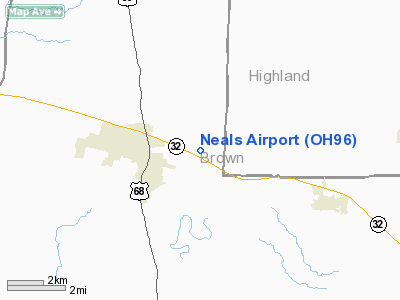
Location & QuickFacts
| FAA Information Effective: | 2008-09-25 |
| Airport Identifier: | OH96 |
| Airport Status: | Operational |
| Longitude/Latitude: | 083-53-10.0000W/39-02-01.0000N
-83.886111/39.033611 (Estimated) |
| Elevation: | 953 ft / 290.47 m (Estimated) |
| Land: | 0 acres |
| From nearest city: | 2 nautical miles NE of Mount Orab, OH |
| Location: | Brown County, OH |
| Magnetic Variation: | 04W (1985) |
Owner & Manager
| Ownership: | Privately owned |
| Owner: | Wendell W. Neal |
| Address: | 4477 Oakland Rd, Rt 1
Bethel, OH 45106 |
| Phone number: | 513-444-2248 |
| Address: |
|
Airport Operations and Facilities
| Airport Use: | Private |
| Wind indicator: | Yes |
| Segmented Circle: | No |
| Control Tower: | No |
| Lighting Schedule: | RDO-CTL
ACTVT ROTG BCN AND LIRL RY 10/28- 122.9. |
| Beacon Color: | Clear (unlighted land airport) |
| Sectional chart: | Cincinnati |
| Region: | AGL - Great Lakes |
| Boundary ARTCC: | ZID - Indianapolis |
| Tie-in FSS: | DAY - Dayton |
| FSS on Airport: | No |
| FSS Toll Free: | 1-800-WX-BRIEF |
Runway Information
Runway 10/28
| Dimension: | 3000 x 75 ft / 914.4 x 22.9 m |
| Surface: | TURF, |
| Edge Lights: | Low |
| |
Runway 10 |
Runway 28 |
| Traffic Pattern: | Left | Left |
|
Radio Navigation Aids
| ID |
Type |
Name |
Ch |
Freq |
Var |
Dist |
| PWF | NDB | Sportys | | 245.00 | 04W | 15.6 nm |
| HOC | NDB | Hillsboro | | 278.00 | 05W | 18.4 nm |
| AMT | NDB | West Union | | 359.00 | 04W | 18.5 nm |
| HW | NDB | Cubla | | 299.00 | 04W | 19.2 nm |
| LUK | NDB | Cincinnati | | 335.00 | 04W | 22.5 nm |
| MDE | NDB | Madeira | | 379.00 | 04W | 24.7 nm |
| ISZ | NDB | Cincinnati-blue Ash | | 388.00 | 04W | 26.8 nm |
| PZO | NDB | Peebles | | 329.00 | 02W | 27.0 nm |
| IL | NDB | Airbo | | 407.00 | 04W | 28.4 nm |
| XW | NDB | Flmng | | 400.00 | 05W | 29.8 nm |
| HAO | NDB | Hamilton | | 260.00 | 04W | 37.9 nm |
| HKF | NDB | Hook Field | | 239.00 | 04W | 38.3 nm |
| XEN | NDB | Xenia | | 395.00 | 03W | 41.0 nm |
| CSS | NDB | Court House | | 414.00 | 05W | 41.1 nm |
| UR | NDB | Burln | | 321.00 | 04W | 41.4 nm |
| EOP | NDB | Waverly | | 385.00 | 06W | 45.2 nm |
| RZT | NDB | Ross County | | 236.00 | 05W | 46.7 nm |
| FFO | TACAN | Patterson | 099X | | 04W | 47.9 nm |
| XSF | TACAN | Springfield | 065X | | 04W | 48.4 nm |
| MXQ | VOR/DME | Midwest | 076X | 112.90 | 04W | 24.1 nm |
| FLM | VOR/DME | Falmouth | 117X | 117.00 | 04W | 30.5 nm |
| SGH | VOR/DME | Springfield | 079X | 113.20 | 04W | 48.3 nm |
| CVG | VORTAC | Cincinnati | 120X | 117.30 | 04W | 38.2 nm |
| YRK | VORTAC | York | 075X | 112.80 | 05W | 48.5 nm |
| LUK | VOT | Cincinnati Muni/lunken | | 108.40 | | 24.5 nm |
Remarks
Images and information placed above are from
http://www.airport-data.com/airport/OH96/
We thank them for the data!
| General Info
|
| Country |
United States
|
| State |
OHIO
|
| FAA ID |
OH96
|
| Latitude |
39-02-01.000N
|
| Longitude |
083-53-10.000W
|
| Elevation |
953 feet
|
| Near City |
MOUNT ORAB
|
We don't guarantee the information is fresh and accurate. The data may
be wrong or outdated.
For more up-to-date information please refer to other sources.
|
|


