 |
|
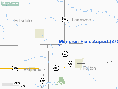
Location & QuickFacts
| FAA Information Effective: | 2008-09-25 |
| Airport Identifier: | 87OH |
| Airport Status: | Operational |
| Longitude/Latitude: | 084-22-24.8130W/41-42-20.1820N
-84.373559/41.705606 (Estimated) |
| Elevation: | 840 ft / 256.03 m (Estimated) |
| Land: | 0 acres |
| From nearest city: | 4 nautical miles NW of Fayette, OH |
| Location: | Fulton County, OH |
| Magnetic Variation: | 04W (1990) |
Owner & Manager
| Ownership: | Privately owned |
| Owner: | Bruce W Mitton |
| Address: | 200 W Main
Fayette, OH 43521 |
| Phone number: | 419-237-2139 |
| Manager: | Bruce W Mitton |
| Address: | 200 W Main
Fayette, OH 43521 |
| Phone number: | 419-237-2139 |
Airport Operations and Facilities
| Airport Use: | Private |
| Segmented Circle: | No |
| Control Tower: | No |
| Sectional chart: | Detroit |
| Region: | AGL - Great Lakes |
| Boundary ARTCC: | ZOB - Cleveland |
| Tie-in FSS: | CLE - Cleveland |
| FSS on Airport: | No |
| FSS Toll Free: | 1-800-WX-BRIEF |
Runway Information
Runway 18/36
| Dimension: | 2640 x 50 ft / 804.7 x 15.2 m |
| Surface: | TURF, |
| |
Runway 18 |
Runway 36 |
| Traffic Pattern: | Left | Left |
| Obstruction: | 30 ft pline, 100.0 ft from runway | 50 ft trees, 0.0 ft from runway |
|
Radio Navigation Aids
| ID |
Type |
Name |
Ch |
Freq |
Var |
Dist |
| USE | NDB | Fulton | | 375.00 | 05W | 12.3 nm |
| BYN | NDB | Bryan | | 260.00 | 04W | 14.2 nm |
| ADG | NDB | Adrian | | 278.00 | 06W | 16.5 nm |
| DFI | NDB | Defiance | | 246.00 | 05W | 22.4 nm |
| TCU | NDB | Tecumseh | | 239.00 | 04W | 29.7 nm |
| ANQ | NDB | Angola | | 347.00 | 05W | 32.3 nm |
| PDR | NDB | Ottawa | | 233.00 | 05W | 44.3 nm |
| IRS | NDB | Sturgis | | 382.00 | 04W | 48.0 nm |
| TOL | TACAN | Toledo | 072X | | 05W | 26.7 nm |
| LFD | VOR/DME | Litchfield | 049X | 111.20 | 05W | 27.7 nm |
| JXN | VOR/DME | Jackson | 033X | 109.60 | 05W | 33.5 nm |
| VWV | VOR/DME | Waterville | 078X | 113.10 | 02W | 36.4 nm |
| CRL | VORTAC | Carleton | 104X | 115.70 | 03W | 45.9 nm |
| YIP | VOT | Willow Run | | 112.00 | | 49.6 nm |
Remarks
- OBJECTS EXIST WITHIN THE AIRSPACE NEEDED TO INSURE SAFE FLIGHT OPNS.
Images and information placed above are from
http://www.airport-data.com/airport/87OH/
We thank them for the data!
| General Info
|
| Country |
United States
|
| State |
OHIO
|
| FAA ID |
87OH
|
| Latitude |
41-42-20.182N
|
| Longitude |
084-22-24.813W
|
| Elevation |
840 feet
|
| Near City |
FAYETTE
|
We don't guarantee the information is fresh and accurate. The data may
be wrong or outdated.
For more up-to-date information please refer to other sources.
|
|


