 |
|
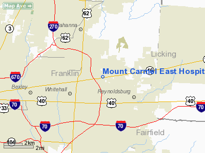
Mount Carmel East Hospital Heliport |
Location & QuickFacts
| FAA Information Effective: | 2008-09-25 |
| Airport Identifier: | 28OI |
| Airport Status: | Operational |
| Longitude/Latitude: | 082-50-29.6340W/39-58-50.2300N
-82.841565/39.980619 (Estimated) |
| Elevation: | 843 ft / 256.95 m (Estimated) |
| Land: | 60 acres |
| From nearest city: | 7 nautical miles E of Columbus, OH |
| Location: | Franklin County, OH |
| Magnetic Variation: | 05W (1985) |
Owner & Manager
| Ownership: | Privately owned |
| Owner: | Mt Carmel East Hospital |
| Address: | 6001 E Broad St
Columbus, OH 43213 |
| Phone number: | 614-868-6730 |
| Manager: | Ron Benedict |
| Address: | 6001 E Broad St
Columbus, OH 43213 |
| Phone number: | 614-868-6730 |
Airport Operations and Facilities
| Airport Use: | Private
MEDICAL USE. |
| Wind indicator: | Yes |
| Segmented Circle: | No |
| Control Tower: | No |
| Sectional chart: | Cincinnati |
| Region: | AGL - Great Lakes |
| Boundary ARTCC: | ZID - Indianapolis |
| Tie-in FSS: | DAY - Dayton |
| FSS on Airport: | No |
| FSS Toll Free: | 1-800-WX-BRIEF |
Runway Information
Helipad H1
| Dimension: | 50 x 50 ft / 15.2 x 15.2 m |
| Surface: | ASPH, |
| |
Runway H1 |
Runway |
| Traffic Pattern: | Left | Left |
|
Radio Navigation Aids
| ID |
Type |
Name |
Ch |
Freq |
Var |
Dist |
| CM | NDB | Sumie | | 391.00 | 05W | 4.0 nm |
| CHC | NDB | Grens | | 272.00 | 04W | 8.8 nm |
| DKG | NDB | Don Scott | | 348.00 | 05W | 12.5 nm |
| OS | NDB | Fuler | | 515.00 | 05W | 17.3 nm |
| HEH | NDB | Newark | | 524.00 | 06W | 17.6 nm |
| BU | NDB | Boutn | | 230.00 | 05W | 19.4 nm |
| DLZ | NDB | Delaware | | 215.00 | 06W | 21.5 nm |
| MRT | NDB | Marysville | | 403.00 | 05W | 27.6 nm |
| CYO | NDB | Circleville | | 366.00 | 05W | 28.2 nm |
| UYF | NDB | London | | 263.00 | 06W | 28.9 nm |
| RZT | NDB | Ross County | | 236.00 | 05W | 33.7 nm |
| CSS | NDB | Court House | | 414.00 | 05W | 34.2 nm |
| MNN | NDB | Marion | | 201.00 | 05W | 39.7 nm |
| HRA | NDB | Zanesville | | 204.00 | 06W | 42.7 nm |
| CCJ | NDB | Clark County | | 341.00 | 04W | 43.7 nm |
| RUV | NDB | Rushsylvania | | 326.00 | 05W | 47.6 nm |
| EOP | NDB | Waverly | | 385.00 | 06W | 49.1 nm |
| LCK | TACAN | Rickenbacker | 069X | | 05W | 11.1 nm |
| XSF | TACAN | Springfield | 065X | | 04W | 46.9 nm |
| XUB | VOR | Yellow Bud | | 112.50 | 05W | 28.0 nm |
| BUD | VOR | Buckeye | | 109.80 | 05W | 39.6 nm |
| TVT | VOR/DME | Tiverton | 112X | 116.50 | 03W | 43.6 nm |
| ZZV | VOR/DME | Zanesville | 051X | 111.40 | 06W | 43.8 nm |
| SGH | VOR/DME | Springfield | 079X | 113.20 | 04W | 47.1 nm |
| APE | VORTAC | Appleton | 114X | 116.70 | 06W | 15.5 nm |
| CMH | VOT | Port Columbus | | 111.00 | | 2.2 nm |
Remarks
- HELI IS LCTD APRX 1-1/2 NM SE OF PT COLUMBUS INTL ARPT, TFC INFO MAY BE COORDD THRU COLUMBUS APCH CTL.
- PRVDD OPNS ARE CONDD FROM 070-110 & 250-290 DEGS; AREA IS APROPLY MKD; WIND INDCR IS MAINTD.
Images and information placed above are from
http://www.airport-data.com/airport/28OI/
We thank them for the data!
| General Info
|
| Country |
United States
|
| State |
OHIO
|
| FAA ID |
28OI
|
| Latitude |
39-58-50.230N
|
| Longitude |
082-50-29.634W
|
| Elevation |
843 feet
|
| Near City |
COLUMBUS
|
We don't guarantee the information is fresh and accurate. The data may
be wrong or outdated.
For more up-to-date information please refer to other sources.
|
|


