|
|
 |
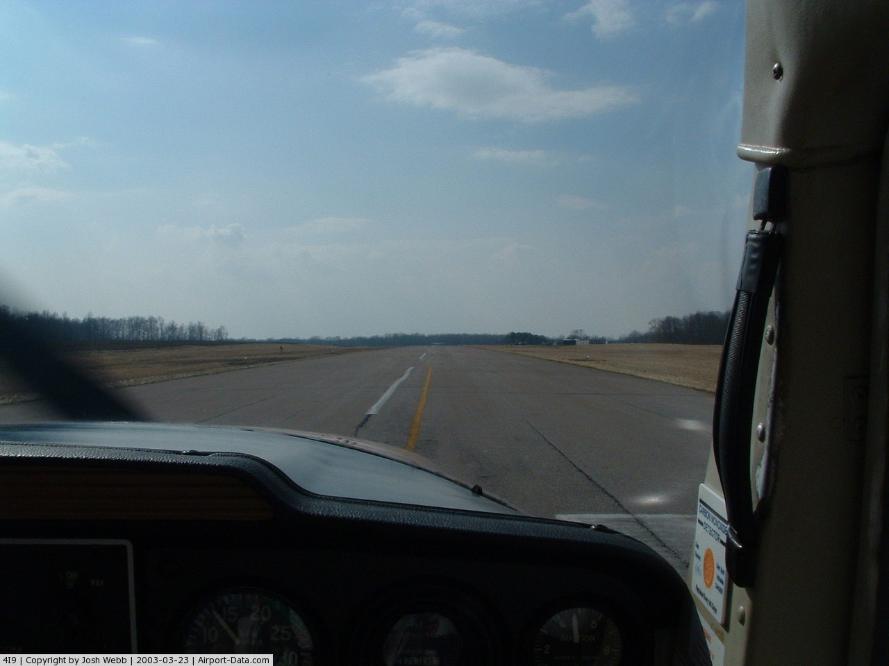
(Click on the photo to enlarge) |
 |
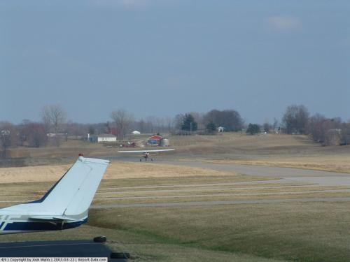
(Click on the photo to enlarge) |
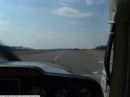 |
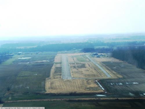
(Click on the photo to enlarge) |
Location & QuickFacts
| FAA Information Effective: | 2008-09-25 |
| Airport Identifier: | 4I9 |
| Airport Status: | Operational |
| Longitude/Latitude: | 082-51-00.2000W/40-31-28.3000N
-82.850056/40.524528 (Estimated) |
| Elevation: | 1085 ft / 330.71 m (Surveyed) |
| Land: | 88 acres |
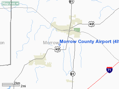
| From nearest city: | 2 nautical miles SW of Mount Gilead, OH |
| Location: | Morrow County, OH |
| Magnetic Variation: | 05W (1985) |
Owner & Manager
| Ownership: | Publicly owned |
| Owner: | Morrow County Arpt Auth. |
| Address: | 4679 Twp. Rd. 126
Cardington, OH 43315 |
| Phone number: | 419-947-1833 |
| Manager: | Carl Fisher, Jr. |
| Address: | 4679 Twp Rd 126
Cardington, OH 43315 |
| Phone number: | 419-947-3320 |
Airport Operations and Facilities
| Airport Use: | Open to public |
| Wind indicator: | Yes |
| Segmented Circle: | No |
| Control Tower: | No |
| Lighting Schedule: | DUSK-DAWN
ACTVT MIRL RY 10/28 - CTAF. |
| Beacon Color: | Clear-Green (lighted land airport) |
| Landing fee charge: | No |
| Sectional chart: | Detroit |
| Region: | AGL - Great Lakes |
| Boundary ARTCC: | ZID - Indianapolis |
| Responsible ARTCC: | ZOB - Cleveland |
| Tie-in FSS: | CLE - Cleveland |
| FSS on Airport: | No |
| FSS Toll Free: | 1-800-WX-BRIEF |
| NOTAMs Facility: | CLE (NOTAM-d service avaliable) |
| Federal Agreements: | NGY |
Airport Communications
| CTAF: | 122.800 |
| Unicom: | 122.800 |
Airport Services
| Airframe Repair: | MAJOR |
| Power Plant Repair: | MAJOR |
Runway Information
Runway 10/28
| Dimension: | 3497 x 65 ft / 1065.9 x 19.8 m |
| Surface: | ASPH, Good Condition |
| Weight Limit: | Single wheel: 3000 lbs. |
| Edge Lights: | Medium |
| |
Runway 10 |
Runway 28 |
| Longitude: | 082-51-22.8550W | 082-50-37.5830W |
| Latitude: | 40-31-28.5790N | 40-31-27.9850N |
| Elevation: | 1075.00 ft | 1085.00 ft |
| Alignment: | 91 | 127 |
| Traffic Pattern: | Left | Left |
| Markings: | Basic, Fair Condition
RWY 10 MARKINGS POOR - WEATHERED. | Basic, Fair Condition
RWY 28 MARKINGS POOR - WEATHERED. |
| Crossing Height: | 0.00 ft | 26.00 ft |
| VASI: | | 2-box SAVASI on left side
RY 28 SAVASI OTS INDEFLY. |
| Visual Glide Angle: | 0.00° | 4.00° |
| Runway End Identifier: | No | No |
| Centerline Lights: | No | No |
| Touchdown Lights: | No | No |
| Obstruction: | 63 ft trees, 2495.0 ft from runway, 75 ft right of centerline, 36:1 slope to clear | 40 ft trees, 860.0 ft from runway, 310 ft left of centerline, 16:1 slope to clear |
|
Radio Navigation Aids
| ID |
Type |
Name |
Ch |
Freq |
Var |
Dist |
| MNN | NDB | Marion | | 201.00 | 05W | 11.5 nm |
| DLZ | NDB | Delaware | | 215.00 | 06W | 18.9 nm |
| MF | NDB | Manns | | 372.00 | 06W | 23.5 nm |
| DKG | NDB | Don Scott | | 348.00 | 05W | 28.7 nm |
| MRT | NDB | Marysville | | 403.00 | 05W | 29.0 nm |
| OS | NDB | Fuler | | 515.00 | 05W | 31.4 nm |
| CHC | NDB | Grens | | 272.00 | 04W | 32.0 nm |
| CM | NDB | Sumie | | 391.00 | 05W | 32.7 nm |
| HEH | NDB | Newark | | 524.00 | 06W | 34.8 nm |
| RUV | NDB | Rushsylvania | | 326.00 | 05W | 37.6 nm |
| AAU | NDB | Ashland | | 329.00 | 07W | 37.9 nm |
| TII | NDB | Tiffin | | 269.00 | 05W | 38.1 nm |
| MLR | NDB | Millersburg/dcmsnd | | 382.00 | 06W | 44.7 nm |
| EDJ | NDB | Bellefontaine | | 242.00 | 05W | 45.0 nm |
| UYF | NDB | London | | 263.00 | 06W | 45.4 nm |
| BU | NDB | Boutn | | 230.00 | 05W | 45.4 nm |
| FZI | NDB | Fostoria | | 379.00 | 05W | 47.0 nm |
| BNR | NDB | Benton Ridge | | 334.00 | 05W | 47.8 nm |
| LCK | TACAN | Rickenbacker | 069X | | 05W | 43.2 nm |
| BUD | VOR | Buckeye | | 109.80 | 05W | 11.2 nm |
| MAH | VOR | Marathon | | 114.90 | 05W | 47.4 nm |
| TVT | VOR/DME | Tiverton | 112X | 116.50 | 03W | 33.3 nm |
| MFD | VORTAC | Mansfield | 025X | 108.80 | 03W | 23.8 nm |
| APE | VORTAC | Appleton | 114X | 116.70 | 06W | 25.5 nm |
| FDY | VORTAC | Findlay | 019X | 108.20 | 02W | 48.7 nm |
| CMH | VOT | Port Columbus | | 111.00 | | 31.9 nm |
Remarks
Images and information placed above are from
http://www.airport-data.com/airport/4I9/
We thank them for the data!
| General Info
|
| Country |
United States
|
| State |
OHIO
|
| FAA ID |
4I9
|
| Latitude |
40-31-28.300N
|
| Longitude |
082-51-00.200W
|
| Elevation |
1085 feet
|
| Near City |
MOUNT GILEAD
|
We don't guarantee the information is fresh and accurate. The data may
be wrong or outdated.
For more up-to-date information please refer to other sources.
|
|