 |
|
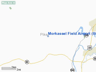
Location & QuickFacts
| FAA Information Effective: | 2008-09-25 |
| Airport Identifier: | 8OI9 |
| Airport Status: | Operational |
| Longitude/Latitude: | 083-06-59.6540W/39-05-57.2470N
-83.116571/39.099235 (Estimated) |
| Elevation: | 850 ft / 259.08 m (Estimated) |
| Land: | 24 acres |
| From nearest city: | 3 nautical miles NE of Idaho, OH |
| Location: | Pike County, OH |
| Magnetic Variation: | 05W (1985) |
Owner & Manager
| Ownership: | Privately owned |
| Owner: | Gerald N. Morkassel |
| Address: | 17015 Sr 772
Waverly, OH 45690 |
| Phone number: | 614-493-2328 |
| Manager: | Gerald N. Morkassel |
| Address: | 17015 Sr 772
Waverly, OH 45690 |
| Phone number: | 614-493-2328 |
Airport Operations and Facilities
| Airport Use: | Private |
| Wind indicator: | Yes |
| Segmented Circle: | No |
| Control Tower: | No |
| Landing fee charge: | No |
| Sectional chart: | Cincinnati |
| Region: | AGL - Great Lakes |
| Boundary ARTCC: | ZID - Indianapolis |
| Tie-in FSS: | DAY - Dayton |
| FSS on Airport: | No |
| FSS Toll Free: | 1-800-WX-BRIEF |
Runway Information
Runway 03/21
| Dimension: | 1950 x 65 ft / 594.4 x 19.8 m |
| Surface: | TURF, |
| |
Runway 03 |
Runway 21 |
| Traffic Pattern: | Left | Left |
| Obstruction: | 40 ft pline, 300.0 ft from runway | 30 ft bldg, 400.0 ft from runway |
|
Radio Navigation Aids
| ID |
Type |
Name |
Ch |
Freq |
Var |
Dist |
| AJY | FAN MARKER | Ashland | | | 03W | 35.9 nm |
| EOP | NDB | Waverly | | 385.00 | 06W | 9.5 nm |
| PZO | NDB | Peebles | | 329.00 | 02W | 14.5 nm |
| HOC | NDB | Hillsboro | | 278.00 | 05W | 20.5 nm |
| RZT | NDB | Ross County | | 236.00 | 05W | 20.8 nm |
| PMH | NDB | Portsmouth | | 373.00 | 04W | 22.9 nm |
| AMT | NDB | West Union | | 359.00 | 04W | 25.5 nm |
| CYO | NDB | Circleville | | 366.00 | 05W | 26.3 nm |
| CSS | NDB | Court House | | 414.00 | 05W | 32.7 nm |
| IL | NDB | Airbo | | 407.00 | 04W | 37.3 nm |
| HW | NDB | Cubla | | 299.00 | 04W | 38.5 nm |
| XW | NDB | Flmng | | 400.00 | 05W | 40.2 nm |
| BU | NDB | Boutn | | 230.00 | 05W | 43.5 nm |
| UGS | NDB | University | | 250.00 | 06W | 47.1 nm |
| GAS | NDB | Gallipolis | | 420.00 | 07W | 47.4 nm |
| LCK | TACAN | Rickenbacker | 069X | | 05W | 43.5 nm |
| XUB | VOR | Yellow Bud | | 112.50 | 05W | 26.5 nm |
| MXQ | VOR/DME | Midwest | 076X | 112.90 | 04W | 37.5 nm |
| YRK | VORTAC | York | 075X | 112.80 | 05W | 28.1 nm |
Remarks
- PROVIDED OBSTRUCTIONS IN THE RWY APPROACH SURFACES ARE REMOVED/LOWERED TO PROVIDE 20:1 APPROACH CLEARANCE; STREAM RUNNING THRU AREA SHOULD BE DIVERTED.
Images and information placed above are from
http://www.airport-data.com/airport/8OI9/
We thank them for the data!
| General Info
|
| Country |
United States
|
| State |
OHIO
|
| FAA ID |
8OI9
|
| Latitude |
39-05-57.247N
|
| Longitude |
083-06-59.654W
|
| Elevation |
850 feet
|
| Near City |
IDAHO
|
We don't guarantee the information is fresh and accurate. The data may
be wrong or outdated.
For more up-to-date information please refer to other sources.
|
|


