 |
|
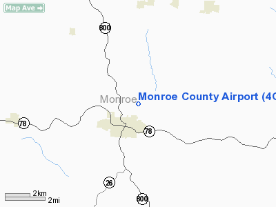
Location & QuickFacts
| FAA Information Effective: | 2008-09-25 |
| Airport Identifier: | 4G5 |
| Airport Status: | Operational |
| Longitude/Latitude: | 081-06-10.0084W/39-46-44.5837N
-81.102780/39.779051 (Estimated) |
| Elevation: | 1197 ft / 364.85 m (Surveyed) |
| Land: | 105 acres |
| From nearest city: | 1 nautical miles N of Woodsfield, OH |
| Location: | Monroe County, OH |
| Magnetic Variation: | 04W (1965) |
Owner & Manager
| Ownership: | Publicly owned |
| Owner: | County Cmsn |
| Address: | 101 N. Main St.
Woodsfield, OH 43793 |
| Phone number: | 740-472-1341 |
| Manager: | David Dalrymple |
| Address: | 47073 State Rte 26
Woodsfield, OH 43793 |
| Phone number: | 740-472-1882
MANAGER CELL PHONE 740-213-3106 |
Airport Operations and Facilities
| Airport Use: | Open to public |
| Wind indicator: | Yes |
| Segmented Circle: | No |
| Control Tower: | No |
| Lighting Schedule: | RDO-CTL
ACTVT MIRL RY 07/25; ROTG BCN & REIL RY 25 - CTAF. |
| Beacon Color: | Clear-Green (lighted land airport) |
| Landing fee charge: | No |
| Sectional chart: | Cincinnati |
| Region: | AGL - Great Lakes |
| Boundary ARTCC: | ZOB - Cleveland |
| Tie-in FSS: | CLE - Cleveland |
| FSS on Airport: | No |
| FSS Toll Free: | 1-800-WX-BRIEF |
| NOTAMs Facility: | CLE (NOTAM-d service avaliable) |
| Federal Agreements: | N |
Airport Communications
| CTAF: | 122.800 |
| Unicom: | 122.800 |
Airport Services
| Fuel available: | 100LL80
FOR FUEL CALL740-472-1882. |
| Airframe Repair: | MAJOR |
| Power Plant Repair: | MAJOR |
| Bottled Oxygen: | NONE |
| Bulk Oxygen: | NONE |
Runway Information
Runway 07/25
| Dimension: | 3805 x 75 ft / 1159.8 x 22.9 m |
| Surface: | ASPH, |
| Weight Limit: | Single wheel: 18000 lbs. |
| Edge Lights: | Medium |
| |
Runway 07 |
Runway 25 |
| Longitude: | 081-06-32.2721W | 081-05-47.7433W |
| Latitude: | 39-46-36.9384N | 39-46-52.2278N |
| Elevation: | 1194.00 ft | 1190.00 ft |
| Alignment: | 66 | 127 |
| Traffic Pattern: | Left | Left |
| Markings: | Non-precision instrument, Good Condition | Non-precision instrument, Good Condition |
| Displaced threshold: | 173.00 ft | 0.00 ft |
| Runway End Identifier: | | Yes |
| Obstruction: | 37 ft trees, 520.0 ft from runway, 238 ft right of centerline, 9:1 slope to clear
RWY 07 APCH RATIO 18:1 TO DSPLCD THLD. | 32 ft trees, 623.0 ft from runway, 210 ft right of centerline, 13:1 slope to clear
+7 FT BRUSH 155-200 FT FM 138 FT R. |
|
Radio Navigation Aids
| ID |
Type |
Name |
Ch |
Freq |
Var |
Dist |
| PKB | FAN MARKER | Marietta Ohio | | | 03W | 27.7 nm |
| CFX | NDB | Cadiz | | 239.00 | 07W | 27.8 nm |
| HRA | NDB | Zanesville | | 204.00 | 06W | 38.5 nm |
| TSO | NDB | Tolson | | 395.00 | 07W | 47.1 nm |
| PNU | NDB | Washington County | | 255.00 | 08W | 48.6 nm |
| AIR | VOR/DME | Bellaire | 118X | 117.10 | 07W | 19.4 nm |
| CTW | VOR/DME | Newcomerstown | 055X | 111.80 | 07W | 32.1 nm |
| ZZV | VOR/DME | Zanesville | 051X | 111.40 | 06W | 37.7 nm |
| HLG | VOR/DME | Wheeling | 059X | 112.20 | 07W | 37.9 nm |
| CKB | VOR/DME | Clarksburg | 073X | 112.60 | 04W | 50.0 nm |
| JPU | VORTAC | Parkersburg | 023X | 108.60 | 03W | 23.9 nm |
Images and information placed above are from
http://www.airport-data.com/airport/4G5/
We thank them for the data!
| General Info
|
| Country |
United States
|
| State |
OHIO
|
| FAA ID |
4G5
|
| Latitude |
39-46-44.561N
|
| Longitude |
081-06-09.980W
|
| Elevation |
1195 feet
|
| Near City |
WOODSFIELD
|
We don't guarantee the information is fresh and accurate. The data may
be wrong or outdated.
For more up-to-date information please refer to other sources.
|
|


