 |
|
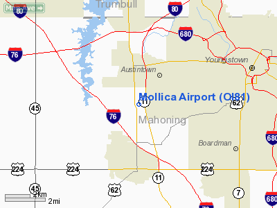
Location & QuickFacts
| FAA Information Effective: | 2008-09-25 |
| Airport Identifier: | OI81 |
| Airport Status: | Operational |
| Longitude/Latitude: | 080-45-31.0000W/41-04-17.0000N
-80.758611/41.071389 (Estimated) |
| Elevation: | 1170 ft / 356.62 m (Estimated) |
| Land: | 20 acres |
| From nearest city: | 2 nautical miles S of Austintown, OH |
| Location: | Mahoning County, OH |
| Magnetic Variation: | 08W (1995) |
Owner & Manager
| Ownership: | Privately owned |
| Owner: | Rae Jeanne Mollica |
| Address: | 5360 Kirk Road
Austintown, OH 44515 |
| Phone number: | 330-793-4234 |
| Manager: | Joseph B. Tooley |
| Address: | 5360 Kirk Road
Austintown, OH 44515 |
| Phone number: | 330-565-6395 |
Airport Operations and Facilities
| Airport Use: | Private |
| Wind indicator: | Yes |
| Segmented Circle: | No |
| Control Tower: | No |
| Sectional chart: | Detroit |
| Region: | AGL - Great Lakes |
| Boundary ARTCC: | ZOB - Cleveland |
| Tie-in FSS: | CLE - Cleveland |
| FSS on Airport: | No |
| FSS Toll Free: | 1-800-WX-BRIEF |
Runway Information
Runway 18/36
| Dimension: | 1750 x 75 ft / 533.4 x 22.9 m |
| Surface: | TURF, |
| |
Runway 18 |
Runway 36 |
| Traffic Pattern: | Left | Left |
| Displaced threshold: | 0.00 ft | 400.00 ft |
| Obstruction: | | 20 ft pline, 50.0 ft from runway |
|
Radio Navigation Aids
| ID |
Type |
Name |
Ch |
Freq |
Var |
Dist |
| HBD | NDB | Hubbard | | 408.00 | 08W | 11.4 nm |
| UCP | NDB | Castle | | 272.00 | 09W | 15.8 nm |
| AK | NDB | Akron | | 362.00 | 07W | 28.5 nm |
| TSO | NDB | Tolson | | 395.00 | 07W | 33.8 nm |
| LQL | NDB | Lakeland | | 263.00 | 08W | 46.2 nm |
| BKL | NDB | Burke Lakefront | | 416.00 | 07W | 49.2 nm |
| FKL | VOR | Franklin | | 109.60 | 06W | 46.3 nm |
| ACO | VOR/DME | Akron | 091X | 114.40 | 04W | 20.2 nm |
| CXR | VOR/DME | Chardon | 074X | 112.70 | 05W | 32.4 nm |
| BSV | VOR/DME | Briggs | 071X | 112.40 | 04W | 36.5 nm |
| JFN | VOR/DME | Jefferson | 099X | 115.20 | 05W | 41.4 nm |
| LNN | VOR/DME | Lost Nation | 039X | 110.20 | 08W | 46.6 nm |
| HLG | VOR/DME | Wheeling | 059X | 112.20 | 07W | 49.5 nm |
| YNG | VORTAC | Youngstown | 027X | 109.00 | 05W | 16.1 nm |
| EWC | VORTAC | Ellwood City | 105X | 115.80 | 08W | 28.9 nm |
| MMJ | VORTAC | Montour | 057X | 112.00 | 08W | 43.5 nm |
| CAK | VOT | Akron/canton Regional | | 110.60 | | 32.4 nm |
Remarks
- PRVDD 125 FT EITHER SIDE OF RY CNTRLN & 200 FT OFF RY ENDS CLEAR OF OBSTNS; OBSTNS REMOVED/LOWERED OR THLD DSPLCD TO PROVIDE 20:1 APCH SLOPE.
Images and information placed above are from
http://www.airport-data.com/airport/OI81/
We thank them for the data!
| General Info
|
| Country |
United States
|
| State |
OHIO
|
| FAA ID |
OI81
|
| Latitude |
41-04-17.000N
|
| Longitude |
080-45-31.000W
|
| Elevation |
1170 feet
|
| Near City |
AUSTINTOWN
|
We don't guarantee the information is fresh and accurate. The data may
be wrong or outdated.
For more up-to-date information please refer to other sources.
|
|


