 |
|
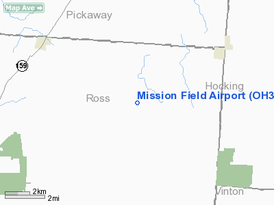
Location & QuickFacts
| FAA Information Effective: | 2008-09-25 |
| Airport Identifier: | OH35 |
| Airport Status: | Operational |
| Longitude/Latitude: | 082-49-21.6240W/39-25-42.2290N
-82.822673/39.428397 (Estimated) |
| Elevation: | 900 ft / 274.32 m (Estimated) |
| Land: | 144 acres |
| From nearest city: | 1 nautical miles S of Hallsville, OH |
| Location: | Ross County, OH |
| Magnetic Variation: | 05W (1985) |
Owner & Manager
| Ownership: | Privately owned |
| Owner: | Charles J. Thurston, Md |
| Address: | 427 Oak Lane
Kingston, OH 45644 |
| Phone number: | 614-655-2626 |
| Manager: | Therese Thurston |
| Address: | 427 Oak Lane
Kingston, OH 45644 |
| Phone number: | 614-655-2626 |
Airport Operations and Facilities
| Airport Use: | Private |
| Wind indicator: | Yes |
| Segmented Circle: | No |
| Control Tower: | No |
| Sectional chart: | Cincinnati |
| Region: | AGL - Great Lakes |
| Boundary ARTCC: | ZID - Indianapolis |
| Tie-in FSS: | DAY - Dayton |
| FSS on Airport: | No |
| FSS Toll Free: | 1-800-WX-BRIEF |
Airport Communications
Runway Information
Runway 12/30
| Dimension: | 2400 x 50 ft / 731.5 x 15.2 m |
| Surface: | TURF,
ROLLING; UNDULATING AND UNEVEN. |
| |
Runway 12 |
Runway 30 |
| Traffic Pattern: | Left | Left |
| Obstruction: | 5 ft crop, 70.0 ft from runway | |
|
Radio Navigation Aids
| ID |
Type |
Name |
Ch |
Freq |
Var |
Dist |
| CYO | NDB | Circleville | | 366.00 | 05W | 9.2 nm |
| RZT | NDB | Ross County | | 236.00 | 05W | 9.6 nm |
| EOP | NDB | Waverly | | 385.00 | 06W | 16.5 nm |
| CSS | NDB | Court House | | 414.00 | 05W | 28.3 nm |
| BU | NDB | Boutn | | 230.00 | 05W | 29.4 nm |
| CM | NDB | Sumie | | 391.00 | 05W | 33.7 nm |
| UGS | NDB | University | | 250.00 | 06W | 34.0 nm |
| CHC | NDB | Grens | | 272.00 | 04W | 36.2 nm |
| HOC | NDB | Hillsboro | | 278.00 | 05W | 36.6 nm |
| PZO | NDB | Peebles | | 329.00 | 02W | 38.5 nm |
| PMH | NDB | Portsmouth | | 373.00 | 04W | 38.9 nm |
| HEH | NDB | Newark | | 524.00 | 06W | 39.6 nm |
| DKG | NDB | Don Scott | | 348.00 | 05W | 40.9 nm |
| OS | NDB | Fuler | | 515.00 | 05W | 42.5 nm |
| UYF | NDB | London | | 263.00 | 06W | 42.5 nm |
| IL | NDB | Airbo | | 407.00 | 04W | 42.6 nm |
| GAS | NDB | Gallipolis | | 420.00 | 07W | 47.2 nm |
| AMT | NDB | West Union | | 359.00 | 04W | 48.8 nm |
| HW | NDB | Cubla | | 299.00 | 04W | 49.1 nm |
| LCK | TACAN | Rickenbacker | 069X | | 05W | 23.4 nm |
| XUB | VOR | Yellow Bud | | 112.50 | 05W | 9.3 nm |
| MXQ | VOR/DME | Midwest | 076X | 112.90 | 04W | 45.4 nm |
| APE | VORTAC | Appleton | 114X | 116.70 | 06W | 44.8 nm |
| YRK | VORTAC | York | 075X | 112.80 | 05W | 47.7 nm |
| CMH | VOT | Port Columbus | | 111.00 | | 34.2 nm |
Remarks
- PRVDD OBSTRUCTIONS IN APCH SFC REMOVED/LOWERED, PREVENT VEHICULAR TFC FROM ENTERING RWY, REFERENCE ADVISORY CIRCULAR 150/5300-4B.
Images and information placed above are from
http://www.airport-data.com/airport/OH35/
We thank them for the data!
| General Info
|
| Country |
United States
|
| State |
OHIO
|
| FAA ID |
OH35
|
| Latitude |
39-25-42.229N
|
| Longitude |
082-49-21.624W
|
| Elevation |
900 feet
|
| Near City |
HALLSVILLE
|
We don't guarantee the information is fresh and accurate. The data may
be wrong or outdated.
For more up-to-date information please refer to other sources.
|
|


