 |
|
Location & QuickFacts
| FAA Information Effective: | 2008-09-25 |
| Airport Identifier: | OI88 |
| Airport Status: | Operational |
| Longitude/Latitude: | 082-26-09.5000W/41-00-40.2000N
-82.435972/41.011167 (Estimated) |
| Elevation: | 1109 ft / 338.02 m (Estimated) |
| Land: | 1106 acres |
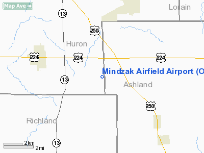
| From nearest city: | 4 nautical miles SS of Greenwich, OH |
| Location: | Huron County, OH |
| Magnetic Variation: | () |
Owner & Manager
| Ownership: | Privately owned |
| Owner: | Thomas P Mindzak |
| Address: | 3864 Plymouth East Road
Greenwich, OH 44837 |
| Phone number: | 419-753-3614 |
| Manager: | Thomas P Windzak |
| Address: | 3864 Plymouth East Road
Greenwich, OH 44837 |
| Phone number: | 419-753-3614 |
Airport Operations and Facilities
| Airport Use: | Private |
| Wind indicator: | Yes |
| Control Tower: | No |
| Sectional chart: | Detroit |
| Region: | AGL - Great Lakes |
| Boundary ARTCC: | ZOB - Cleveland |
| Tie-in FSS: | CLE - Cleveland |
| FSS Toll Free: | 1-800-WX-BRIEF |
Runway Information
Runway 11/29
| Dimension: | 1885 x 66 ft / 574.5 x 20.1 m |
| Surface: | TURF, Good Condition |
| |
Runway 11 |
Runway 29 |
| Traffic Pattern: | Left | Left |
| Obstruction: | | 45 ft pline, 900.0 ft from runway |
|
Radio Navigation Aids
| ID |
Type |
Name |
Ch |
Freq |
Var |
Dist |
| AAU | NDB | Ashland | | 329.00 | 07W | 8.8 nm |
| MF | NDB | Manns | | 372.00 | 06W | 14.7 nm |
| CL | NDB | Harri | | 344.00 | 07W | 29.0 nm |
| TII | NDB | Tiffin | | 269.00 | 05W | 35.4 nm |
| PCW | NDB | Port Clinton | | 423.00 | 06W | 36.2 nm |
| MNN | NDB | Marion | | 201.00 | 05W | 37.3 nm |
| MLR | NDB | Millersburg/dcmsnd | | 382.00 | 06W | 38.1 nm |
| EZE | NDB | Engel | | 226.00 | 07W | 43.2 nm |
| FZI | NDB | Fostoria | | 379.00 | 05W | 44.8 nm |
| BKL | NDB | Burke Lakefront | | 416.00 | 07W | 46.8 nm |
| PT | NDB | Pelee Island | | 283.00 | 05W | 47.4 nm |
| AK | NDB | Akron | | 362.00 | 07W | 47.7 nm |
| BUD | VOR | Buckeye | | 109.80 | 05W | 37.1 nm |
| DJB | VOR/DME | Dryer | 083X | 113.60 | 05W | 24.3 nm |
| SKY | VOR/DME | Sandusky | 029X | 109.20 | 04W | 27.3 nm |
| TVT | VOR/DME | Tiverton | 112X | 116.50 | 03W | 36.1 nm |
| BSV | VOR/DME | Briggs | 071X | 112.40 | 04W | 48.4 nm |
| MFD | VORTAC | Mansfield | 025X | 108.80 | 03W | 11.1 nm |
| CLE | VOT | Cleveland | | 110.40 | | 35.8 nm |
| CAK | VOT | Akron/canton Regional | | 110.60 | | 45.5 nm |
Remarks
- LAKE 100 FT FR END OF RY 11.
- OWNER MONITORS 122.9, REQUEST PERMISSION TO LND.
- PRVDD VFR OPNS, PVT USE, AREA IS MARKED, WIND INDICATOR IS MAINTAINED, CLEAR 20:1 APCHS & CLEAR OBSTACLE FREE ZONE.
Images and information placed above are from
http://www.airport-data.com/airport/OI88/
We thank them for the data!
|
|


