 |
|
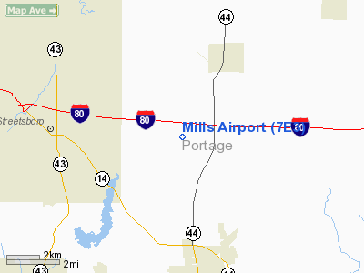
Location & QuickFacts
| FAA Information Effective: | 2008-09-25 |
| Airport Identifier: | 7E3 |
| Airport Status: | Operational |
| Longitude/Latitude: | 081-15-13.8000W/41-14-18.2000N
-81.253833/41.238389 (Estimated) |
| Elevation: | 1140 ft / 347.47 m (Estimated) |
| Land: | 4 acres |
| From nearest city: | 3 nautical miles SW of Mantua, OH |
| Location: | Portage County, OH |
| Magnetic Variation: | 07W (1985) |
Owner & Manager
| Ownership: | Privately owned |
| Owner: | Larry & Alvin Mills |
| Address: | 4022 State Route 303
Mantua, OH 44255 |
| Phone number: | 330-297-7579 |
| Manager: | Larry & Alvin Mills
ADDL AMGR DON HONECK WORK 330-296-9936, HOME 330-296-3178, MOBILE 330-607-1103. |
| Address: | 4022 State Route 303
Mantua, OH 44255 |
| Phone number: | 330-297-7579 |
Airport Operations and Facilities
| Airport Use: | Open to public |
| Wind indicator: | Yes |
| Segmented Circle: | No |
| Control Tower: | No |
| Landing fee charge: | No |
| Sectional chart: | Detroit |
| Region: | AGL - Great Lakes |
| Boundary ARTCC: | ZOB - Cleveland |
| Tie-in FSS: | CLE - Cleveland |
| FSS on Airport: | No |
| FSS Toll Free: | 1-800-WX-BRIEF |
| NOTAMs Facility: | CLE (NOTAM-d service avaliable) |
Airport Communications
Airport Services
Runway Information
Runway 03/21
| Dimension: | 2640 x 60 ft / 804.7 x 18.3 m |
| Surface: | TURF, Good Condition |
| |
Runway 03 |
Runway 21 |
| Longitude: | 081-15-20.0424W | 081-15-07.5171W |
| Latitude: | 41-14-06.0863N | 41-14-30.3971N |
| Elevation: | 1133.00 ft | 1100.00 ft |
| Traffic Pattern: | Left | Left |
| Markings: | None, | None, |
| Runway End Identifier: | No | No |
| Centerline Lights: | No | No |
| Touchdown Lights: | No | No |
| Obstruction: | 125 ft tree, 1575.0 ft from runway, 260 ft left of centerline, 12:1 slope to clear | 31 ft plines, 0.0 ft from runway, 125 ft left of centerline |
|
Radio Navigation Aids
| ID |
Type |
Name |
Ch |
Freq |
Var |
Dist |
| AK | NDB | Akron | | 362.00 | 07W | 11.8 nm |
| BKL | NDB | Burke Lakefront | | 416.00 | 07W | 25.4 nm |
| EZE | NDB | Engel | | 226.00 | 07W | 26.0 nm |
| LQL | NDB | Lakeland | | 263.00 | 08W | 27.3 nm |
| CL | NDB | Harri | | 344.00 | 07W | 32.7 nm |
| HBD | NDB | Hubbard | | 408.00 | 08W | 33.1 nm |
| UCP | NDB | Castle | | 272.00 | 09W | 40.1 nm |
| TSO | NDB | Tolson | | 395.00 | 07W | 41.4 nm |
| AAU | NDB | Ashland | | 329.00 | 07W | 48.2 nm |
| ACO | VOR/DME | Akron | 091X | 114.40 | 04W | 8.2 nm |
| CXR | VOR/DME | Chardon | 074X | 112.70 | 05W | 17.2 nm |
| LNN | VOR/DME | Lost Nation | 039X | 110.20 | 08W | 27.5 nm |
| BSV | VOR/DME | Briggs | 071X | 112.40 | 04W | 31.0 nm |
| JFN | VOR/DME | Jefferson | 099X | 115.20 | 05W | 38.8 nm |
| DJB | VOR/DME | Dryer | 083X | 113.60 | 05W | 41.6 nm |
| YNG | VORTAC | Youngstown | 027X | 109.00 | 05W | 26.7 nm |
| CAK | VOT | Akron/canton Regional | | 110.60 | | 21.2 nm |
| CLE | VOT | Cleveland | | 110.40 | | 28.8 nm |
Remarks
Images and information placed above are from
http://www.airport-data.com/airport/7E3/
We thank them for the data!
| General Info
|
| Country |
United States
|
| State |
OHIO
|
| FAA ID |
7E3
|
| Latitude |
41-14-18.200N
|
| Longitude |
081-15-13.800W
|
| Elevation |
1140 feet
|
| Near City |
MANTUA
|
We don't guarantee the information is fresh and accurate. The data may
be wrong or outdated.
For more up-to-date information please refer to other sources.
|
|


