 |
|
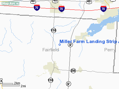
Miller Farm Landing Strip Airport |
Location & QuickFacts
| FAA Information Effective: | 2008-09-25 |
| Airport Identifier: | 7B4 |
| Airport Status: | Operational |
| Longitude/Latitude: | 082-35-20.5840W/39-53-04.2290N
-82.589051/39.884508 (Estimated) |
| Elevation: | 930 ft / 283.46 m (Estimated) |
| Land: | 10 acres |
| From nearest city: | 3 nautical miles NE of Baltimore, OH |
| Location: | Fairfield County, OH |
| Magnetic Variation: | 05W (1985) |
Owner & Manager
| Ownership: | Privately owned |
| Owner: | Wilma P. Miller |
| Address: | 455 Stemen Rd Nw
Baltimore, OH 43105 |
| Phone number: | 614-862-8129 |
| Manager: | Clarence Price |
| Address: | 155 Stemen Rd. Nw
Baltimore, OH 43105 |
| Phone number: | 614-862-8422 |
Airport Operations and Facilities
| Airport Use: | Open to public |
| Wind indicator: | Yes |
| Segmented Circle: | No |
| Control Tower: | No |
| Lighting Schedule: | PHONE REQ
FOR RWY LGTS CALL 614-862-6053. |
| Landing fee charge: | No |
| Sectional chart: | Cincinnati |
| Region: | AGL - Great Lakes |
| Boundary ARTCC: | ZID - Indianapolis |
| Tie-in FSS: | DAY - Dayton |
| FSS on Airport: | No |
| FSS Toll Free: | 1-800-WX-BRIEF |
| NOTAMs Facility: | DAY (NOTAM-d service avaliable) |
Airport Communications
Airport Services
| Airframe Repair: | MAJOR |
| Power Plant Repair: | MAJOR |
Runway Information
Runway 09/27
| Dimension: | 3250 x 50 ft / 990.6 x 15.2 m |
| Surface: | TURF, Good Condition |
| Edge Lights: | Non-standard lighting system
NSTD LIRL; RY ENDS LIGHTED WITH 360 DEG RED LGTS & DSPLD THLDS LIGHTED WITH 1 360 DEG GREEN LGT EACH SIDE OF RY. |
| |
Runway 09 |
Runway 27 |
| Traffic Pattern: | Left | Left |
| Displaced threshold: | 270.00 ft
09/27 DSPLCD THLDS MARKED WITH GREEN LGT ATOP YELLOW CONE. | 275.00 ft |
| Obstruction: | 68 ft trees, 450.0 ft from runway, 120 ft right of centerline, 6:1 slope to clear
APCH SLOPE 7:1 TO DSPLCD THLD DUE TO +46 FT TREE 340 FT FR DSPLCD THLD 150 FT L. | 15 ft trees, 0.0 ft from runway, 60 ft right of centerline
APCH SLOPE 18:1 BASED ON DSPLCD THLD. |
|
Radio Navigation Aids
| ID |
Type |
Name |
Ch |
Freq |
Var |
Dist |
| CM | NDB | Sumie | | 391.00 | 05W | 9.8 nm |
| HEH | NDB | Newark | | 524.00 | 06W | 10.3 nm |
| CHC | NDB | Grens | | 272.00 | 04W | 21.6 nm |
| DKG | NDB | Don Scott | | 348.00 | 05W | 25.4 nm |
| CYO | NDB | Circleville | | 366.00 | 05W | 28.3 nm |
| BU | NDB | Boutn | | 230.00 | 05W | 28.7 nm |
| OS | NDB | Fuler | | 515.00 | 05W | 30.3 nm |
| HRA | NDB | Zanesville | | 204.00 | 06W | 30.9 nm |
| DLZ | NDB | Delaware | | 215.00 | 06W | 33.4 nm |
| RZT | NDB | Ross County | | 236.00 | 05W | 33.7 nm |
| UYF | NDB | London | | 263.00 | 06W | 40.6 nm |
| MRT | NDB | Marysville | | 403.00 | 05W | 40.6 nm |
| CSS | NDB | Court House | | 414.00 | 05W | 40.8 nm |
| UGS | NDB | University | | 250.00 | 06W | 43.4 nm |
| EOP | NDB | Waverly | | 385.00 | 06W | 46.0 nm |
| MNN | NDB | Marion | | 201.00 | 05W | 49.3 nm |
| LCK | TACAN | Rickenbacker | 069X | | 05W | 16.3 nm |
| XUB | VOR | Yellow Bud | | 112.50 | 05W | 28.0 nm |
| BUD | VOR | Buckeye | | 109.80 | 05W | 49.1 nm |
| ZZV | VOR/DME | Zanesville | 051X | 111.40 | 06W | 32.3 nm |
| TVT | VOR/DME | Tiverton | 112X | 116.50 | 03W | 40.5 nm |
| APE | VORTAC | Appleton | 114X | 116.70 | 06W | 16.0 nm |
| CMH | VOT | Port Columbus | | 111.00 | | 15.2 nm |
Remarks
- NO TGL, NO STUDENT OPNS.
- +15 FT TREES ON RY END & B/W RY END LGTS.
- VFR USE ONLY.
Images and information placed above are from
http://www.airport-data.com/airport/7B4/
We thank them for the data!
| General Info
|
| Country |
United States
|
| State |
OHIO
|
| FAA ID |
7B4
|
| Latitude |
39-53-04.229N
|
| Longitude |
082-35-20.584W
|
| Elevation |
930 feet
|
| Near City |
BALTIMORE
|
We don't guarantee the information is fresh and accurate. The data may
be wrong or outdated.
For more up-to-date information please refer to other sources.
|
|


