 |
|
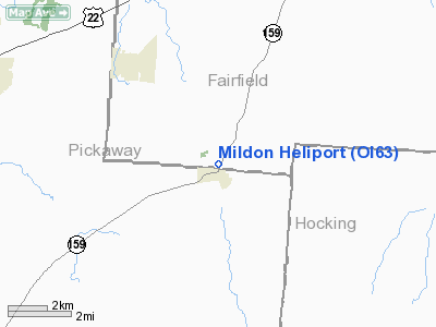
Location & QuickFacts
| FAA Information Effective: | 2008-09-25 |
| Airport Identifier: | OI63 |
| Airport Status: | Operational |
| Longitude/Latitude: | 082-46-30.6170W/39-33-35.2270N
-82.775171/39.559785 (Estimated) |
| Elevation: | 950 ft / 289.56 m (Estimated) |
| Land: | 0 acres |
| From nearest city: | 0 nautical miles NE of Tarlton, OH |
| Location: | Fairfield County, OH |
| Magnetic Variation: | 05W (1985) |
Owner & Manager
| Ownership: | Privately owned |
| Owner: | Franklin E. Middaugh |
| Address: | 11745 Chillicothe-lancaster
Amanda, OH 43102 |
| Phone number: | 614-969-4073 |
| Manager: | Franklin E. Middaugh |
| Address: | 11745 Chillicothe-lancaster
Amanda, OH 43102 |
| Phone number: | 614-969-4073 |
Airport Operations and Facilities
| Airport Use: | Private
PERSONAL USE. |
| Wind indicator: | No |
| Segmented Circle: | No |
| Control Tower: | No |
| Sectional chart: | Cincinnati |
| Region: | AGL - Great Lakes |
| Boundary ARTCC: | ZID - Indianapolis |
| Tie-in FSS: | DAY - Dayton |
| FSS on Airport: | No |
| FSS Toll Free: | 1-800-WX-BRIEF |
Runway Information
Helipad H1
| Dimension: | 75 x 75 ft / 22.9 x 22.9 m |
| Surface: | TURF, |
| |
Runway H1 |
Runway |
| Traffic Pattern: | Left | Left |
|
Radio Navigation Aids
| ID |
Type |
Name |
Ch |
Freq |
Var |
Dist |
| CYO | NDB | Circleville | | 366.00 | 05W | 9.7 nm |
| RZT | NDB | Ross County | | 236.00 | 05W | 13.8 nm |
| EOP | NDB | Waverly | | 385.00 | 06W | 24.7 nm |
| BU | NDB | Boutn | | 230.00 | 05W | 25.3 nm |
| CM | NDB | Sumie | | 391.00 | 05W | 25.7 nm |
| CSS | NDB | Court House | | 414.00 | 05W | 28.7 nm |
| CHC | NDB | Grens | | 272.00 | 04W | 29.5 nm |
| HEH | NDB | Newark | | 524.00 | 06W | 31.5 nm |
| DKG | NDB | Don Scott | | 348.00 | 05W | 34.3 nm |
| UGS | NDB | University | | 250.00 | 06W | 35.2 nm |
| OS | NDB | Fuler | | 515.00 | 05W | 36.5 nm |
| UYF | NDB | London | | 263.00 | 06W | 39.1 nm |
| HOC | NDB | Hillsboro | | 278.00 | 05W | 42.2 nm |
| HRA | NDB | Zanesville | | 204.00 | 06W | 44.7 nm |
| IL | NDB | Airbo | | 407.00 | 04W | 44.8 nm |
| DLZ | NDB | Delaware | | 215.00 | 06W | 45.7 nm |
| PZO | NDB | Peebles | | 329.00 | 02W | 46.2 nm |
| PMH | NDB | Portsmouth | | 373.00 | 04W | 46.9 nm |
| MRT | NDB | Marysville | | 403.00 | 05W | 48.1 nm |
| LCK | TACAN | Rickenbacker | 069X | | 05W | 16.5 nm |
| XUB | VOR | Yellow Bud | | 112.50 | 05W | 9.6 nm |
| ZZV | VOR/DME | Zanesville | 051X | 111.40 | 06W | 46.8 nm |
| MXQ | VOR/DME | Midwest | 076X | 112.90 | 04W | 48.2 nm |
| APE | VORTAC | Appleton | 114X | 116.70 | 06W | 36.6 nm |
| CMH | VOT | Port Columbus | | 111.00 | | 26.6 nm |
Remarks
- E111: TAKEOFF/LNDG AREA IS APPROPRIATELY MKD; NON-OBSTRUCTING WIND INDICATOR IS MAINTAINED.
Images and information placed above are from
http://www.airport-data.com/airport/OI63/
We thank them for the data!
| General Info
|
| Country |
United States
|
| State |
OHIO
|
| FAA ID |
OI63
|
| Latitude |
39-33-35.227N
|
| Longitude |
082-46-30.617W
|
| Elevation |
950 feet
|
| Near City |
TARLTON
|
We don't guarantee the information is fresh and accurate. The data may
be wrong or outdated.
For more up-to-date information please refer to other sources.
|
|


