 |
|
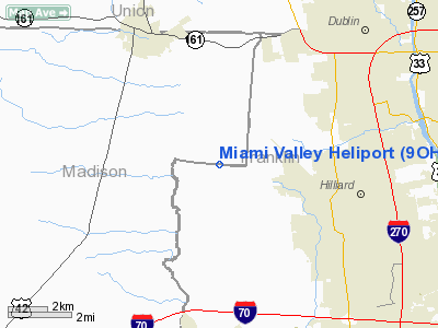
Location & QuickFacts
| FAA Information Effective: | 2008-09-25 |
| Airport Identifier: | 9OH5 |
| Airport Status: | Operational |
| Longitude/Latitude: | 083-13-37.6920W/40-02-53.2230N
-83.227137/40.048117 (Estimated) |
| Elevation: | 940 ft / 286.51 m (Estimated) |
| Land: | 6 acres |
| From nearest city: | 1 nautical miles W of Troy, OH |
| Location: | Miami County, OH |
| Magnetic Variation: | 04W (1985) |
Owner & Manager
| Ownership: | Privately owned |
| Owner: | Brent Black |
| Address: | Box 533
Tipp City, OH 45371 |
| Phone number: | 513-335-1222 |
| Manager: | Brent Black |
| Address: | Box 533
Tipp City, OH 45371 |
| Phone number: | 419-268-2902 |
Airport Operations and Facilities
| Airport Use: | Private |
| Wind indicator: | Yes |
| Segmented Circle: | No |
| Control Tower: | No |
| Sectional chart: | Detroit |
| Region: | AGL - Great Lakes |
| Boundary ARTCC: | ZID - Indianapolis |
| Tie-in FSS: | DAY - Dayton |
| FSS Toll Free: | 1-800-WX-BRIEF |
Airport Communications
Runway Information
Helipad H1
| Dimension: | 60 x 60 ft / 18.3 x 18.3 m |
| Surface: | GRVL, |
| |
Runway H1 |
Runway |
| Traffic Pattern: | Left | Left |
|
Radio Navigation Aids
| ID |
Type |
Name |
Ch |
Freq |
Var |
Dist |
| OS | NDB | Fuler | | 515.00 | 05W | 2.0 nm |
| DKG | NDB | Don Scott | | 348.00 | 05W | 7.1 nm |
| CHC | NDB | Grens | | 272.00 | 04W | 9.4 nm |
| MRT | NDB | Marysville | | 403.00 | 05W | 12.1 nm |
| UYF | NDB | London | | 263.00 | 06W | 13.0 nm |
| BU | NDB | Boutn | | 230.00 | 05W | 13.8 nm |
| DLZ | NDB | Delaware | | 215.00 | 06W | 14.9 nm |
| CM | NDB | Sumie | | 391.00 | 05W | 22.1 nm |
| CCJ | NDB | Clark County | | 341.00 | 04W | 27.5 nm |
| CSS | NDB | Court House | | 414.00 | 05W | 27.9 nm |
| RUV | NDB | Rushsylvania | | 326.00 | 05W | 31.9 nm |
| EDJ | NDB | Bellefontaine | | 242.00 | 05W | 33.2 nm |
| CYO | NDB | Circleville | | 366.00 | 05W | 33.6 nm |
| MNN | NDB | Marion | | 201.00 | 05W | 35.0 nm |
| HEH | NDB | Newark | | 524.00 | 06W | 35.2 nm |
| RZT | NDB | Ross County | | 236.00 | 05W | 37.8 nm |
| XEN | NDB | Xenia | | 395.00 | 03W | 38.1 nm |
| IL | NDB | Airbo | | 407.00 | 04W | 40.9 nm |
| LCK | TACAN | Rickenbacker | 069X | | 05W | 19.9 nm |
| XSF | TACAN | Springfield | 065X | | 04W | 31.0 nm |
| FFO | TACAN | Patterson | 099X | | 04W | 40.6 nm |
| XUB | VOR | Yellow Bud | | 112.50 | 05W | 33.4 nm |
| BUD | VOR | Buckeye | | 109.80 | 05W | 35.0 nm |
| SGH | VOR/DME | Springfield | 079X | 113.20 | 04W | 31.2 nm |
| MXQ | VOR/DME | Midwest | 076X | 112.90 | 04W | 45.7 nm |
| APE | VORTAC | Appleton | 114X | 116.70 | 06W | 30.0 nm |
| ROD | VORTAC | Rosewood | 122X | 117.50 | 05W | 40.2 nm |
| CMH | VOT | Port Columbus | | 111.00 | | 16.1 nm |
| DAY | VOT | Dayton J M Cox-day | | 111.00 | | 46.6 nm |
Remarks
- (A52-HI) 25 FT LGT POLE 210 FT SW; 30 FT TREES 800 FT S; 35 FT BLDGS 55 FT E.
- PRVDD MINIMUM 8:1 APCH SFCS AND 2:1 TRSNL SFCS MAINTD OVR ALL NEARBY OBSTNS WITHIN FLT PATH.
Images and information placed above are from
http://www.airport-data.com/airport/9OH5/
We thank them for the data!
| General Info
|
| Country |
United States
|
| State |
OHIO
|
| FAA ID |
9OH5
|
| Latitude |
40-02-53.223N
|
| Longitude |
083-13-37.692W
|
| Elevation |
940 feet
|
| Near City |
TROY
|
We don't guarantee the information is fresh and accurate. The data may
be wrong or outdated.
For more up-to-date information please refer to other sources.
|
|


