 |
|
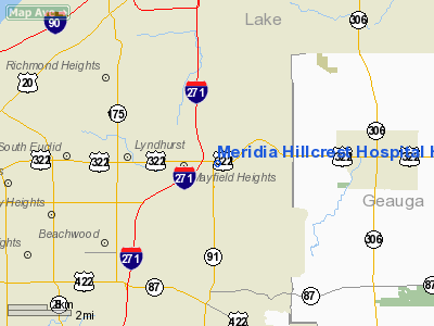
Meridia Hillcrest Hospital Heliport |
Location & QuickFacts
| FAA Information Effective: | 2008-09-25 |
| Airport Identifier: | OI83 |
| Airport Status: | Operational |
| Longitude/Latitude: | 081-26-08.5200W/41-31-08.6400N
-81.435700/41.519067 (Estimated) |
| Elevation: | 1093 ft / 333.15 m (Estimated) |
| Land: | 0 acres |
| From nearest city: | 0 nautical miles N of Mayfield, OH |
| Location: | Cuyahoga County, OH |
| Magnetic Variation: | 07W (1990) |
Owner & Manager
| Ownership: | Privately owned |
| Owner: | Cleveland Clinic Foundation |
| Address: | 9500 Euclid Ave
Cleveland, OH 44195 |
| Phone number: | 216-445-4595 |
| Manager: | Christopher Manacci |
| Address: | 9500 Euclid Ave
Cleveland, OH 44195 |
| Phone number: | 216-445-4595 |
Airport Operations and Facilities
| Airport Use: | Private
MEDICAL USE. |
| Segmented Circle: | No |
| Control Tower: | No |
| Lighting Schedule: | DUSK-DAWN |
| Sectional chart: | Detroit |
| Region: | AGL - Great Lakes |
| Boundary ARTCC: | ZOB - Cleveland |
| Tie-in FSS: | CLE - Cleveland |
| FSS Toll Free: | 1-800-WX-BRIEF |
Runway Information
Helipad H1
| Dimension: | 50 x 50 ft / 15.2 x 15.2 m |
| Surface: | ASPH, |
| |
Runway H1 |
Runway |
| Traffic Pattern: | Left | Left |
|
Radio Navigation Aids
| ID |
Type |
Name |
Ch |
Freq |
Var |
Dist |
| LQL | NDB | Lakeland | | 263.00 | 08W | 10.1 nm |
| BKL | NDB | Burke Lakefront | | 416.00 | 07W | 10.3 nm |
| EZE | NDB | Engel | | 226.00 | 07W | 13.1 nm |
| CL | NDB | Harri | | 344.00 | 07W | 26.2 nm |
| AK | NDB | Akron | | 362.00 | 07W | 27.1 nm |
| HBD | NDB | Hubbard | | 408.00 | 08W | 46.4 nm |
| AAU | NDB | Ashland | | 329.00 | 07W | 49.8 nm |
| LNN | VOR/DME | Lost Nation | 039X | 110.20 | 08W | 10.2 nm |
| CXR | VOR/DME | Chardon | 074X | 112.70 | 05W | 12.3 nm |
| ACO | VOR/DME | Akron | 091X | 114.40 | 04W | 26.9 nm |
| JFN | VOR/DME | Jefferson | 099X | 115.20 | 05W | 34.1 nm |
| DJB | VOR/DME | Dryer | 083X | 113.60 | 05W | 34.1 nm |
| BSV | VOR/DME | Briggs | 071X | 112.40 | 04W | 46.8 nm |
| YNG | VORTAC | Youngstown | 027X | 109.00 | 05W | 36.1 nm |
| CLE | VOT | Cleveland | | 110.40 | | 19.7 nm |
| CAK | VOT | Akron/canton Regional | | 110.60 | | 36.2 nm |
Remarks
- (E111-1) OBSTN BALL ON ELECTRICAL WIRES CROSSING THE 330 DEG APCH/DEP ROUTE 250 FT NW OF HELIPAD; AND A NON-OBSTN WIND INDICATOR IS MAINTAINED ADJACENT TO TKOF/LNDG AREA.
- PRVDD ALL APCH/DEPOPNS CONDUCTED IN AN AREA TO/FROM 230 DEGS AND TO/FROM 330 DEGS; REMOVE MARKING LOTPOLE 30 FT N OF HELIPAD; TKOF/LNDG AREA APPROPRIATELY MKD & OBSTN LGTD ON ALL ROOF CORNERS OF HOSPITAL PARKING LOT GARAGE W OF HELIPORT.
Images and information placed above are from
http://www.airport-data.com/airport/OI83/
We thank them for the data!
| General Info
|
| Country |
United States
|
| State |
OHIO
|
| FAA ID |
OI83
|
| Latitude |
41-31-06.187N
|
| Longitude |
081-26-05.419W
|
| Elevation |
1045 feet
|
| Near City |
MAYFIELD
|
We don't guarantee the information is fresh and accurate. The data may
be wrong or outdated.
For more up-to-date information please refer to other sources.
|
|


