 |
|
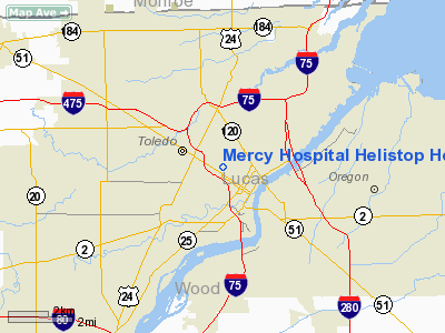
Mercy Hospital Helistop Heliport |
Location & QuickFacts
| FAA Information Effective: | 2008-09-25 |
| Airport Identifier: | OI54 |
| Airport Status: | Operational |
| Longitude/Latitude: | 083-33-09.7620W/41-39-34.1770N
-83.552712/41.659494 (Estimated) |
| Elevation: | 610 ft / 185.93 m (Estimated) |
| Land: | 0 acres |
| From nearest city: | 0 nautical miles N of Toledo, OH |
| Location: | Lucas County, OH |
| Magnetic Variation: | 05W (1985) |
Owner & Manager
| Ownership: | Privately owned |
| Owner: | Mercy Hospital |
| Address: | 2200 Jefferson Ave
Toledo, OH 43624 |
| Phone number: | 419-259-1275 |
| Manager: | Dale Mapes |
| Address: | Mercy Hosp; 2200 Jefferson Av
Toledo, OH 43624 |
| Phone number: | 419-259-1275 |
Airport Operations and Facilities
| Airport Use: | Private
MEDICAL USE. |
| Wind indicator: | Yes |
| Segmented Circle: | Yes |
| Control Tower: | No |
| Landing fee charge: | No |
| Sectional chart: | Detroit |
| Region: | AGL - Great Lakes |
| Boundary ARTCC: | ZOB - Cleveland |
| Tie-in FSS: | CLE - Cleveland |
| FSS on Airport: | No |
| FSS Toll Free: | 1-800-WX-BRIEF |
Runway Information
Helipad H1
| Dimension: | 144 x 100 ft / 43.9 x 30.5 m |
| Surface: | ASPH, |
| |
Runway H1 |
Runway |
| Traffic Pattern: | Left | Left |
|
Radio Navigation Aids
| ID |
Type |
Name |
Ch |
Freq |
Var |
Dist |
| USE | NDB | Fulton | | 375.00 | 05W | 26.2 nm |
| ADG | NDB | Adrian | | 278.00 | 06W | 26.7 nm |
| TCU | NDB | Tecumseh | | 239.00 | 04W | 27.0 nm |
| FZI | NDB | Fostoria | | 379.00 | 05W | 29.1 nm |
| PCW | NDB | Port Clinton | | 423.00 | 06W | 31.9 nm |
| RYS | NDB | Grosse Ile | | 419.00 | 06W | 32.0 nm |
| TII | NDB | Tiffin | | 269.00 | 05W | 37.2 nm |
| BNR | NDB | Benton Ridge | | 334.00 | 05W | 38.7 nm |
| PT | NDB | Pelee Island | | 283.00 | 05W | 40.3 nm |
| G | NDB | Golf | | 398.00 | 05W | 41.8 nm |
| PDR | NDB | Ottawa | | 233.00 | 05W | 42.3 nm |
| BYN | NDB | Bryan | | 260.00 | 04W | 42.5 nm |
| DFI | NDB | Defiance | | 246.00 | 05W | 43.9 nm |
| VQ | NDB | Cargl | | 230.00 | 05W | 49.7 nm |
| QG | NDB | Windsor | | 353.00 | 06W | 49.8 nm |
| TOL | TACAN | Toledo | 072X | | 05W | 11.8 nm |
| MAH | VOR | Marathon | | 114.90 | 05W | 39.1 nm |
| VWV | VOR/DME | Waterville | 078X | 113.10 | 02W | 13.1 nm |
| DXO | VOR/DME | Detroit | 081X | 113.40 | 06W | 34.3 nm |
| SKY | VOR/DME | Sandusky | 029X | 109.20 | 04W | 42.6 nm |
| YQG | VOR/DME | Windsor | 085X | 113.80 | 06W | 48.0 nm |
| CRL | VORTAC | Carleton | 104X | 115.70 | 03W | 23.7 nm |
| FDY | VORTAC | Findlay | 019X | 108.20 | 02W | 43.3 nm |
| SVM | VORTAC | Salem | 090X | 114.30 | 03W | 45.1 nm |
| YIP | VOT | Willow Run | | 112.00 | | 34.6 nm |
| DTW | VOT | Detroit Met Wayne | | 109.80 | | 35.2 nm |
Remarks
- E111:APCH/DEP OPNS ARE CONDUCTED IN AN AREA 170 DEGS CLOCKWISE TO 280 DEGS USING PAD AS CENTER OF COMPASS ROSE; HELIPAD IS APROPLY MKD; A NON-OBSTRUCTING WIND INDICATOR IS MAINTAINED ADJACENT TO LNDG/TAKEOFF AREA.
Images and information placed above are from
http://www.airport-data.com/airport/OI54/
We thank them for the data!
| General Info
|
| Country |
United States
|
| State |
OHIO
|
| FAA ID |
OI54
|
| Latitude |
41-39-34.177N
|
| Longitude |
083-33-09.762W
|
| Elevation |
610 feet
|
| Near City |
TOLEDO
|
We don't guarantee the information is fresh and accurate. The data may
be wrong or outdated.
For more up-to-date information please refer to other sources.
|
|


