 |
|
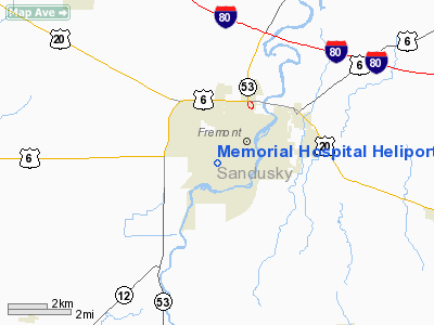
Memorial Hospital Heliport |
Location & QuickFacts
| FAA Information Effective: | 2008-09-25 |
| Airport Identifier: | OI79 |
| Airport Status: | Operational |
| Longitude/Latitude: | 083-08-07.7090W/41-20-21.1890N
-83.135475/41.339219 (Estimated) |
| Elevation: | 630 ft / 192.02 m (Estimated) |
| Land: | 0 acres |
| From nearest city: | 0 nautical miles N of Fremont, OH |
| Location: | Sandusky County, OH |
| Magnetic Variation: | 05W (1985) |
Owner & Manager
| Ownership: | Privately owned |
| Owner: | Meml Hospital |
| Address: | 715 S. Taft Avenue
Fremont, OH 43420 |
| Phone number: | 419-332-7321 |
| Manager: | John A Gorman |
| Address: | 715 S. Taft Avenue
Fremont, OH 43420 |
| Phone number: | 419-332-7321 |
Airport Operations and Facilities
| Airport Use: | Private
MEDICAL USE. |
| Wind indicator: | Yes |
| Segmented Circle: | No |
| Control Tower: | No |
| Landing fee charge: | No |
| Sectional chart: | Detroit |
| Region: | AGL - Great Lakes |
| Boundary ARTCC: | ZOB - Cleveland |
| Tie-in FSS: | CLE - Cleveland |
| FSS on Airport: | No |
| FSS Toll Free: | 1-800-WX-BRIEF |
Runway Information
Helipad H1
| Dimension: | 24 x 24 ft / 7.3 x 7.3 m |
| Surface: | CONC, |
| |
Runway H1 |
Runway |
| Traffic Pattern: | Left | Left |
|
Radio Navigation Aids
| ID |
Type |
Name |
Ch |
Freq |
Var |
Dist |
| FZI | NDB | Fostoria | | 379.00 | 05W | 14.8 nm |
| TII | NDB | Tiffin | | 269.00 | 05W | 14.9 nm |
| PCW | NDB | Port Clinton | | 423.00 | 06W | 16.1 nm |
| BNR | NDB | Benton Ridge | | 334.00 | 05W | 30.8 nm |
| PT | NDB | Pelee Island | | 283.00 | 05W | 33.7 nm |
| PDR | NDB | Ottawa | | 233.00 | 05W | 42.3 nm |
| MNN | NDB | Marion | | 201.00 | 05W | 43.5 nm |
| RYS | NDB | Grosse Ile | | 419.00 | 06W | 45.8 nm |
| AAU | NDB | Ashland | | 329.00 | 07W | 45.9 nm |
| MF | NDB | Manns | | 372.00 | 06W | 46.5 nm |
| USE | NDB | Fulton | | 375.00 | 05W | 47.8 nm |
| TOL | TACAN | Toledo | 072X | | 05W | 33.6 nm |
| MAH | VOR | Marathon | | 114.90 | 05W | 30.9 nm |
| BUD | VOR | Buckeye | | 109.80 | 05W | 43.6 nm |
| SKY | VOR/DME | Sandusky | 029X | 109.20 | 04W | 22.4 nm |
| VWV | VOR/DME | Waterville | 078X | 113.10 | 02W | 23.7 nm |
| DJB | VOR/DME | Dryer | 083X | 113.60 | 05W | 43.9 nm |
| FDY | VORTAC | Findlay | 019X | 108.20 | 02W | 36.4 nm |
| MFD | VORTAC | Mansfield | 025X | 108.80 | 03W | 37.5 nm |
| CRL | VORTAC | Carleton | 104X | 115.70 | 03W | 45.0 nm |
Remarks
- E111: PRVDD ALL APP/DEP RTE HOP ARE CONDUCTED ON HEADINGS OF 90 OR 270 DEGS ONLY; TKOF/LNDG AREA IS APROPLY MKD; E111 CONT'D: A NON-OBSTNG WIND INDCR IS MAINTD ADJ TO TKOF/LNDG AREA.
Images and information placed above are from
http://www.airport-data.com/airport/OI79/
We thank them for the data!
| General Info
|
| Country |
United States
|
| State |
OHIO
|
| FAA ID |
OI79
|
| Latitude |
41-20-21.189N
|
| Longitude |
083-08-07.709W
|
| Elevation |
630 feet
|
| Near City |
FREMONT
|
We don't guarantee the information is fresh and accurate. The data may
be wrong or outdated.
For more up-to-date information please refer to other sources.
|
|


