 |
|
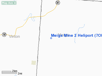
Location & QuickFacts
| FAA Information Effective: | 2008-09-25 |
| Airport Identifier: | 7OH4 |
| Airport Status: | Operational |
| Longitude/Latitude: | 082-16-59.5420W/39-07-30.2690N
-82.283206/39.125075 (Estimated) |
| Elevation: | 716 ft / 218.24 m (Estimated) |
| Land: | 0 acres |
| From nearest city: | 6 nautical miles S of Albany, OH |
| Location: | Athens County, OH |
| Magnetic Variation: | 05W (1990) |
Owner & Manager
| Ownership: | Privately owned |
| Owner: | Southern Ohio Coal Co |
| Address: | P.o. Box 490
Athens, OH 45701-0490 |
| Phone number: | 614-286-5051 |
| Manager: | Southern Ohio Coal Co |
| Address: | P.o. Box 490
Athens, OH 45701-0490 |
| Phone number: | 614-286-5051 |
Airport Operations and Facilities
| Airport Use: | Private |
| Segmented Circle: | No |
| Control Tower: | No |
| Sectional chart: | Cincinnati |
| Region: | AGL - Great Lakes |
| Boundary ARTCC: | ZID - Indianapolis |
| Tie-in FSS: | DAY - Dayton |
| FSS Toll Free: | 1-800-WX-BRIEF |
Runway Information
Helipad H1
| Dimension: | 60 x 60 ft / 18.3 x 18.3 m |
| Surface: | CONC, |
| |
Runway H1 |
Runway |
| Traffic Pattern: | Left | Left |
|
Radio Navigation Aids
| ID |
Type |
Name |
Ch |
Freq |
Var |
Dist |
| AJY | FAN MARKER | Ashland | | | 03W | 41.7 nm |
| PKB | FAN MARKER | Marietta Ohio | | | 03W | 43.4 nm |
| UGS | NDB | University | | 250.00 | 06W | 10.8 nm |
| GAS | NDB | Gallipolis | | 420.00 | 07W | 18.4 nm |
| EOP | NDB | Waverly | | 385.00 | 06W | 30.4 nm |
| PMH | NDB | Portsmouth | | 373.00 | 04W | 33.4 nm |
| RZT | NDB | Ross County | | 236.00 | 05W | 39.5 nm |
| CYO | NDB | Circleville | | 366.00 | 05W | 40.3 nm |
| HRA | NDB | Zanesville | | 204.00 | 06W | 49.9 nm |
| XUB | VOR | Yellow Bud | | 112.50 | 05W | 40.3 nm |
| HNN | VORTAC | Henderson | 106X | 115.90 | 03W | 25.3 nm |
| YRK | VORTAC | York | 075X | 112.80 | 05W | 43.5 nm |
| JPU | VORTAC | Parkersburg | 023X | 108.60 | 03W | 46.3 nm |
Remarks
- PRVDD APCH/DEP ROUTES OPS ARE CONDUCTED IN ALL DIRECTIONS; TKOF/LDG ARE MARKED; WIND INDICATOR IS MAINTAINED; & PLINES N & S BE MARKED & OBSTNS LGTD FOR NGT OPS. BLDG 50 FT W BE OBSTN LGTD FOR NGT OPS.
Images and information placed above are from
http://www.airport-data.com/airport/7OH4/
We thank them for the data!
| General Info
|
| Country |
United States
|
| State |
OHIO
|
| FAA ID |
7OH4
|
| Latitude |
39-07-30.269N
|
| Longitude |
082-16-59.542W
|
| Elevation |
716 feet
|
| Near City |
ALBANY
|
We don't guarantee the information is fresh and accurate. The data may
be wrong or outdated.
For more up-to-date information please refer to other sources.
|
|


