 |
|
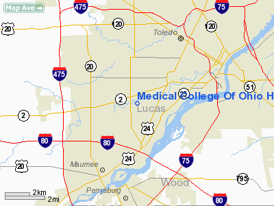
Medical College Of Ohio Hospital Heliport |
Location & QuickFacts
| FAA Information Effective: | 2008-09-25 |
| Airport Identifier: | 74OH |
| Airport Status: | Operational |
| Longitude/Latitude: | 083-37-09.7660W/41-37-10.1820N
-83.619379/41.619495 (Estimated) |
| Elevation: | 620 ft / 188.98 m (Estimated) |
| Land: | 0 acres |
| From nearest city: | 4 nautical miles SW of Toledo, OH |
| Location: | Lucas County, OH |
| Magnetic Variation: | 06W (2000) |
Owner & Manager
| Ownership: | Privately owned |
| Owner: | Medical College Of Ohio |
| Address: | 3000 Arlington Ave
Toledo, OH 43614 |
| Phone number: | 419-381-3888 |
| Manager: | Sally Sulfaro |
| Address: | Po Box 10008
Toledo, OH 43699 |
| Phone number: | 419-381-3415
EXTENSION 650. |
Airport Operations and Facilities
| Airport Use: | Private
MEDICAL USE. |
| Wind indicator: | Yes |
| Segmented Circle: | No |
| Control Tower: | No |
| Landing fee charge: | No |
| Sectional chart: | Cincinnati |
| Region: | AGL - Great Lakes |
| Boundary ARTCC: | ZOB - Cleveland |
| Tie-in FSS: | CLE - Cleveland |
| FSS on Airport: | No |
| FSS Toll Free: | 1-800-WX-BRIEF |
Airport Communications
Airport Services
| Airframe Repair: | NONE |
| Power Plant Repair: | NONE |
Runway Information
Helipad H1
| Dimension: | 40 x 40 ft / 12.2 x 12.2 m |
| Surface: | CONC, |
| |
Runway H1 |
Runway |
| Traffic Pattern: | Left | Left |
|
Radio Navigation Aids
| ID |
Type |
Name |
Ch |
Freq |
Var |
Dist |
| USE | NDB | Fulton | | 375.00 | 05W | 23.1 nm |
| ADG | NDB | Adrian | | 278.00 | 06W | 25.5 nm |
| TCU | NDB | Tecumseh | | 239.00 | 04W | 27.6 nm |
| FZI | NDB | Fostoria | | 379.00 | 05W | 27.8 nm |
| PCW | NDB | Port Clinton | | 423.00 | 06W | 34.3 nm |
| RYS | NDB | Grosse Ile | | 419.00 | 06W | 35.7 nm |
| BNR | NDB | Benton Ridge | | 334.00 | 05W | 36.0 nm |
| TII | NDB | Tiffin | | 269.00 | 05W | 36.4 nm |
| PDR | NDB | Ottawa | | 233.00 | 05W | 38.8 nm |
| BYN | NDB | Bryan | | 260.00 | 04W | 39.0 nm |
| DFI | NDB | Defiance | | 246.00 | 05W | 40.2 nm |
| PT | NDB | Pelee Island | | 283.00 | 05W | 43.7 nm |
| G | NDB | Golf | | 398.00 | 05W | 45.4 nm |
| TOL | TACAN | Toledo | 072X | | 05W | 8.2 nm |
| MAH | VOR | Marathon | | 114.90 | 05W | 36.4 nm |
| VWV | VOR/DME | Waterville | 078X | 113.10 | 02W | 10.1 nm |
| DXO | VOR/DME | Detroit | 081X | 113.40 | 06W | 37.4 nm |
| SKY | VOR/DME | Sandusky | 029X | 109.20 | 04W | 44.8 nm |
| CRL | VORTAC | Carleton | 104X | 115.70 | 03W | 26.8 nm |
| FDY | VORTAC | Findlay | 019X | 108.20 | 02W | 40.4 nm |
| SVM | VORTAC | Salem | 090X | 114.30 | 03W | 47.5 nm |
| YIP | VOT | Willow Run | | 112.00 | | 37.2 nm |
| DTW | VOT | Detroit Met Wayne | | 109.80 | | 38.3 nm |
Remarks
- VFR WEATHER CONDITIONS ONLY.
Images and information placed above are from
http://www.airport-data.com/airport/74OH/
We thank them for the data!
| General Info
|
| Country |
United States
|
| State |
OHIO
|
| FAA ID |
74OH
|
| Latitude |
41-37-10.182N
|
| Longitude |
083-37-09.766W
|
| Elevation |
620 feet
|
| Near City |
TOLEDO
|
We don't guarantee the information is fresh and accurate. The data may
be wrong or outdated.
For more up-to-date information please refer to other sources.
|
|


