 |
|
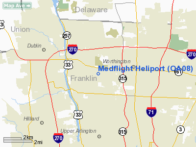
Location & QuickFacts
| FAA Information Effective: | 2008-09-25 |
| Airport Identifier: | OA08 |
| Airport Status: | Operational |
| Longitude/Latitude: | 083-04-06.0000W/40-05-06.0000N
-83.068333/40.085000 (Estimated) |
| Elevation: | 890 ft / 271.27 m (Estimated) |
| Land: | 0 acres |
| From nearest city: | 0 nautical miles N of Columbus, OH |
| Location: | Franklin County, OH |
| Magnetic Variation: | 06W (1995) |
Owner & Manager
| Ownership: | Privately owned |
| Owner: | Medflight |
| Address: | 2827 West Dublin-granville Rd
Columbus, OH 43235 |
| Phone number: | 800-770-6181 |
| Manager: | Steve Jacklin |
| Address: | 2827 West Dublin-granville Rd
Columbus, OH 43235 |
| Phone number: | 614-764-1221 |
Airport Operations and Facilities
| Airport Use: | Private
MEDICAL USE. |
| Wind indicator: | Yes |
| Segmented Circle: | No |
| Control Tower: | No |
| Lighting Schedule: | DUSK-DAWN |
| Sectional chart: | Detroit |
| Region: | AGL - Great Lakes |
| Boundary ARTCC: | ZID - Indianapolis |
| Tie-in FSS: | DAY - Dayton |
| FSS on Airport: | No |
| FSS Toll Free: | 1-800-WX-BRIEF |
Runway Information
Helipad H1
| Dimension: | 50 x 50 ft / 15.2 x 15.2 m |
| Surface: | CONC, |
| |
Runway H1 |
Runway |
| Traffic Pattern: | Left | Left |
|
Radio Navigation Aids
| ID |
Type |
Name |
Ch |
Freq |
Var |
Dist |
| DKG | NDB | Don Scott | | 348.00 | 05W | 0.6 nm |
| CHC | NDB | Grens | | 272.00 | 04W | 4.9 nm |
| OS | NDB | Fuler | | 515.00 | 05W | 6.0 nm |
| DLZ | NDB | Delaware | | 215.00 | 06W | 11.7 nm |
| MRT | NDB | Marysville | | 403.00 | 05W | 15.5 nm |
| CM | NDB | Sumie | | 391.00 | 05W | 15.6 nm |
| BU | NDB | Boutn | | 230.00 | 05W | 17.2 nm |
| UYF | NDB | London | | 263.00 | 06W | 20.4 nm |
| HEH | NDB | Newark | | 524.00 | 06W | 28.1 nm |
| MNN | NDB | Marion | | 201.00 | 05W | 32.0 nm |
| CSS | NDB | Court House | | 414.00 | 05W | 32.7 nm |
| CYO | NDB | Circleville | | 366.00 | 05W | 34.0 nm |
| CCJ | NDB | Clark County | | 341.00 | 04W | 35.1 nm |
| RUV | NDB | Rushsylvania | | 326.00 | 05W | 35.5 nm |
| EDJ | NDB | Bellefontaine | | 242.00 | 05W | 38.3 nm |
| RZT | NDB | Ross County | | 236.00 | 05W | 38.9 nm |
| XEN | NDB | Xenia | | 395.00 | 03W | 45.5 nm |
| IL | NDB | Airbo | | 407.00 | 04W | 47.2 nm |
| MF | NDB | Manns | | 372.00 | 06W | 49.9 nm |
| LCK | TACAN | Rickenbacker | 069X | | 05W | 17.8 nm |
| XSF | TACAN | Springfield | 065X | | 04W | 38.6 nm |
| FFO | TACAN | Patterson | 099X | | 04W | 48.2 nm |
| BUD | VOR | Buckeye | | 109.80 | 05W | 32.0 nm |
| XUB | VOR | Yellow Bud | | 112.50 | 05W | 33.8 nm |
| SGH | VOR/DME | Springfield | 079X | 113.20 | 04W | 38.8 nm |
| TVT | VOR/DME | Tiverton | 112X | 116.50 | 03W | 48.7 nm |
| APE | VORTAC | Appleton | 114X | 116.70 | 06W | 22.4 nm |
| ROD | VORTAC | Rosewood | 122X | 117.50 | 05W | 46.4 nm |
| CMH | VOT | Port Columbus | | 111.00 | | 10.0 nm |
Remarks
- HELIPORT IS CO-LOCATED WITH OHIO STATE UNIVERSITY ARPT.
- PRVDD APCH/DEP 070-300 DEGS; COMPLY WITH PART 91.126; LETTER OF AGREEMENT WITH OHIO STATE UNIVERSITY ARPT.
Images and information placed above are from
http://www.airport-data.com/airport/OA08/
We thank them for the data!
| General Info
|
| Country |
United States
|
| State |
OHIO
|
| FAA ID |
OA08
|
| Latitude |
40-05-06.000N
|
| Longitude |
083-04-06.000W
|
| Elevation |
890 feet
|
| Near City |
COLUMBUS
|
We don't guarantee the information is fresh and accurate. The data may
be wrong or outdated.
For more up-to-date information please refer to other sources.
|
|


