 |
|
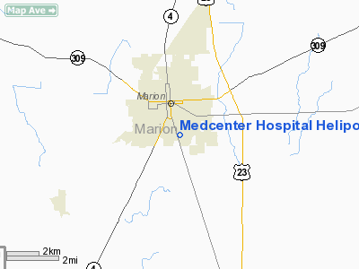
Medcenter Hospital Heliport |
Location & QuickFacts
| FAA Information Effective: | 2008-09-25 |
| Airport Identifier: | 20OI |
| Airport Status: | Operational |
| Longitude/Latitude: | 083-07-12.6850W/40-34-11.2120N
-83.120190/40.569781 (Estimated) |
| Elevation: | 985 ft / 300.23 m (Estimated) |
| Land: | 0 acres |
| From nearest city: | 0 nautical miles N of Marion, OH |
| Location: | Marion County, OH |
| Magnetic Variation: | 05W (1984) |
Owner & Manager
| Ownership: | Privately owned |
| Owner: | Marion General Hospital |
| Address: | Mckinley Park Dr
Marion, OH 43302-6397 |
| Phone number: | 740-383-7702 |
| Manager: | Cheryl Herbert |
| Address: | Mckinley Park Dr
Marion, OH 43302-6397 |
| Phone number: | 740-383-7702 |
Airport Operations and Facilities
| Airport Use: | Private
MEDICAL USE. |
| Wind indicator: | Yes |
| Segmented Circle: | No |
| Control Tower: | No |
| Landing fee charge: | No |
| Sectional chart: | Detroit |
| Region: | AGL - Great Lakes |
| Boundary ARTCC: | ZOB - Cleveland |
| Tie-in FSS: | CLE - Cleveland |
| FSS on Airport: | No |
| FSS Toll Free: | 1-800-WX-BRIEF |
Runway Information
Helipad H1
| Dimension: | 45 x 45 ft / 13.7 x 13.7 m |
| Surface: | ASPH, |
| |
Runway H1 |
Runway |
| Traffic Pattern: | Left | Left |
|
Radio Navigation Aids
| ID |
Type |
Name |
Ch |
Freq |
Var |
Dist |
| MNN | NDB | Marion | | 201.00 | 05W | 3.7 nm |
| DLZ | NDB | Delaware | | 215.00 | 06W | 17.6 nm |
| MRT | NDB | Marysville | | 403.00 | 05W | 23.1 nm |
| RUV | NDB | Rushsylvania | | 326.00 | 05W | 25.9 nm |
| DKG | NDB | Don Scott | | 348.00 | 05W | 29.5 nm |
| OS | NDB | Fuler | | 515.00 | 05W | 30.0 nm |
| TII | NDB | Tiffin | | 269.00 | 05W | 32.0 nm |
| MF | NDB | Manns | | 372.00 | 06W | 33.0 nm |
| EDJ | NDB | Bellefontaine | | 242.00 | 05W | 33.9 nm |
| CHC | NDB | Grens | | 272.00 | 04W | 33.9 nm |
| BNR | NDB | Benton Ridge | | 334.00 | 05W | 36.9 nm |
| CM | NDB | Sumie | | 391.00 | 05W | 38.9 nm |
| FZI | NDB | Fostoria | | 379.00 | 05W | 39.3 nm |
| UYF | NDB | London | | 263.00 | 06W | 41.4 nm |
| LYL | NDB | Lima | | 362.00 | 04W | 42.0 nm |
| HEH | NDB | Newark | | 524.00 | 06W | 44.4 nm |
| BU | NDB | Boutn | | 230.00 | 05W | 45.3 nm |
| AAU | NDB | Ashland | | 329.00 | 07W | 46.0 nm |
| PDR | NDB | Ottawa | | 233.00 | 05W | 47.8 nm |
| LCK | TACAN | Rickenbacker | 069X | | 05W | 46.6 nm |
| BUD | VOR | Buckeye | | 109.80 | 05W | 3.8 nm |
| MAH | VOR | Marathon | | 114.90 | 05W | 36.5 nm |
| AOH | VOR | Allen County | | 108.40 | 04W | 39.5 nm |
| TVT | VOR/DME | Tiverton | 112X | 116.50 | 03W | 45.9 nm |
| MFD | VORTAC | Mansfield | 025X | 108.80 | 03W | 30.1 nm |
| APE | VORTAC | Appleton | 114X | 116.70 | 06W | 35.0 nm |
| FDY | VORTAC | Findlay | 019X | 108.20 | 02W | 37.1 nm |
| ROD | VORTAC | Rosewood | 122X | 117.50 | 05W | 45.5 nm |
| CMH | VOT | Port Columbus | | 111.00 | | 36.2 nm |
Remarks
- PRVDD OPNS ARE CONDD IN AN AREA FM 140-210 DEGS; AREA IS APROPLY MKD, WIND INDCR IS MAINTD.
Images and information placed above are from
http://www.airport-data.com/airport/20OI/
We thank them for the data!
| General Info
|
| Country |
United States
|
| State |
OHIO
|
| FAA ID |
20OI
|
| Latitude |
40-34-11.212N
|
| Longitude |
083-07-12.685W
|
| Elevation |
985 feet
|
| Near City |
MARION
|
We don't guarantee the information is fresh and accurate. The data may
be wrong or outdated.
For more up-to-date information please refer to other sources.
|
|


