 |
|
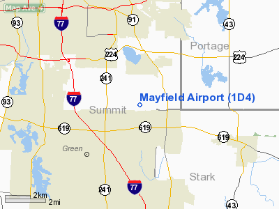
Location & QuickFacts
| FAA Information Effective: | 2008-09-25 |
| Airport Identifier: | 1D4 |
| Airport Status: | Operational |
| Longitude/Latitude: | 081-25-54.4050W/40-59-33.2030N
-81.431779/40.992556 (Estimated) |
| Elevation: | 1100 ft / 335.28 m (Estimated) |
| Land: | 10 acres |
| From nearest city: | 5 nautical miles SE of Akron, OH |
| Location: | Summit County, OH |
| Magnetic Variation: | 07W (1985) |
Owner & Manager
| Ownership: | Privately owned |
| Owner: | Robert R. May, Trustee |
| Address: | 2571 Myersville Rd
Uniontown, OH 44685 |
| Phone number: | 330-699-3066 |
| Manager: | Mike Baker |
| Address: | 2569 Myersville Rd
Uniontown, OH 44685 |
| Phone number: | 330-595-2130
CELL NR. 330-414-5272 |
Airport Operations and Facilities
| Airport Use: | Open to public |
| Segmented Circle: | No |
| Control Tower: | No |
| Landing fee charge: | No |
| Sectional chart: | Detroit |
| Region: | AGL - Great Lakes |
| Traffic Pattern Alt: | 1700 ft |
| Boundary ARTCC: | ZOB - Cleveland |
| Tie-in FSS: | CLE - Cleveland |
| FSS on Airport: | No |
| FSS Toll Free: | 1-800-WX-BRIEF |
| NOTAMs Facility: | CLE (NOTAM-d service avaliable) |
Airport Communications
Airport Services
| Airframe Repair: | NONE |
| Power Plant Repair: | NONE |
| Bottled Oxygen: | NONE |
| Bulk Oxygen: | NONE |
Runway Information
Runway 09/27
| Dimension: | 2315 x 110 ft / 705.6 x 33.5 m |
| Surface: | TURF, Good Condition |
| |
Runway 09 |
Runway 27 |
| Longitude: | 081-26-08.7000W | 081-25-38.6000W |
| Latitude: | 40-59-33.1900N | 40-59-33.1000N |
| Elevation: | 1092.00 ft | 1100.00 ft |
| Traffic Pattern: | Left | Right |
| Displaced threshold: | 180.00 ft
09/27 DSPLCD THLD MKD WITH YELLOW TIRES. | 590.00 ft |
| Centerline Lights: | No | No |
| Obstruction: | 59 ft trees, 65 ft right of centerline
APCH RATIO 0:1 TO DSPLCD THLD DUE TO 78 FT TREES 0 FT FM DSPLCD THLD 65 FT R. | 69 ft trees, 0.0 ft from runway, 110 ft left of centerline
APCH RATIO 0:1 TO DSPLCD THLD DUE TO +55 FT TREES 0 FT FM DSPLCD THLD 90 FT R. |
|
Radio Navigation Aids
| ID |
Type |
Name |
Ch |
Freq |
Var |
Dist |
| AK | NDB | Akron | | 362.00 | 07W | 5.1 nm |
| TSO | NDB | Tolson | | 395.00 | 07W | 30.5 nm |
| CL | NDB | Harri | | 344.00 | 07W | 31.8 nm |
| EZE | NDB | Engel | | 226.00 | 07W | 32.6 nm |
| MLR | NDB | Millersburg/dcmsnd | | 382.00 | 06W | 33.7 nm |
| BKL | NDB | Burke Lakefront | | 416.00 | 07W | 33.9 nm |
| AAU | NDB | Ashland | | 329.00 | 07W | 37.3 nm |
| LQL | NDB | Lakeland | | 263.00 | 08W | 41.5 nm |
| HBD | NDB | Hubbard | | 408.00 | 08W | 41.9 nm |
| UCP | NDB | Castle | | 272.00 | 09W | 46.1 nm |
| MF | NDB | Manns | | 372.00 | 06W | 48.0 nm |
| CFX | NDB | Cadiz | | 239.00 | 07W | 49.3 nm |
| ACO | VOR/DME | Akron | 091X | 114.40 | 04W | 12.5 nm |
| BSV | VOR/DME | Briggs | 071X | 112.40 | 04W | 15.1 nm |
| CXR | VOR/DME | Chardon | 074X | 112.70 | 05W | 33.8 nm |
| DJB | VOR/DME | Dryer | 083X | 113.60 | 05W | 39.7 nm |
| LNN | VOR/DME | Lost Nation | 039X | 110.20 | 08W | 41.6 nm |
| TVT | VOR/DME | Tiverton | 112X | 116.50 | 03W | 45.1 nm |
| CTW | VOR/DME | Newcomerstown | 055X | 111.80 | 07W | 45.9 nm |
| YNG | VORTAC | Youngstown | 027X | 109.00 | 05W | 39.8 nm |
| CAK | VOT | Akron/canton Regional | | 110.60 | | 4.6 nm |
| CLE | VOT | Cleveland | | 110.40 | | 31.4 nm |
Images and information placed above are from
http://www.airport-data.com/airport/1D4/
We thank them for the data!
| General Info
|
| Country |
United States
|
| State |
OHIO
|
| FAA ID |
1D4
|
| Latitude |
40-59-33.203N
|
| Longitude |
081-25-54.405W
|
| Elevation |
1100 feet
|
| Near City |
AKRON
|
We don't guarantee the information is fresh and accurate. The data may
be wrong or outdated.
For more up-to-date information please refer to other sources.
|
|


