 |
|
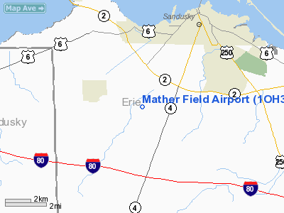
Location & QuickFacts
| FAA Information Effective: | 2008-09-25 |
| Airport Identifier: | 1OH3 |
| Airport Status: | Operational |
| Longitude/Latitude: | 082-45-45.6670W/41-23-21.1880N
-82.762685/41.389219 (Estimated) |
| Elevation: | 640 ft / 195.07 m (Estimated) |
| Land: | 45 acres |
| From nearest city: | 2 nautical miles E of Castalia, OH |
| Location: | Erie County, OH |
| Magnetic Variation: | 05W (1985) |
Owner & Manager
| Ownership: | Privately owned |
| Owner: | Don Mather |
| Address: | 402 Cove Street
Sandusky, OH 44810 |
| Phone number: | 419-627-1331 |
| Manager: | Don Mather |
| Address: | 402 Cove Street
Sandusky, OH 44810 |
Airport Operations and Facilities
| Airport Use: | Private |
| Wind indicator: | Yes |
| Segmented Circle: | No |
| Control Tower: | No |
| Sectional chart: | Detroit |
| Region: | AGL - Great Lakes |
| Boundary ARTCC: | ZOB - Cleveland |
| Tie-in FSS: | CLE - Cleveland |
| FSS Toll Free: | 1-800-WX-BRIEF |
Runway Information
Runway 09/27
| Dimension: | 3400 x 150 ft / 1036.3 x 45.7 m |
| Surface: | TURF, |
| |
Runway 09 |
Runway 27 |
| Traffic Pattern: | Left | Left |
| Obstruction: | 30 ft bldg, 500.0 ft from runway | |
|
Radio Navigation Aids
| ID |
Type |
Name |
Ch |
Freq |
Var |
Dist |
| PCW | NDB | Port Clinton | | 423.00 | 06W | 9.1 nm |
| PT | NDB | Pelee Island | | 283.00 | 05W | 23.8 nm |
| TII | NDB | Tiffin | | 269.00 | 05W | 26.7 nm |
| FZI | NDB | Fostoria | | 379.00 | 05W | 31.0 nm |
| AAU | NDB | Ashland | | 329.00 | 07W | 34.4 nm |
| CL | NDB | Harri | | 344.00 | 07W | 36.1 nm |
| MF | NDB | Manns | | 372.00 | 06W | 40.1 nm |
| RYS | NDB | Grosse Ile | | 419.00 | 06W | 46.2 nm |
| BNR | NDB | Benton Ridge | | 334.00 | 05W | 46.6 nm |
| EZE | NDB | Engel | | 226.00 | 07W | 47.2 nm |
| MNN | NDB | Marion | | 201.00 | 05W | 48.5 nm |
| TOL | TACAN | Toledo | 072X | | 05W | 48.3 nm |
| MAH | VOR | Marathon | | 114.90 | 05W | 46.6 nm |
| BUD | VOR | Buckeye | | 109.80 | 05W | 48.4 nm |
| SKY | VOR/DME | Sandusky | 029X | 109.20 | 04W | 5.6 nm |
| DJB | VOR/DME | Dryer | 083X | 113.60 | 05W | 27.2 nm |
| VWV | VOR/DME | Waterville | 078X | 113.10 | 02W | 39.7 nm |
| MFD | VORTAC | Mansfield | 025X | 108.80 | 03W | 32.2 nm |
| CLE | VOT | Cleveland | | 110.40 | | 41.2 nm |
Remarks
- 800' TWR 1.5 MILE W OF APT & 400' TWR 4000' W OF APT.
- PRVDD ANY OBSTN IN RY APCH SLOPE SFC REMOVED/LOWERED OR THR DSPLCD & MKD TO PRVD MIN 20:1 APCH SLOPE CLNC OVER OBSTN; REF FAA AC 150/5300-13.
Images and information placed above are from
http://www.airport-data.com/airport/1OH3/
We thank them for the data!
| General Info
|
| Country |
United States
|
| State |
OHIO
|
| FAA ID |
1OH3
|
| Latitude |
41-23-21.188N
|
| Longitude |
082-45-45.667W
|
| Elevation |
640 feet
|
| Near City |
CASTALIA
|
We don't guarantee the information is fresh and accurate. The data may
be wrong or outdated.
For more up-to-date information please refer to other sources.
|
|


