 |
|
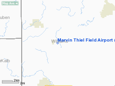
Marvin Thiel Field Airport |
Location & QuickFacts
| FAA Information Effective: | 2008-09-25 |
| Airport Identifier: | OI72 |
| Airport Status: | Operational |
| Longitude/Latitude: | 084-43-15.0000W/41-31-20.0000N
-84.720833/41.522222 (Estimated) |
| Elevation: | 859 ft / 261.82 m (Estimated) |
| Land: | 0 acres |
| From nearest city: | 1 nautical miles NW of Blakeslee, OH |
| Location: | Williams County, OH |
| Magnetic Variation: | 04W (1990) |
Owner & Manager
| Ownership: | Privately owned |
| Owner: | Marvin J Thiel |
| Address: | 05 364 Rd H
Edon, OH 43518 |
| Phone number: | 419-272-2712 |
| Manager: | Marvin J Thiel |
| Address: | 05 364 Rd H
Edon, OH 43518 |
| Phone number: | 419-272-2141 |
Airport Operations and Facilities
| Airport Use: | Private |
| Wind indicator: | Yes |
| Segmented Circle: | No |
| Control Tower: | No |
| Sectional chart: | Detroit |
| Region: | AGL - Great Lakes |
| Boundary ARTCC: | ZOB - Cleveland |
| Tie-in FSS: | CLE - Cleveland |
| FSS on Airport: | No |
| FSS Toll Free: | 1-800-WX-BRIEF |
Runway Information
Runway 09/27
| Dimension: | 1880 x 26 ft / 573.0 x 7.9 m |
| Surface: | CONC, |
| |
Runway 09 |
Runway 27 |
| Traffic Pattern: | Left | Left |
|
Radio Navigation Aids
| ID |
Type |
Name |
Ch |
Freq |
Var |
Dist |
| BYN | NDB | Bryan | | 260.00 | 04W | 11.7 nm |
| DFI | NDB | Defiance | | 246.00 | 05W | 17.4 nm |
| ANQ | NDB | Angola | | 347.00 | 05W | 17.9 nm |
| USE | NDB | Fulton | | 375.00 | 05W | 27.0 nm |
| ADG | NDB | Adrian | | 278.00 | 06W | 35.6 nm |
| IRS | NDB | Sturgis | | 382.00 | 04W | 36.5 nm |
| VFU | NDB | Stanley | | 411.00 | 05W | 39.9 nm |
| PDR | NDB | Ottawa | | 233.00 | 05W | 44.8 nm |
| HAI | NDB | Three Rivers | | 407.00 | 02W | 47.0 nm |
| TCU | NDB | Tecumseh | | 239.00 | 04W | 48.7 nm |
| TOL | TACAN | Toledo | 072X | | 05W | 41.7 nm |
| OLK | VOR | Wolf Lake | | 110.40 | 03W | 38.7 nm |
| LFD | VOR/DME | Litchfield | 049X | 111.20 | 05W | 32.5 nm |
| JXN | VOR/DME | Jackson | 033X | 109.60 | 05W | 45.8 nm |
| VWV | VOR/DME | Waterville | 078X | 113.10 | 02W | 48.9 nm |
| FWA | VORTAC | Fort Wayne | 125X | 117.80 | 00E | 38.9 nm |
| FWA | VOT | Fort Wayne Baer | | 111.00 | | 39.0 nm |
Remarks
- PRVDD OBSTN LOWERED OT THLD DSPLCD TO PRVD A CLEAR 20:1 APCH; AREA EITHER SIDE OF RY & 200 FT OFF ENDS CLEAR; AREA 60 FT EITHER SIDE OF RY & 240 FT OFF RY ENDS HAVE NO HAZARDS.
Images and information placed above are from
http://www.airport-data.com/airport/OI72/
We thank them for the data!
| General Info
|
| Country |
United States
|
| State |
OHIO
|
| FAA ID |
OI72
|
| Latitude |
41-31-20.000N
|
| Longitude |
084-43-15.000W
|
| Elevation |
859 feet
|
| Near City |
BLAKESLEE
|
We don't guarantee the information is fresh and accurate. The data may
be wrong or outdated.
For more up-to-date information please refer to other sources.
|
|


