|
|
Mansfield Lahm Rgnl Airport |
Coordinates: 40°49′17″N 82°31′0″W / 40.82139°N 82.516667°W / 40.82139; -82.516667
| Mansfield Lahm Regional Airport |
 |
| IATA: MFD – ICAO: KMFD – FAA LID: MFD |
| Summary |
| Airport type |
Public |
| Owner |
City of Mansfield |
| Serves |
Mansfield, Ohio |
| Elevation AMSL |
1,297 ft / 395 m |
| Runways |
| Direction |
Length |
Surface |
| ft |
m |
| 14/32 |
9,000 |
2,744 |
Asphalt |
| 5/23 |
6,795 |
2,071 |
Asphalt |
| Helipads |
| Number |
Length |
Surface |
| ft |
m |
| H2 |
24 |
7 |
Asphalt |
| Statistics (2005) |
| Aircraft operations |
33,191 |
| Based aircraft |
80 |
| Source: Federal Aviation Administration |
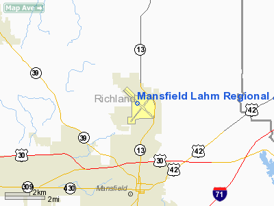
Mansfield Lahm Regional Airport (IATA: MFD, ICAO: KMFD, FAA LID: MFD) is a city-owned, joint civil-military, public-use airport located three miles (5 km) north of the central business district of Mansfield, a city in Richland County, Ohio, United States. Airport facilities and aircraft utilization
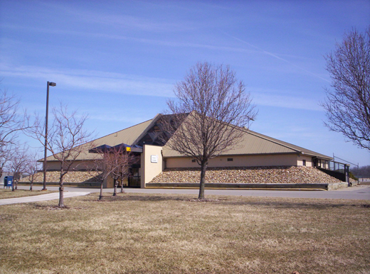 | |
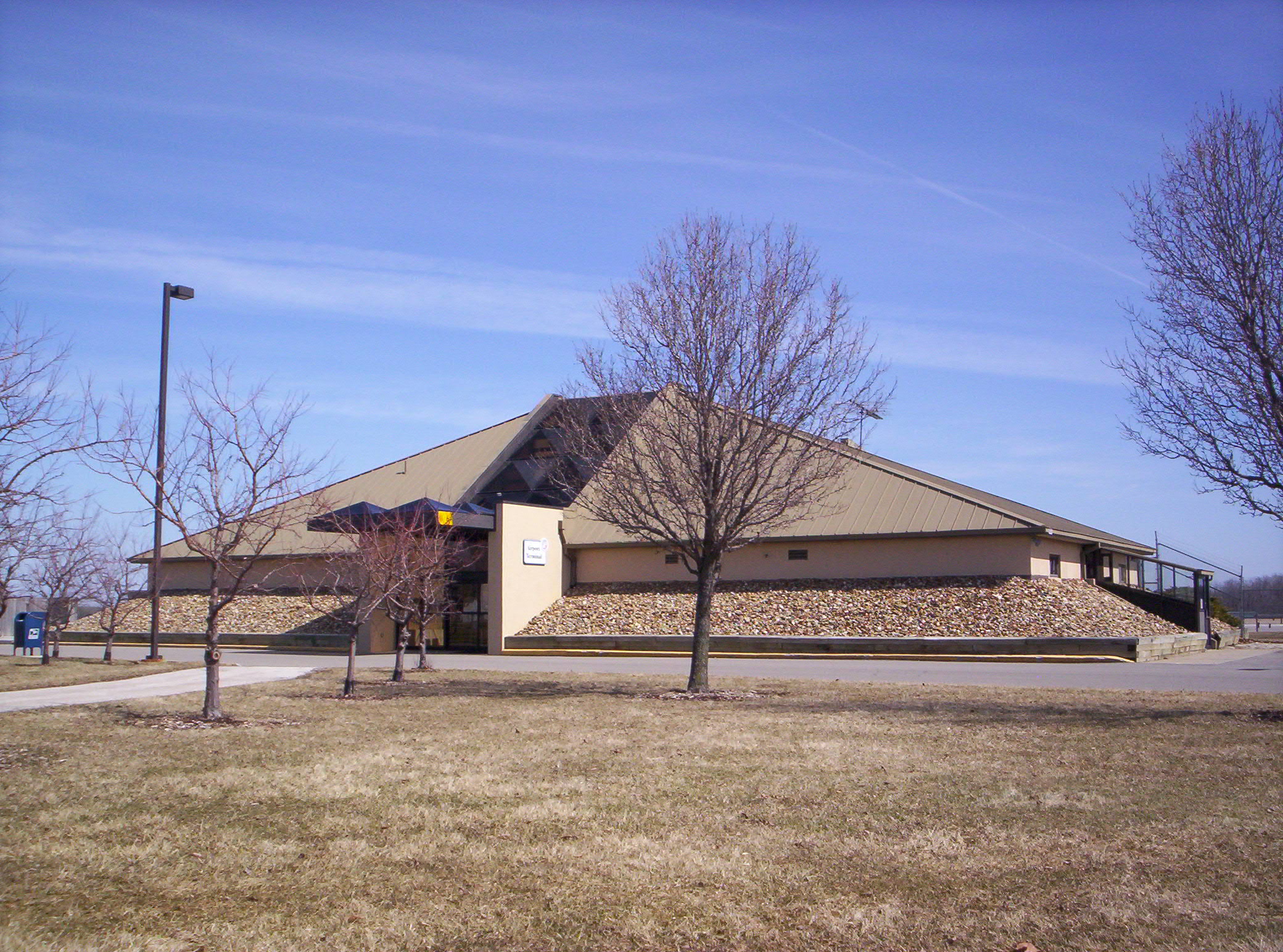
Airport terminal building at MFD. |
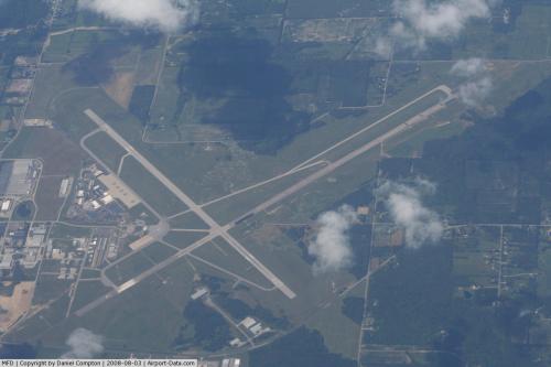
Mansfield Lahm Regional Airport covers an area of 2,340 acres (947 ha) which contains two asphalt paved runways: 14/32 measuring 9,000 x 150 ft (2,744 x 46 m) and 5/23 measuring 6,795 x 150 ft (2,071 x 46 m). It also has one helipad with a 24 x 24 ft (7 x 7 m) asphalt surface.
For the 12-month period ending December 31, 2005, the airport had 33,191 aircraft operations, an average of 90 per day: 77% general aviation, 14% air taxi, 9% military and <1% scheduled commercial. There are 80 aircraft based at this airport: 78% single-engine, 9% multi-engine, 4% jet and 10% military.
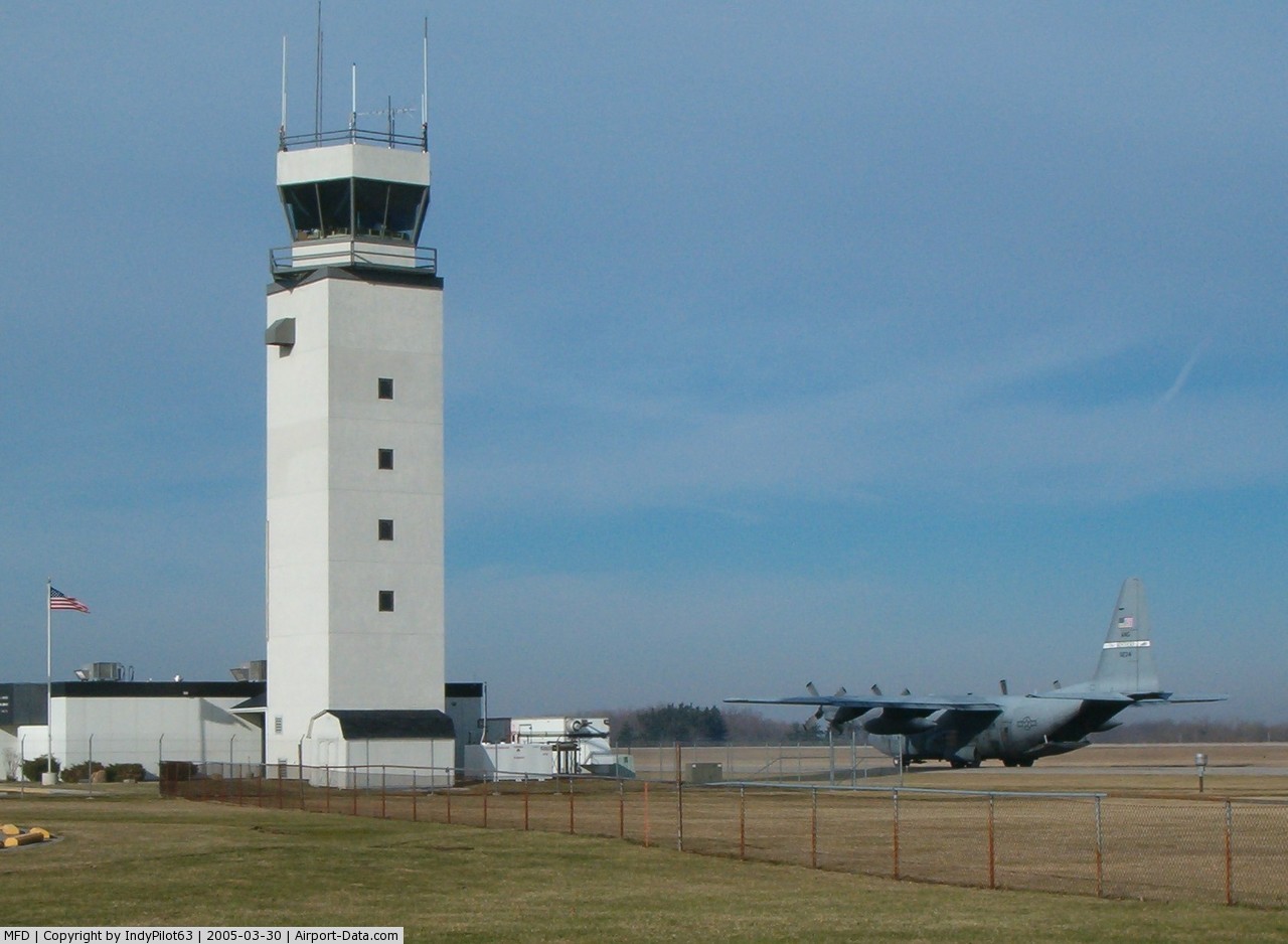
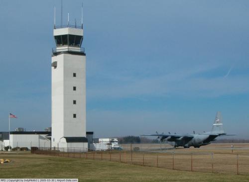
Military facilitiesThe airport is also home to the Mansfield Lahm Air National Guard Base and the 179th Airlift Wing (179 AW), an Ohio Air National Guard unit operationally-gained by the Air Mobility Command (AMC). The unit consists of approximately 1000 personnel, of which approximately 300 are full-time Active Guard and Reserve (AGR) and Air Reserve Technician (ART) personnel and the remaining 760 are traditional part-time air national guardsmen. The wing has been active at Mansfield Lahm since its establishment in 1948, originally operating a variety of fighter aircraft until 1976 when it transitioned to an airlift mission with C-130 Hercules aircraft. The wing currently flies the C-130H version of the Hercules and has performed service during Operations Desert Shield, Desert Storm, Southern Watch, Noble Eagle, Enduring Freedom and Iraqi Freedom.
Due to Base Realignment and Closure (BRAC) 2005, the 179 AW will lose all of its C-130H aircraft by late summer 2010. The aircraft are scheduled to be dispersed to various active Air Force, Air Force Reserve Command and Air National Guard C-130H units at Little Rock Air Force Base, Arkansas, and Maxwell Air Force Base, Alabama. Reports as of November 2009 are that a total of two C-130's have been relocated. However, due to Mansfield Lahm ANGB's superior record, and the urgent actions by state and local officials, reconsiderations were made and the base was incorporated into the Ohio Air National Guard's future by receiving a bridge mission of flying the C-21 Learjet until they begin receiving the C-27J Spartan aircraft. Latest information reveals that the C-21 bridge mission may be skipped altogether.
On 20 July 2008, the 179 AW continued its growth by the standing up of the 200th RED HORSE (Rapid Engineer Deployable Heavy Operational Repair Squadron Engineers) detachment. The Mansfield base has been assigned 200 Red Horse personnel in one detachment, with an additional 200 RED HORSE personnel slated to be assigned to Port Clinton, Ohio by 2010.
The above content comes from Wikipedia and is published under free licenses – click here to read more.
 |
(Click on the photo to enlarge) |
 |
(Click on the photo to enlarge) |
Location & QuickFacts
| FAA Information Effective: | 2008-09-25 |
| Airport Identifier: | MFD |
| Airport Status: | Operational |
| Longitude/Latitude: | 082-30-59.9000W/40-49-17.1000N
-82.516639/40.821417 (Estimated) |
| Elevation: | 1297 ft / 395.33 m (Surveyed) |
| Land: | 2340 acres |
| From nearest city: | 3 nautical miles N of Mansfield, OH |
| Location: | Richland County, OH |
| Magnetic Variation: | 06W (1985) |
Owner & Manager
| Ownership: | Publicly owned |
| Owner: | City Of Mansfield |
| Address: | 2000 Harrington Meml Rd
Mansfield, OH 44903 |
| Phone number: | 419-522-2191 |
| Manager: | Mark T. Daugherty |
| Address: | 2000 Harrington Meml Rd
Mansfield, OH 44903 |
| Phone number: | 419-522-2191 |
Airport Operations and Facilities
| Airport Use: | Open to public |
| Wind indicator: | Yes |
| Segmented Circle: | No |
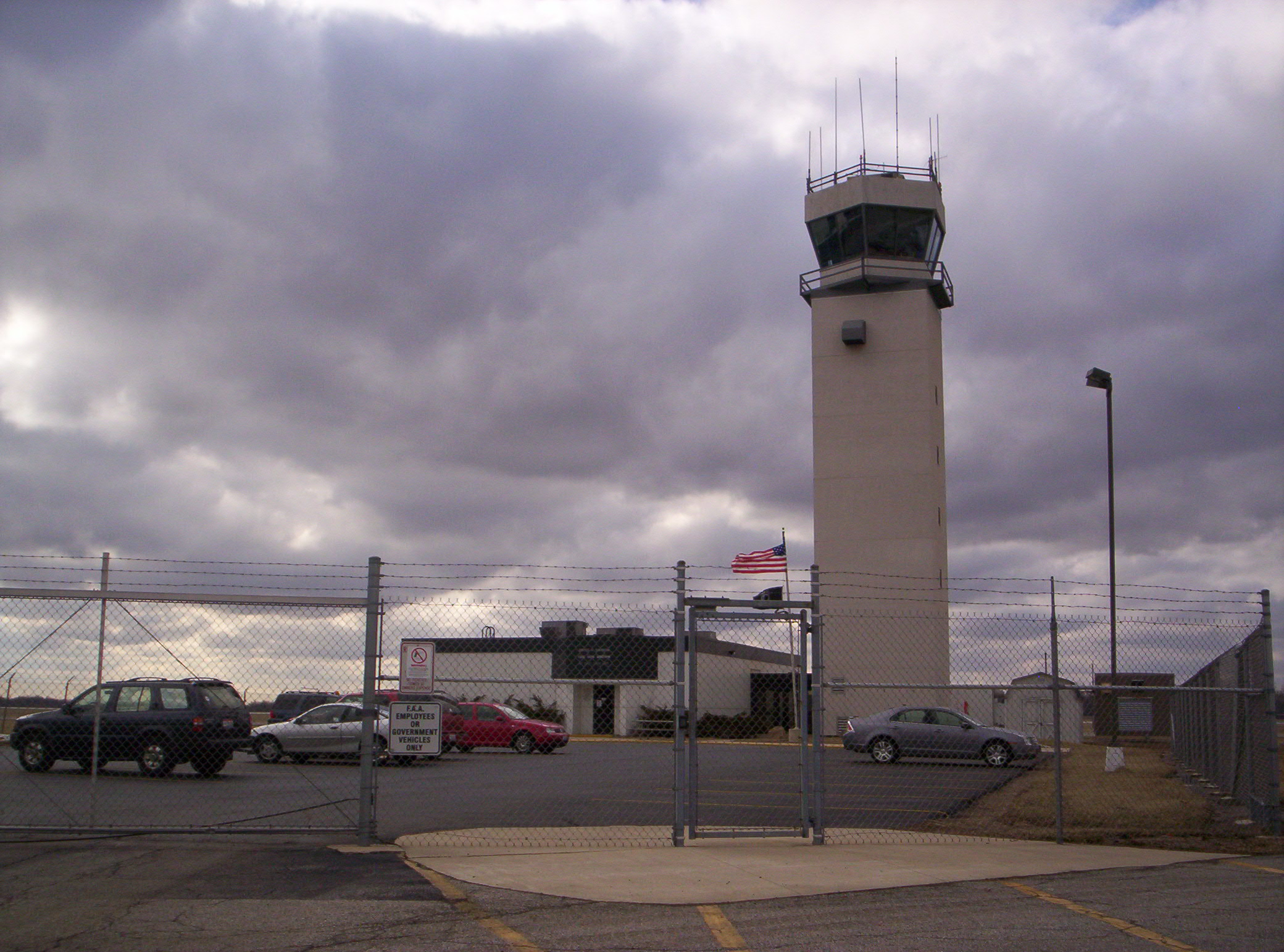
| Control Tower: | Yes |
| Lighting Schedule: | DUSK-DAWN
WHEN ATCT CLSD ACTVT HIRL RYS 05/23 & 14/32, MALSR RY 32 REIL RYS 05 & 23 - CTAF. |
| Beacon Color: | Clear-Green (lighted land airport) |
| Landing fee charge: | No
LNDG FEES ON ALL COMMERCIAL OPERATORS INVOICED ON MONTHLY BASIS; FOR OTHER ARRANGEMENTS CONTACT AMGR ON 419-522-2191. |
| Sectional chart: | Detroit |
| Region: | AGL - Great Lakes |
| Boundary ARTCC: | ZOB - Cleveland |
| Tie-in FSS: | CLE - Cleveland |
| FSS on Airport: | No |
| FSS Toll Free: | 1-800-WX-BRIEF |
| NOTAMs Facility: | MFD (NOTAM-d service avaliable) |
| Certification type/date: | IV A U 11/200
TWO HR PPR FOR ACR OPNS WITH MORE THAN 30 PSGNR SEATS. CALL 419-522-2191. |
| Federal Agreements: | NGY3 |
Airport Communications
| CTAF: | 119.800 |
| Unicom: | 122.950 |
Airport Services
| Fuel available: | 100LLA |
| Airframe Repair: | MAJOR |
| Power Plant Repair: | MAJOR |
| Bottled Oxygen: | NONE |
| Bulk Oxygen: | NONE |
Runway Information
Runway 05/23
| Dimension: | 6795 x 150 ft / 2071.1 x 45.7 m |
| Surface: | ASPH, Fair Condition |
| Surface Treatment: | Saw-cut or plastic Grooved |
| Weight Limit: | Single wheel: 90000 lbs.
Dual wheel: 96000 lbs.
Dual tandem wheel: 150000 lbs. |
| Edge Lights: | High
PERIMETER LIGHTS. |
| |
Runway 05 |
Runway 23 |
| Longitude: | 082-31-29.2996W | 082-30-24.7329W |
| Latitude: | 40-48-41.5634N | 40-49-27.4026N |
| Elevation: | 1287.00 ft | 1276.00 ft |
| Alignment: | 47 | 127 |
| Traffic Pattern: | Left | Left |
| Markings: | Non-precision instrument, Fair Condition | Non-precision instrument, Fair Condition |
| Crossing Height: | 50.00 ft | 45.00 ft |
| VASI: | 4-light PAPI on left side | 4-light PAPI on left side |
| Visual Glide Angle: | 3.00° | 3.00° |
| Runway End Identifier: | Yes | Yes |
| Obstruction: | , 50:1 slope to clear | 48 ft trees, 1550.0 ft from runway, 600 ft right of centerline, 28:1 slope to clear |
|
Runway 14/32
| Dimension: | 9001 x 150 ft / 2743.5 x 45.7 m |
| Surface: | ASPH, Fair Condition |
| Surface Treatment: | Saw-cut or plastic Grooved |
| Weight Limit: | Single wheel: 150000 lbs.
Dual wheel: 185000 lbs.
Dual tandem wheel: 300000 lbs. |
| Edge Lights: | High
PERIMETER LIGHTS. |
| |
Runway 14 |
Runway 32 |
| Longitude: | 082-31-41.9771W | 082-30-22.0601W |
| Latitude: | 40-49-59.1231N | 40-48-54.1405N |
| Elevation: | 1245.00 ft | 1290.00 ft |
| Alignment: | 127 | 127 |
| ILS Type: | | ILS
|
| Traffic Pattern: | Left | Left |
| Markings: | Precision instrument, Fair Condition | Precision instrument, Fair Condition |
| Crossing Height: | 42.00 ft | 0.00 ft |
| VASI: | 4-light PAPI on left side | |
| Visual Glide Angle: | 3.00° | 0.00° |
| RVR Equipment: | | touchdown |
| Approach lights: | | MALSR |
| Runway End Identifier: | No | |
| Obstruction: | 27 ft road, 1143.0 ft from runway, 629 ft right of centerline, 34:1 slope to clear | 58 ft trees, 2650.0 ft from runway, 250 ft right of centerline, 42:1 slope to clear |
|
Helipad H2
| Dimension: | 24 x 24 ft / 7.3 x 7.3 m |
| Surface: | ASPH, Good Condition |
| |
Runway H2 |
Runway |
| Traffic Pattern: | Left | Left |
|
Radio Navigation Aids
| ID |
Type |
Name |
Ch |
Freq |
Var |
Dist |
| MF | NDB | Manns | | 372.00 | 06W | 4.7 nm |
| AAU | NDB | Ashland | | 329.00 | 07W | 14.7 nm |
| MNN | NDB | Marion | | 201.00 | 05W | 28.0 nm |
| MLR | NDB | Millersburg/dcmsnd | | 382.00 | 06W | 33.8 nm |
| TII | NDB | Tiffin | | 269.00 | 05W | 35.5 nm |
| CL | NDB | Harri | | 344.00 | 07W | 39.9 nm |
| DLZ | NDB | Delaware | | 215.00 | 06W | 42.3 nm |
| PCW | NDB | Port Clinton | | 423.00 | 06W | 44.8 nm |
| FZI | NDB | Fostoria | | 379.00 | 05W | 45.6 nm |
| HEH | NDB | Newark | | 524.00 | 06W | 47.9 nm |
| BUD | VOR | Buckeye | | 109.80 | 05W | 27.8 nm |
| TVT | VOR/DME | Tiverton | 112X | 116.50 | 03W | 28.2 nm |
| DJB | VOR/DME | Dryer | 083X | 113.60 | 05W | 36.0 nm |
| SKY | VOR/DME | Sandusky | 029X | 109.20 | 04W | 37.4 nm |
| BSV | VOR/DME | Briggs | 071X | 112.40 | 04W | 49.6 nm |
| MFD | VORTAC | Mansfield | 025X | 108.80 | 03W | 4.4 nm |
| APE | VORTAC | Appleton | 114X | 116.70 | 06W | 40.4 nm |
| CLE | VOT | Cleveland | | 110.40 | | 46.6 nm |
| CAK | VOT | Akron/canton Regional | | 110.60 | | 49.2 nm |
Remarks
- DEER & BIRDS & WATERFOWL ON & INVOF ARPT.
- ACFT ON EITHER END OF RY 5/23 AND 14/32 CANNOT BE SEEN ON THE OTHER END DUE TO RY GRADE.
- ACFT LARGER THAN A 'G1' OR WITH A WING SPAN GREATER THAN 80 FT (TIP TO TIP) ARE RESTRICTED ON TWYS G/H/J/L/M/N & SHOULD USE THE MAIN RAMP AREA.
- CONDL PRVDD OPNS CONDD ACCORDING TO MANSFIELD ATCT INSTRNS. CONDL PVDD AREA APROPLY MRKD, WIND INDCR MAINTD, SITE IS AS SHOWN ON SKETCH.
Images and information placed above are from
http://www.airport-data.com/airport/MFD/
We thank them for the data!
| General Info
|
| Country |
United States
|
| State |
OHIO
|
| FAA ID |
MFD
|
| Latitude |
40-49-17.100N
|
| Longitude |
082-30-59.900W
|
| Elevation |
1297 feet
|
| Near City |
MANSFIELD
|
We don't guarantee the information is fresh and accurate. The data may
be wrong or outdated.
For more up-to-date information please refer to other sources.
|
|